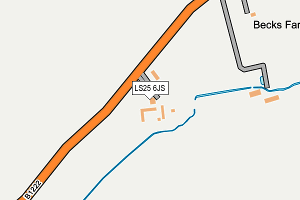
LS25 6JS lies on Newthorpe in South Milford, Leeds. LS25 6JS is located in the Sherburn in Elmet electoral ward, within the unitary authority of North Yorkshire and the English Parliamentary constituency of Selby and Ainsty. The Sub Integrated Care Board (ICB) Location is NHS Humber and North Yorkshire ICB - 03Q and the police force is North Yorkshire. This postcode has been in use since January 1980.


GetTheData
Source: OS OpenMap – Local (Ordnance Survey)
Source: OS VectorMap District (Ordnance Survey)
Licence: Open Government Licence (requires attribution)
| Easting | 447724 |
| Northing | 432804 |
| Latitude | 53.789373 |
| Longitude | -1.277088 |
GetTheData
Source: Open Postcode Geo
Licence: Open Government Licence
| Street | Newthorpe |
| Locality | South Milford |
| Town/City | Leeds |
| Country | England |
| Postcode District | LS25 |
| ➜ LS25 open data dashboard ➜ See where LS25 is on a map | |
GetTheData
Source: Land Registry Price Paid Data
Licence: Open Government Licence
Elevation or altitude of LS25 6JS as distance above sea level:
| Metres | Feet | |
|---|---|---|
| Elevation | 30m | 98ft |
Elevation is measured from the approximate centre of the postcode, to the nearest point on an OS contour line from OS Terrain 50, which has contour spacing of ten vertical metres.
➜ How high above sea level am I? Find the elevation of your current position using your device's GPS.
GetTheData
Source: Open Postcode Elevation
Licence: Open Government Licence
| Ward | Sherburn In Elmet |
| Constituency | Selby And Ainsty |
GetTheData
Source: ONS Postcode Database
Licence: Open Government Licence
| Gorse Lane (B1222) | Newthorpe | 791m |
| Gorse Lane (B1222) | Newthorpe | 795m |
| Manor House (Church Hill) | Sherburn In Elmet | 1,156m |
| Squires Cafe Bar (B1222) | Newthorpe | 1,176m |
| Squires Cafe Bar (B1222) | Newthorpe | 1,178m |
| South Milford Station | 1.9km |
| Sherburn-in-Elmet Station | 3.1km |
| Micklefield Station | 3.3km |
GetTheData
Source: NaPTAN
Licence: Open Government Licence
GetTheData
Source: ONS Postcode Database
Licence: Open Government Licence


➜ Get more ratings from the Food Standards Agency
GetTheData
Source: Food Standards Agency
Licence: FSA terms & conditions
| Last Collection | |||
|---|---|---|---|
| Location | Mon-Fri | Sat | Distance |
| Newthorpe Village | 16:45 | 08:45 | 791m |
| Highfields | 17:00 | 09:00 | 1,511m |
| South Milford P.o. | 17:30 | 11:00 | 2,095m |
GetTheData
Source: Dracos
Licence: Creative Commons Attribution-ShareAlike
| Facility | Distance |
|---|---|
| Sherburn High School Garden Lane, Sherburn In Elmet, Leeds Health and Fitness Gym, Grass Pitches, Sports Hall, Swimming Pool, Artificial Grass Pitch | 1.3km |
| Sherburn In Elmet Playing Fields Sherburn In Elmet, Leeds Grass Pitches | 1.5km |
| Sherburn Eversley Cricket Club Church View, Sherburn In Elmet, Leeds Grass Pitches | 1.6km |
GetTheData
Source: Active Places
Licence: Open Government Licence
| School | Phase of Education | Distance |
|---|---|---|
| Sherburn High School Garden Lane, Sherburn-in-Elmet, Leeds, LS25 6AS | Secondary | 1.3km |
| Sherburn in Elmet, Athelstan Community Primary School Milford Road, Sherburn-in-Elmet, Leeds, LS25 6QN | Primary | 1.7km |
| Sherburn Hungate Primary School North Crescent, Sherburn-in-Elmet, Leeds, LS25 6DD | Primary | 2.1km |
GetTheData
Source: Edubase
Licence: Open Government Licence
The below table lists the International Territorial Level (ITL) codes (formerly Nomenclature of Territorial Units for Statistics (NUTS) codes) and Local Administrative Units (LAU) codes for LS25 6JS:
| ITL 1 Code | Name |
|---|---|
| TLE | Yorkshire and The Humber |
| ITL 2 Code | Name |
| TLE2 | North Yorkshire |
| ITL 3 Code | Name |
| TLE22 | North Yorkshire CC |
| LAU 1 Code | Name |
| E07000169 | Selby |
GetTheData
Source: ONS Postcode Directory
Licence: Open Government Licence
The below table lists the Census Output Area (OA), Lower Layer Super Output Area (LSOA), and Middle Layer Super Output Area (MSOA) for LS25 6JS:
| Code | Name | |
|---|---|---|
| OA | E00142143 | |
| LSOA | E01027898 | Selby 004A |
| MSOA | E02005812 | Selby 004 |
GetTheData
Source: ONS Postcode Directory
Licence: Open Government Licence
| LS25 6JT | 204m | |
| LS25 6JR | Gorse Lane | 638m |
| LS25 6JU | Huddleston | 819m |
| LS25 6JN | Hall Lane | 1026m |
| LS25 6FL | Church Hill Terrace | 1121m |
| LS25 6FH | Church Hill Rise | 1128m |
| LS25 6NX | Church Meadow | 1208m |
| LS25 6AX | Church Hill | 1272m |
| LS25 6AU | Garden Lane | 1284m |
| LS25 6AT | Garden Lane | 1315m |
GetTheData
Source: Open Postcode Geo; Land Registry Price Paid Data
Licence: Open Government Licence