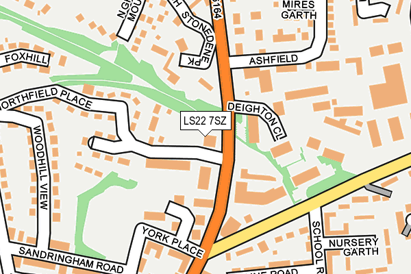
LS22 7SZ is located in the Wetherby electoral ward, within the metropolitan district of Leeds and the English Parliamentary constituency of Elmet and Rothwell. The Sub Integrated Care Board (ICB) Location is NHS West Yorkshire ICB - 15F and the police force is West Yorkshire. This postcode has been in use since January 1993.


GetTheData
Source: OS OpenMap – Local (Ordnance Survey)
Source: OS VectorMap District (Ordnance Survey)
Licence: Open Government Licence (requires attribution)
| Easting | 440556 |
| Northing | 448728 |
| Latitude | 53.933094 |
| Longitude | -1.383784 |
GetTheData
Source: Open Postcode Geo
Licence: Open Government Licence
| Country | England |
| Postcode District | LS22 |
| ➜ LS22 open data dashboard ➜ See where LS22 is on a map ➜ Where is Wetherby? | |
GetTheData
Source: Land Registry Price Paid Data
Licence: Open Government Licence
Elevation or altitude of LS22 7SZ as distance above sea level:
| Metres | Feet | |
|---|---|---|
| Elevation | 30m | 98ft |
Elevation is measured from the approximate centre of the postcode, to the nearest point on an OS contour line from OS Terrain 50, which has contour spacing of ten vertical metres.
➜ How high above sea level am I? Find the elevation of your current position using your device's GPS.
GetTheData
Source: Open Postcode Elevation
Licence: Open Government Licence
| Ward | Wetherby |
| Constituency | Elmet And Rothwell |
GetTheData
Source: ONS Postcode Database
Licence: Open Government Licence
| November 2023 | Vehicle crime | On or near Parking Area | 438m |
| August 2023 | Other theft | On or near Eel Mires Garth | 241m |
| July 2023 | Violence and sexual offences | On or near Parking Area | 438m |
| ➜ Get more crime data in our Crime section | |||
GetTheData
Source: data.police.uk
Licence: Open Government Licence
| Deighton Road Ashfield (Deighton Road) | Wetherby | 85m |
| Deighton Road York Rd (Deighton Road) | Wetherby | 108m |
| Deighton Road York Rd (Deighton Road) | Wetherby | 131m |
| Deighton Road Ashfield (Deighton Road) | Wetherby | 133m |
| York Rd School Road (York Road) | Wetherby | 160m |
GetTheData
Source: NaPTAN
Licence: Open Government Licence
GetTheData
Source: ONS Postcode Database
Licence: Open Government Licence


➜ Get more ratings from the Food Standards Agency
GetTheData
Source: Food Standards Agency
Licence: FSA terms & conditions
| Last Collection | |||
|---|---|---|---|
| Location | Mon-Fri | Sat | Distance |
| Ashfield Deighton Road | 17:30 | 12:00 | 177m |
| North End | 17:45 | 12:00 | 185m |
| Wetherby Do | 18:30 | 318m | |
GetTheData
Source: Dracos
Licence: Creative Commons Attribution-ShareAlike
| Facility | Distance |
|---|---|
| Wetherby High School Hallfield Lane, Wetherby Grass Pitches, Sports Hall, Artificial Grass Pitch, Outdoor Tennis Courts | 394m |
| 5 Star Fitness Crossley Street, Wetherby Health and Fitness Gym | 453m |
| St Joseph's Catholic Primary School (Wetherby) Barleyfields Road, Wetherby Grass Pitches | 455m |
GetTheData
Source: Active Places
Licence: Open Government Licence
| School | Phase of Education | Distance |
|---|---|---|
| St James' Church of England Voluntary Controlled Primary School Hallfield Lane, Wetherby, LS22 6JS | Primary | 397m |
| Wetherby High School Hallfield Lane, Wetherby, LS22 6JS | Secondary | 437m |
| St Joseph's Catholic Primary School, Wetherby Barley Fields Road, Wetherby, LS22 6PR | Primary | 451m |
GetTheData
Source: Edubase
Licence: Open Government Licence
The below table lists the International Territorial Level (ITL) codes (formerly Nomenclature of Territorial Units for Statistics (NUTS) codes) and Local Administrative Units (LAU) codes for LS22 7SZ:
| ITL 1 Code | Name |
|---|---|
| TLE | Yorkshire and The Humber |
| ITL 2 Code | Name |
| TLE4 | West Yorkshire |
| ITL 3 Code | Name |
| TLE42 | Leeds |
| LAU 1 Code | Name |
| E08000035 | Leeds |
GetTheData
Source: ONS Postcode Directory
Licence: Open Government Licence
The below table lists the Census Output Area (OA), Lower Layer Super Output Area (LSOA), and Middle Layer Super Output Area (MSOA) for LS22 7SZ:
| Code | Name | |
|---|---|---|
| OA | E00059029 | |
| LSOA | E01011701 | Leeds 001C |
| MSOA | E02002330 | Leeds 001 |
GetTheData
Source: ONS Postcode Directory
Licence: Open Government Licence
| LS22 7BB | Deighton Road | 61m |
| LS22 7TS | Deighton Road | 75m |
| LS22 6TE | Northfield Mews | 82m |
| LS22 6PB | 98m | |
| LS22 6XF | 99m | |
| LS22 6SY | 119m | |
| LS22 6PA | York Place | 131m |
| LS22 6PE | 135m | |
| LS22 7FZ | Stonedene Park | 142m |
| LS22 6TB | Northfield Place | 144m |
GetTheData
Source: Open Postcode Geo; Land Registry Price Paid Data
Licence: Open Government Licence