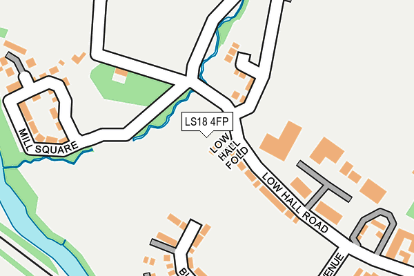
LS18 4FP is located in the Horsforth electoral ward, within the metropolitan district of Leeds and the English Parliamentary constituency of Pudsey. The Sub Integrated Care Board (ICB) Location is NHS West Yorkshire ICB - 15F and the police force is West Yorkshire. This postcode has been in use since August 2018.


GetTheData
Source: OS OpenMap – Local (Ordnance Survey)
Source: OS VectorMap District (Ordnance Survey)
Licence: Open Government Licence (requires attribution)
| Easting | 421938 |
| Northing | 437647 |
| Latitude | 53.834636 |
| Longitude | -1.668139 |
GetTheData
Source: Open Postcode Geo
Licence: Open Government Licence
| Country | England |
| Postcode District | LS18 |
| ➜ LS18 open data dashboard ➜ See where LS18 is on a map ➜ Where is Rawdon? | |
GetTheData
Source: Land Registry Price Paid Data
Licence: Open Government Licence
Elevation or altitude of LS18 4FP as distance above sea level:
| Metres | Feet | |
|---|---|---|
| Elevation | 60m | 197ft |
Elevation is measured from the approximate centre of the postcode, to the nearest point on an OS contour line from OS Terrain 50, which has contour spacing of ten vertical metres.
➜ How high above sea level am I? Find the elevation of your current position using your device's GPS.
GetTheData
Source: Open Postcode Elevation
Licence: Open Government Licence
| Ward | Horsforth |
| Constituency | Pudsey |
GetTheData
Source: ONS Postcode Database
Licence: Open Government Licence
| October 2023 | Burglary | On or near Low Hall Road | 196m |
| July 2023 | Other crime | On or near Low Hall Road | 196m |
| January 2023 | Violence and sexual offences | On or near Low Hall Road | 196m |
| ➜ Get more crime data in our Crime section | |||
GetTheData
Source: data.police.uk
Licence: Open Government Licence
| Calverley Lane Clariant (Calverley Lane) | Horsforth | 465m |
| Rawdon Rd Water Lane (Rawdon Road) | Horsforth | 685m |
| Rawdon Road | Horsforth | 717m |
| Rawdon Rd Hall Lane (Rawdon Road) | Horsforth | 767m |
| Rawdon Rd Hall Lane (Rawdon Road) | Horsforth | 772m |
| Apperley Bridge Station | 2.6km |
| Horsforth Station | 2.9km |
| Kirkstall Forge Station | 3.2km |
GetTheData
Source: NaPTAN
Licence: Open Government Licence
GetTheData
Source: ONS Postcode Database
Licence: Open Government Licence


➜ Get more ratings from the Food Standards Agency
GetTheData
Source: Food Standards Agency
Licence: FSA terms & conditions
| Last Collection | |||
|---|---|---|---|
| Location | Mon-Fri | Sat | Distance |
| Low Hall Road | 18:00 | 11:00 | 411m |
| Daisy Bank | 17:45 | 11:00 | 780m |
| Woodlands Drive | 16:30 | 11:15 | 963m |
GetTheData
Source: Dracos
Licence: Creative Commons Attribution-ShareAlike
| Facility | Distance |
|---|---|
| Clariant Sports Ground (Closed) Calverley Lane, Horsforth , Leeds Grass Pitches | 506m |
| Calverley C Of E Primary School Town Gate, Town Gate, Calverley, Pudsey Grass Pitches | 1.2km |
| West End Primary School West End Lane, Horsforth, Leeds Grass Pitches | 1.3km |
GetTheData
Source: Active Places
Licence: Open Government Licence
| School | Phase of Education | Distance |
|---|---|---|
| Calverley Church of England Voluntary Aided Primary School Town Gate, Calverley, LS28 5NF | Primary | 1.2km |
| West End Primary School West End Lane, Horsforth, Leeds, LS18 5JP | Primary | 1.2km |
| Horsforth Newlaithes Primary School Victoria Crescent, Horsforth, Leeds, LS18 4PT | Primary | 1.5km |
GetTheData
Source: Edubase
Licence: Open Government Licence
The below table lists the International Territorial Level (ITL) codes (formerly Nomenclature of Territorial Units for Statistics (NUTS) codes) and Local Administrative Units (LAU) codes for LS18 4FP:
| ITL 1 Code | Name |
|---|---|
| TLE | Yorkshire and The Humber |
| ITL 2 Code | Name |
| TLE4 | West Yorkshire |
| ITL 3 Code | Name |
| TLE42 | Leeds |
| LAU 1 Code | Name |
| E08000035 | Leeds |
GetTheData
Source: ONS Postcode Directory
Licence: Open Government Licence
The below table lists the Census Output Area (OA), Lower Layer Super Output Area (LSOA), and Middle Layer Super Output Area (MSOA) for LS18 4FP:
| Code | Name | |
|---|---|---|
| OA | E00057750 | |
| LSOA | E01011458 | Leeds 027D |
| MSOA | E02002356 | Leeds 027 |
GetTheData
Source: ONS Postcode Directory
Licence: Open Government Licence
| LS18 4FQ | Low Hall Road | 132m |
| LS18 4EF | Low Hall Road | 224m |
| LS18 4EQ | Red Beck Cottages | 248m |
| LS19 6JS | Wood Bottom | 276m |
| LS18 4FG | Bletchley Road | 288m |
| LS18 4FA | Bletchley Road | 323m |
| LS18 4FL | Brodrick Mews | 323m |
| LS18 4FW | Morris Close | 342m |
| LS18 4FT | Mackintosh Mews | 343m |
| LS18 4FR | Mackintosh Avenue | 353m |
GetTheData
Source: Open Postcode Geo; Land Registry Price Paid Data
Licence: Open Government Licence