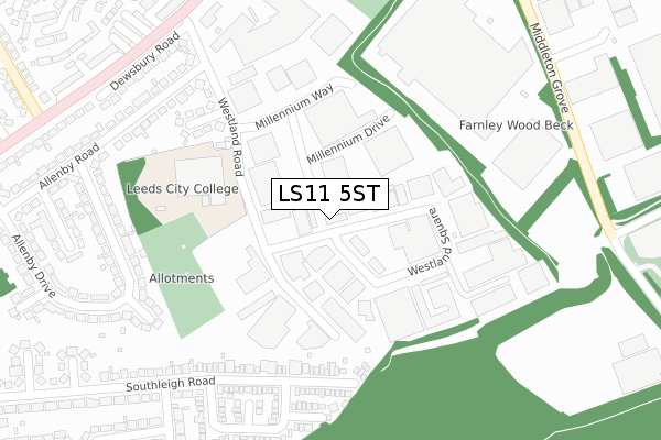
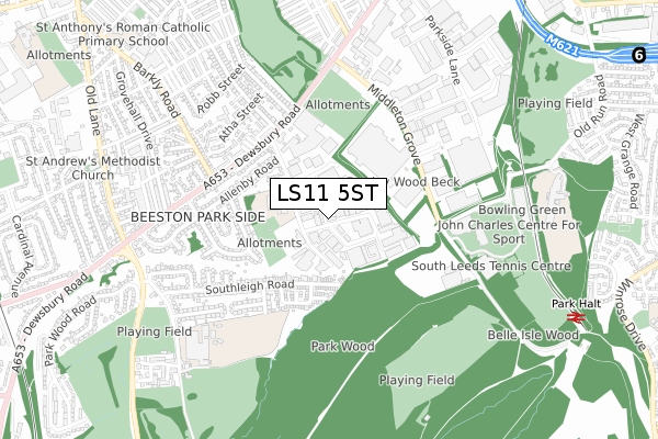
LS11 5ST is located in the Beeston & Holbeck electoral ward, within the metropolitan district of Leeds and the English Parliamentary constituency of Leeds Central. The Sub Integrated Care Board (ICB) Location is NHS West Yorkshire ICB - 15F and the police force is West Yorkshire. This postcode has been in use since February 1990.


GetTheData
Source: OS Open Zoomstack (Ordnance Survey)
Licence: Open Government Licence (requires attribution)
Attribution: Contains OS data © Crown copyright and database right 2024
Source: Open Postcode Geo
Licence: Open Government Licence (requires attribution)
Attribution: Contains OS data © Crown copyright and database right 2024; Contains Royal Mail data © Royal Mail copyright and database right 2024; Source: Office for National Statistics licensed under the Open Government Licence v.3.0
| Easting | 429713 |
| Northing | 429935 |
| Latitude | 53.764923 |
| Longitude | -1.550737 |
GetTheData
Source: Open Postcode Geo
Licence: Open Government Licence
| Country | England |
| Postcode District | LS11 |
| ➜ LS11 open data dashboard ➜ See where LS11 is on a map ➜ Where is Leeds? | |
GetTheData
Source: Land Registry Price Paid Data
Licence: Open Government Licence
Elevation or altitude of LS11 5ST as distance above sea level:
| Metres | Feet | |
|---|---|---|
| Elevation | 50m | 164ft |
Elevation is measured from the approximate centre of the postcode, to the nearest point on an OS contour line from OS Terrain 50, which has contour spacing of ten vertical metres.
➜ How high above sea level am I? Find the elevation of your current position using your device's GPS.
GetTheData
Source: Open Postcode Elevation
Licence: Open Government Licence
| Ward | Beeston & Holbeck |
| Constituency | Leeds Central |
GetTheData
Source: ONS Postcode Database
Licence: Open Government Licence
| June 2022 | Other theft | On or near Allenby View | 243m |
| June 2022 | Anti-social behaviour | On or near Southleigh Garth | 302m |
| June 2022 | Violence and sexual offences | On or near Southleigh Avenue | 392m |
| ➜ Get more crime data in our Crime section | |||
GetTheData
Source: data.police.uk
Licence: Open Government Licence
| Broadway Ph (Dewsbury Road) | Beeston | 373m |
| Broadway Ph (Dewsbury Road) | Beeston | 417m |
| Dewsbury Road Back Mafeking Ave (Dewsbury Road) | Beeston | 417m |
| Middleton Grove | Beeston | 419m |
| Middleton Grove | Beeston | 422m |
| Cottingley Station | 2.5km |
| Morley Station | 3.1km |
| Leeds Station | 3.4km |
GetTheData
Source: NaPTAN
Licence: Open Government Licence
GetTheData
Source: ONS Postcode Database
Licence: Open Government Licence


➜ Get more ratings from the Food Standards Agency
GetTheData
Source: Food Standards Agency
Licence: FSA terms & conditions
| Last Collection | |||
|---|---|---|---|
| Location | Mon-Fri | Sat | Distance |
| Westland Road | 18:30 | 11:15 | 102m |
| Westland Road | 18:30 | 102m | |
| Cross Flats P.o. | 17:30 | 12:30 | 441m |
GetTheData
Source: Dracos
Licence: Creative Commons Attribution-ShareAlike
| Facility | Distance |
|---|---|
| John Charles Centre For Sport Middleton Grove, Beeston, Leeds Indoor Bowls, Athletics, Swimming Pool, Health and Fitness Gym, Indoor Tennis Centre, Artificial Grass Pitch, Grass Pitches, Studio, Outdoor Tennis Courts | 518m |
| Cockburn School Gipsy Lane, Leeds Health and Fitness Gym, Grass Pitches, Sports Hall, Outdoor Tennis Courts, Artificial Grass Pitch | 700m |
| Cross Flatts Park Harlech Crescent, Leeds Grass Pitches | 761m |
GetTheData
Source: Active Places
Licence: Open Government Licence
| School | Phase of Education | Distance |
|---|---|---|
| Cockburn School Parkside, Gipsy Lane, Leeds, LS11 5TT | Secondary | 764m |
| Cockburn John Charles Academy Old Run Road, Old Run Rd, Leeds, LS10 2JU | Secondary | 856m |
| Park View Primary Academy Harlech Road, Leeds, LS11 7DG | Primary | 966m |
GetTheData
Source: Edubase
Licence: Open Government Licence
The below table lists the International Territorial Level (ITL) codes (formerly Nomenclature of Territorial Units for Statistics (NUTS) codes) and Local Administrative Units (LAU) codes for LS11 5ST:
| ITL 1 Code | Name |
|---|---|
| TLE | Yorkshire and The Humber |
| ITL 2 Code | Name |
| TLE4 | West Yorkshire |
| ITL 3 Code | Name |
| TLE42 | Leeds |
| LAU 1 Code | Name |
| E08000035 | Leeds |
GetTheData
Source: ONS Postcode Directory
Licence: Open Government Licence
The below table lists the Census Output Area (OA), Lower Layer Super Output Area (LSOA), and Middle Layer Super Output Area (MSOA) for LS11 5ST:
| Code | Name | |
|---|---|---|
| OA | E00057010 | |
| LSOA | E01011322 | Leeds 091E |
| MSOA | E02002420 | Leeds 091 |
GetTheData
Source: ONS Postcode Directory
Licence: Open Government Licence
| LS11 5XA | Westland Road | 132m |
| LS11 5SS | Westland Square | 137m |
| LS11 5XG | Southleigh Road | 236m |
| LS11 5SD | Allenby View | 240m |
| LS11 5SB | Westland Road | 252m |
| LS11 5XQ | Southleigh Road | 273m |
| LS11 5XJ | Southleigh Garth | 287m |
| LS11 5RY | Allenby Drive | 312m |
| LS11 5XH | Southleigh Croft | 322m |
| LS11 5SA | Allenby Grove | 325m |
GetTheData
Source: Open Postcode Geo; Land Registry Price Paid Data
Licence: Open Government Licence