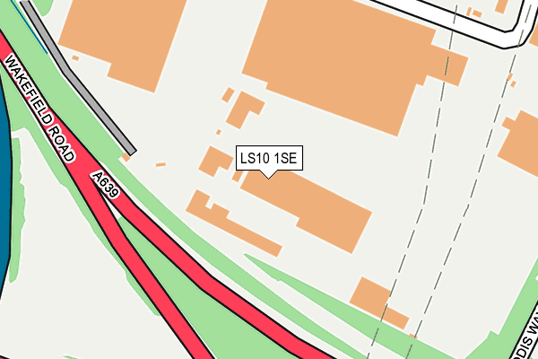
LS10 1SE is located in the Hunslet & Riverside electoral ward, within the metropolitan district of Leeds and the English Parliamentary constituency of Leeds Central. The Sub Integrated Care Board (ICB) Location is NHS West Yorkshire ICB - 15F and the police force is West Yorkshire. This postcode has been in use since January 1980.


GetTheData
Source: OS OpenMap – Local (Ordnance Survey)
Source: OS VectorMap District (Ordnance Survey)
Licence: Open Government Licence (requires attribution)
| Easting | 432432 |
| Northing | 430104 |
| Latitude | 53.766297 |
| Longitude | -1.509477 |
GetTheData
Source: Open Postcode Geo
Licence: Open Government Licence
| Country | England |
| Postcode District | LS10 |
| ➜ LS10 open data dashboard ➜ See where LS10 is on a map ➜ Where is Leeds? | |
GetTheData
Source: Land Registry Price Paid Data
Licence: Open Government Licence
Elevation or altitude of LS10 1SE as distance above sea level:
| Metres | Feet | |
|---|---|---|
| Elevation | 30m | 98ft |
Elevation is measured from the approximate centre of the postcode, to the nearest point on an OS contour line from OS Terrain 50, which has contour spacing of ten vertical metres.
➜ How high above sea level am I? Find the elevation of your current position using your device's GPS.
GetTheData
Source: Open Postcode Elevation
Licence: Open Government Licence
| Ward | Hunslet & Riverside |
| Constituency | Leeds Central |
GetTheData
Source: ONS Postcode Database
Licence: Open Government Licence
| June 2022 | Violence and sexual offences | On or near Valley Farm Way | 240m |
| June 2022 | Violence and sexual offences | On or near Valley Farm Way | 240m |
| June 2022 | Bicycle theft | On or near A639 | 392m |
| ➜ Get more crime data in our Crime section | |||
GetTheData
Source: data.police.uk
Licence: Open Government Licence
| Pontefract Rd Intermezzo Drive (Pontefract Road) | Stourton | 441m |
| Pontefract Rd Intermezzo Drive (Pontefract Road) | Stourton | 442m |
| Wakefield Road Leeds Valley Park (Wakefield Road) | Stourton | 444m |
| Wakefield Rd Valley Farm Road (Wakefield Road) | Stourton | 454m |
| Wakefield Road Leeds Valley Park (Wakefield Road) | Stourton | 476m |
| Leeds Station | 4.1km |
| Woodlesford Station | 4.5km |
| Cross Gates Station | 5.7km |
GetTheData
Source: NaPTAN
Licence: Open Government Licence
GetTheData
Source: ONS Postcode Database
Licence: Open Government Licence


➜ Get more ratings from the Food Standards Agency
GetTheData
Source: Food Standards Agency
Licence: FSA terms & conditions
| Last Collection | |||
|---|---|---|---|
| Location | Mon-Fri | Sat | Distance |
| Leeds Mail Centre Leodis House | 19:30 | 15:15 | 449m |
| Wakefield Road/Opp Queen St | 18:30 | 12:45 | 825m |
| Wakefield Road/Opp Queen St | 827m | ||
GetTheData
Source: Dracos
Licence: Creative Commons Attribution-ShareAlike
| Facility | Distance |
|---|---|
| South Leeds Youth Hub Middleton Road, Middleton Road, Leeds Artificial Grass Pitch | 1.1km |
| South Leeds High School (Belleisle Campus) (Closed) Middleton Road, Leeds Sports Hall, Studio | 1.1km |
| Pepper Road Recreation Ground Pepper Road, Hunslet, Leeds Grass Pitches | 1.2km |
GetTheData
Source: Active Places
Licence: Open Government Licence
| School | Phase of Education | Distance |
|---|---|---|
| Southway Independant School Middleton Road, Leeds, West Yorkshire, LS10 3JA | Not applicable | 1.1km |
| Springwell Leeds Academy Middleton Road, Leeds, LS10 3JA | Not applicable | 1.2km |
| Broomfield South SILC Broom Place, Leeds, LS10 3JP | Not applicable | 1.4km |
GetTheData
Source: Edubase
Licence: Open Government Licence
The below table lists the International Territorial Level (ITL) codes (formerly Nomenclature of Territorial Units for Statistics (NUTS) codes) and Local Administrative Units (LAU) codes for LS10 1SE:
| ITL 1 Code | Name |
|---|---|
| TLE | Yorkshire and The Humber |
| ITL 2 Code | Name |
| TLE4 | West Yorkshire |
| ITL 3 Code | Name |
| TLE42 | Leeds |
| LAU 1 Code | Name |
| E08000035 | Leeds |
GetTheData
Source: ONS Postcode Directory
Licence: Open Government Licence
The below table lists the Census Output Area (OA), Lower Layer Super Output Area (LSOA), and Middle Layer Super Output Area (MSOA) for LS10 1SE:
| Code | Name | |
|---|---|---|
| OA | E00057795 | |
| LSOA | E01011470 | Leeds 112C |
| MSOA | E02006876 | Leeds 112 |
GetTheData
Source: ONS Postcode Directory
Licence: Open Government Licence
| LS10 1SL | Queen Street | 699m |
| LS10 4QY | Middlecroft Close | 713m |
| LS10 3DD | Westbury Terrace | 723m |
| LS10 4QZ | Middlecroft Road | 740m |
| LS10 3DG | Westbury Grove | 745m |
| LS10 3DB | Westbury Mount | 746m |
| LS10 3DA | Westbury Place South | 751m |
| LS10 4RR | Highlands Grove | 772m |
| LS10 3DE | Westbury Place North | 785m |
| LS10 4RQ | Lea Park Croft | 790m |
GetTheData
Source: Open Postcode Geo; Land Registry Price Paid Data
Licence: Open Government Licence