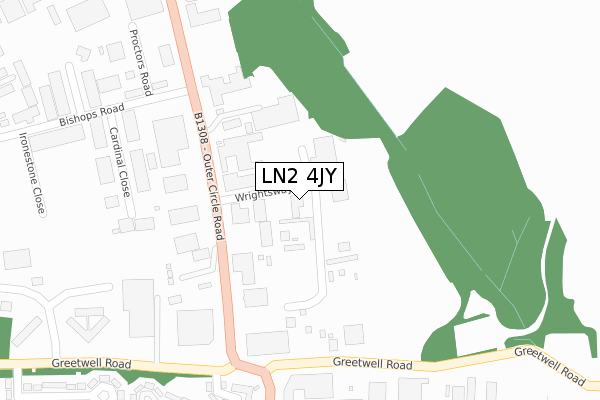
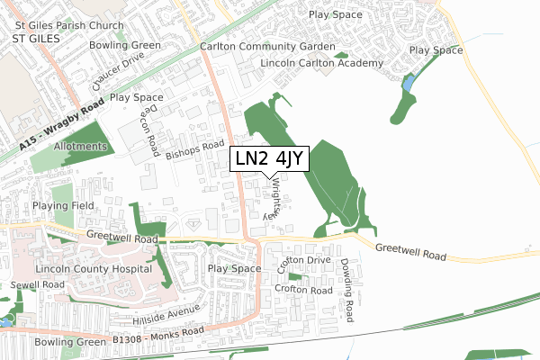
LN2 4JY lies on Wrightsway in Lincoln. LN2 4JY is located in the Abbey electoral ward, within the local authority district of Lincoln and the English Parliamentary constituency of Lincoln. The Sub Integrated Care Board (ICB) Location is NHS Lincolnshire ICB - 71E and the police force is Lincolnshire. This postcode has been in use since January 1980.


GetTheData
Source: OS Open Zoomstack (Ordnance Survey)
Licence: Open Government Licence (requires attribution)
Attribution: Contains OS data © Crown copyright and database right 2024
Source: Open Postcode Geo
Licence: Open Government Licence (requires attribution)
Attribution: Contains OS data © Crown copyright and database right 2024; Contains Royal Mail data © Royal Mail copyright and database right 2024; Source: Office for National Statistics licensed under the Open Government Licence v.3.0
| Easting | 499810 |
| Northing | 372128 |
| Latitude | 53.236812 |
| Longitude | -0.506008 |
GetTheData
Source: Open Postcode Geo
Licence: Open Government Licence
| Street | Wrightsway |
| Town/City | Lincoln |
| Country | England |
| Postcode District | LN2 |
| ➜ LN2 open data dashboard ➜ See where LN2 is on a map ➜ Where is Lincoln? | |
GetTheData
Source: Land Registry Price Paid Data
Licence: Open Government Licence
Elevation or altitude of LN2 4JY as distance above sea level:
| Metres | Feet | |
|---|---|---|
| Elevation | 30m | 98ft |
Elevation is measured from the approximate centre of the postcode, to the nearest point on an OS contour line from OS Terrain 50, which has contour spacing of ten vertical metres.
➜ How high above sea level am I? Find the elevation of your current position using your device's GPS.
GetTheData
Source: Open Postcode Elevation
Licence: Open Government Licence
| Ward | Abbey |
| Constituency | Lincoln |
GetTheData
Source: ONS Postcode Database
Licence: Open Government Licence
IMPRINT COLOUR PRINTERS, WRIGHTSWAY, LINCOLN, LN2 4JY 2001 27 JUN £154,000 |
GetTheData
Source: HM Land Registry Price Paid Data
Licence: Contains HM Land Registry data © Crown copyright and database right 2024. This data is licensed under the Open Government Licence v3.0.
| June 2022 | Vehicle crime | On or near Wrightsway | 57m |
| June 2022 | Public order | On or near Tower Gardens | 346m |
| June 2022 | Violence and sexual offences | On or near Tower Gardens | 346m |
| ➜ Wrightsway crime map and outcomes | |||
GetTheData
Source: data.police.uk
Licence: Open Government Licence
| Bishops Road (Outer Circle Road) | Lincoln | 163m |
| Bishops Road (Outer Circle Road) | Lincoln | 228m |
| Ford Garage (Outer Circle Road) | Tower Estate | 251m |
| Wickes (Greetwell Road) | Tower Estate | 267m |
| Wickes (Greetwell Road) | Tower Estate | 277m |
| Lincoln Central Station | 2.6km |
GetTheData
Source: NaPTAN
Licence: Open Government Licence
GetTheData
Source: ONS Postcode Database
Licence: Open Government Licence


➜ Get more ratings from the Food Standards Agency
GetTheData
Source: Food Standards Agency
Licence: FSA terms & conditions
| Last Collection | |||
|---|---|---|---|
| Location | Mon-Fri | Sat | Distance |
| Greetwell Road | 17:30 | 11:15 | 1,050m |
| Wolsey Way | 17:30 | 12:15 | 1,054m |
| Grafton Street | 17:00 | 12:15 | 1,401m |
GetTheData
Source: Dracos
Licence: Creative Commons Attribution-ShareAlike
| Facility | Distance |
|---|---|
| Curves (Lincoln North) Dean Road, Lincoln Health and Fitness Gym | 404m |
| Lincoln Carlton Academy Carlton Boulevard, Lincoln Grass Pitches | 610m |
| Puregym (Lincoln Carlton Centre) Carlton Boulevard, Lincoln Health and Fitness Gym | 626m |
GetTheData
Source: Active Places
Licence: Open Government Licence
| School | Phase of Education | Distance |
|---|---|---|
| Lincoln Carlton Academy Carlton Boulevard, Lincoln, LN2 4AG | Primary | 896m |
| St Giles Academy Addison Drive, St Giles Academy, Lincoln, LN2 4LQ | Primary | 1km |
| The Lincoln St Giles Nursery School Addison Drive, Lincoln, LN2 4LQ | Nursery | 1.1km |
GetTheData
Source: Edubase
Licence: Open Government Licence
The below table lists the International Territorial Level (ITL) codes (formerly Nomenclature of Territorial Units for Statistics (NUTS) codes) and Local Administrative Units (LAU) codes for LN2 4JY:
| ITL 1 Code | Name |
|---|---|
| TLF | East Midlands (England) |
| ITL 2 Code | Name |
| TLF3 | Lincolnshire |
| ITL 3 Code | Name |
| TLF30 | Lincolnshire CC |
| LAU 1 Code | Name |
| E07000138 | Lincoln |
GetTheData
Source: ONS Postcode Directory
Licence: Open Government Licence
The below table lists the Census Output Area (OA), Lower Layer Super Output Area (LSOA), and Middle Layer Super Output Area (MSOA) for LN2 4JY:
| Code | Name | |
|---|---|---|
| OA | E00173646 | |
| LSOA | E01026123 | Lincoln 004B |
| MSOA | E02005445 | Lincoln 004 |
GetTheData
Source: ONS Postcode Directory
Licence: Open Government Licence
| LN2 4HU | Outer Circle Road | 114m |
| LN2 4HZ | Outer Circle Road | 215m |
| LN2 4LA | Proctors Road | 352m |
| LN2 5QG | Tower Gardens | 359m |
| LN2 4US | Lime Kiln Way | 409m |
| LN3 4NR | Crofton Drive | 415m |
| LN2 5QE | Tower Crescent | 418m |
| LN2 4FW | Putnam Drive | 439m |
| LN2 4GP | Stark Way | 463m |
| LN2 5QQ | Tower Avenue | 466m |
GetTheData
Source: Open Postcode Geo; Land Registry Price Paid Data
Licence: Open Government Licence