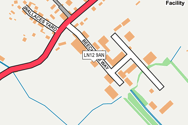
LN12 9AN is located in the Alford electoral ward, within the local authority district of East Lindsey and the English Parliamentary constituency of Louth and Horncastle. The Sub Integrated Care Board (ICB) Location is NHS Lincolnshire ICB - 71E and the police force is Lincolnshire. This postcode has been in use since July 2016.


GetTheData
Source: OS OpenMap – Local (Ordnance Survey)
Source: OS VectorMap District (Ordnance Survey)
Licence: Open Government Licence (requires attribution)
| Easting | 544683 |
| Northing | 375393 |
| Latitude | 53.255823 |
| Longitude | 0.167360 |
GetTheData
Source: Open Postcode Geo
Licence: Open Government Licence
| Country | England |
| Postcode District | LN12 |
| ➜ LN12 open data dashboard ➜ See where LN12 is on a map ➜ Where is Alford? | |
GetTheData
Source: Land Registry Price Paid Data
Licence: Open Government Licence
Elevation or altitude of LN12 9AN as distance above sea level:
| Metres | Feet | |
|---|---|---|
| Elevation | 10m | 33ft |
Elevation is measured from the approximate centre of the postcode, to the nearest point on an OS contour line from OS Terrain 50, which has contour spacing of ten vertical metres.
➜ How high above sea level am I? Find the elevation of your current position using your device's GPS.
GetTheData
Source: Open Postcode Elevation
Licence: Open Government Licence
| Ward | Alford |
| Constituency | Louth And Horncastle |
GetTheData
Source: ONS Postcode Database
Licence: Open Government Licence
| June 2022 | Violence and sexual offences | On or near Station Road | 274m |
| June 2022 | Violence and sexual offences | On or near Kennedy Avenue | 490m |
| May 2022 | Violence and sexual offences | On or near Station Road | 274m |
| ➜ Get more crime data in our Crime section | |||
GetTheData
Source: data.police.uk
Licence: Open Government Licence
| Beeching Industrial Estate (Beechings Way) | Alford | 21m |
| Beeching Industrial Estate (Beechings Way) | Alford | 27m |
| Hunts Coach Depot (Station Road) | Alford | 179m |
| Queen Elizabeth School (Station Road) | Alford | 403m |
| Queen Elizabeth School (Station Road) | Alford | 414m |
GetTheData
Source: NaPTAN
Licence: Open Government Licence
GetTheData
Source: ONS Postcode Database
Licence: Open Government Licence


➜ Get more ratings from the Food Standards Agency
GetTheData
Source: Food Standards Agency
Licence: FSA terms & conditions
| Last Collection | |||
|---|---|---|---|
| Location | Mon-Fri | Sat | Distance |
| Willoughby Post Office | 16:15 | 09:45 | 4,159m |
GetTheData
Source: Dracos
Licence: Creative Commons Attribution-ShareAlike
| Facility | Distance |
|---|---|
| Queen Elizabeth's Grammar (Alford) Station Road, Alford Swimming Pool, Sports Hall, Grass Pitches, Health and Fitness Gym | 368m |
| Alford And District Cricket Club Low Lane, Well, Alford Grass Pitches | 1km |
| Alford Sports Hall Hanby Lane, Alford Sports Hall, Health and Fitness Gym, Swimming Pool, Grass Pitches, Artificial Grass Pitch | 1.1km |
GetTheData
Source: Active Places
Licence: Open Government Licence
| School | Phase of Education | Distance |
|---|---|---|
| Queen Elizabeth's Grammar Alford - A Selective Academy Station Road, Alford, LN13 9HY | Secondary | 368m |
| Alford Primary School Hanby Lane, Alford, LN13 9BJ | Primary | 1km |
| John Spendluffe Foundation Technology College Hanby Lane, Alford, LN13 9BL | Secondary | 1.1km |
GetTheData
Source: Edubase
Licence: Open Government Licence
The below table lists the International Territorial Level (ITL) codes (formerly Nomenclature of Territorial Units for Statistics (NUTS) codes) and Local Administrative Units (LAU) codes for LN12 9AN:
| ITL 1 Code | Name |
|---|---|
| TLF | East Midlands (England) |
| ITL 2 Code | Name |
| TLF3 | Lincolnshire |
| ITL 3 Code | Name |
| TLF30 | Lincolnshire CC |
| LAU 1 Code | Name |
| E07000137 | East Lindsey |
GetTheData
Source: ONS Postcode Directory
Licence: Open Government Licence
The below table lists the Census Output Area (OA), Lower Layer Super Output Area (LSOA), and Middle Layer Super Output Area (MSOA) for LN12 9AN:
| Code | Name | |
|---|---|---|
| OA | E00132158 | |
| LSOA | E01026043 | East Lindsey 008B |
| MSOA | E02005431 | East Lindsey 008 |
GetTheData
Source: ONS Postcode Directory
Licence: Open Government Licence
| LN13 9JE | Beechings Way | 125m |
| LN13 9HY | Station Road | 215m |
| LN13 9JB | Station Road | 232m |
| LN13 9DD | Wallaces Yard | 269m |
| LN13 0AJ | Stephensons Close | 314m |
| LN13 0AH | Coles Avenue | 393m |
| LN13 9HW | Chauntry Road | 403m |
| LN13 0PN | Staveley Road | 422m |
| LN13 9HX | Bourne Road | 470m |
| LN13 9HJ | Chauntry Road | 484m |
GetTheData
Source: Open Postcode Geo; Land Registry Price Paid Data
Licence: Open Government Licence