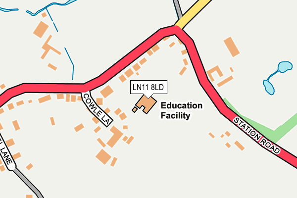
LN11 8LD is located in the Legbourne electoral ward, within the local authority district of East Lindsey and the English Parliamentary constituency of Louth and Horncastle. The Sub Integrated Care Board (ICB) Location is NHS Lincolnshire ICB - 71E and the police force is Lincolnshire. This postcode has been in use since May 1994.


GetTheData
Source: OS OpenMap – Local (Ordnance Survey)
Source: OS VectorMap District (Ordnance Survey)
Licence: Open Government Licence (requires attribution)
| Easting | 537240 |
| Northing | 384434 |
| Latitude | 53.339013 |
| Longitude | 0.059774 |
GetTheData
Source: Open Postcode Geo
Licence: Open Government Licence
| Country | England |
| Postcode District | LN11 |
| ➜ LN11 open data dashboard ➜ See where LN11 is on a map ➜ Where is Legbourne? | |
GetTheData
Source: Land Registry Price Paid Data
Licence: Open Government Licence
Elevation or altitude of LN11 8LD as distance above sea level:
| Metres | Feet | |
|---|---|---|
| Elevation | 20m | 66ft |
Elevation is measured from the approximate centre of the postcode, to the nearest point on an OS contour line from OS Terrain 50, which has contour spacing of ten vertical metres.
➜ How high above sea level am I? Find the elevation of your current position using your device's GPS.
GetTheData
Source: Open Postcode Elevation
Licence: Open Government Licence
| Ward | Legbourne |
| Constituency | Louth And Horncastle |
GetTheData
Source: ONS Postcode Database
Licence: Open Government Licence
| March 2022 | Anti-social behaviour | On or near Cowle Lane | 111m |
| March 2022 | Other theft | On or near A157 | 152m |
| December 2021 | Anti-social behaviour | On or near Chapel Lane | 309m |
| ➜ Get more crime data in our Crime section | |||
GetTheData
Source: data.police.uk
Licence: Open Government Licence
| East Wold Primary School (Station Road) | Legbourne | 91m |
| East Wold Primary School (Station Road) | Legbourne | 97m |
| Demand Responsive Area | Legbourne | 419m |
| Post Office (Station Road) | Legbourne | 460m |
| Post Office (Station Road) | Legbourne | 486m |
GetTheData
Source: NaPTAN
Licence: Open Government Licence
GetTheData
Source: ONS Postcode Database
Licence: Open Government Licence


➜ Get more ratings from the Food Standards Agency
GetTheData
Source: Food Standards Agency
Licence: FSA terms & conditions
| Last Collection | |||
|---|---|---|---|
| Location | Mon-Fri | Sat | Distance |
| Stewton Lane | 17:00 | 12:00 | 4,083m |
| Newmarket Post Office | 17:15 | 12:00 | 4,530m |
| Trinity Post Office | 17:15 | 11:30 | 4,880m |
GetTheData
Source: Dracos
Licence: Creative Commons Attribution-ShareAlike
| Facility | Distance |
|---|---|
| Legbourne And Little Cawthorpe Community Centre Chapel Lane, Legbourne Grass Pitches, Sports Hall | 317m |
| Inshape Gym Manby Road, Stewton Health and Fitness Gym | 2.3km |
| Kenwick Health & Leisure Club Kenwick, Louth Swimming Pool, Health and Fitness Gym, Studio, Squash Courts, Outdoor Tennis Courts | 2.7km |
GetTheData
Source: Active Places
Licence: Open Government Licence
| School | Phase of Education | Distance |
|---|---|---|
| East Wold Church of England Primary School Station Road, Legbourne, Louth, LN11 8LD | Primary | 0m |
| Grimoldby Primary School Tinkle Street, Grimoldby, Louth, LN11 8SW | Primary | 3.8km |
| St Bernard's School Wood Lane, Louth, LN11 8RS | Not applicable | 4km |
GetTheData
Source: Edubase
Licence: Open Government Licence
The below table lists the International Territorial Level (ITL) codes (formerly Nomenclature of Territorial Units for Statistics (NUTS) codes) and Local Administrative Units (LAU) codes for LN11 8LD:
| ITL 1 Code | Name |
|---|---|
| TLF | East Midlands (England) |
| ITL 2 Code | Name |
| TLF3 | Lincolnshire |
| ITL 3 Code | Name |
| TLF30 | Lincolnshire CC |
| LAU 1 Code | Name |
| E07000137 | East Lindsey |
GetTheData
Source: ONS Postcode Directory
Licence: Open Government Licence
The below table lists the Census Output Area (OA), Lower Layer Super Output Area (LSOA), and Middle Layer Super Output Area (MSOA) for LN11 8LD:
| Code | Name | |
|---|---|---|
| OA | E00132306 | |
| LSOA | E01026070 | East Lindsey 009C |
| MSOA | E02005432 | East Lindsey 009 |
GetTheData
Source: ONS Postcode Directory
Licence: Open Government Licence
| LN11 8LP | Cowle Lane | 89m |
| LN11 8LS | Reston Road | 133m |
| LN11 8LL | Station Road | 261m |
| LN11 8LW | Chapel Lane | 331m |
| LN11 8NE | Alfred Smith Way | 391m |
| LN11 8LN | Church Lane | 436m |
| LN11 8NF | The Hollows | 493m |
| LN11 8LY | Poplars Lane | 678m |
| LN11 8LG | Househams Lane | 723m |
| LN11 8NH | Manor Park | 776m |
GetTheData
Source: Open Postcode Geo; Land Registry Price Paid Data
Licence: Open Government Licence