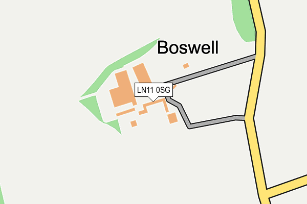
LN11 0SG is located in the Binbrook electoral ward, within the local authority district of East Lindsey and the English Parliamentary constituency of Louth and Horncastle. The Sub Integrated Care Board (ICB) Location is NHS Lincolnshire ICB - 71E and the police force is Lincolnshire. This postcode has been in use since January 1980.


GetTheData
Source: OS OpenMap – Local (Ordnance Survey)
Source: OS VectorMap District (Ordnance Survey)
Licence: Open Government Licence (requires attribution)
| Easting | 527784 |
| Northing | 390415 |
| Latitude | 53.395110 |
| Longitude | -0.079742 |
GetTheData
Source: Open Postcode Geo
Licence: Open Government Licence
| Country | England |
| Postcode District | LN11 |
| ➜ LN11 open data dashboard ➜ See where LN11 is on a map ➜ Where is Boswell? | |
GetTheData
Source: Land Registry Price Paid Data
Licence: Open Government Licence
Elevation or altitude of LN11 0SG as distance above sea level:
| Metres | Feet | |
|---|---|---|
| Elevation | 120m | 394ft |
Elevation is measured from the approximate centre of the postcode, to the nearest point on an OS contour line from OS Terrain 50, which has contour spacing of ten vertical metres.
➜ How high above sea level am I? Find the elevation of your current position using your device's GPS.
GetTheData
Source: Open Postcode Elevation
Licence: Open Government Licence
| Ward | Binbrook |
| Constituency | Louth And Horncastle |
GetTheData
Source: ONS Postcode Database
Licence: Open Government Licence
| Mill Lane End (Mill Lane) | North Elkington | 273m |
| Mill Lane End (Mill Lane) | North Elkington | 278m |
| Mill Farm (Mill Lane) | North Elkington | 1,244m |
| Demand Responsive Area | North Elkington | 1,252m |
| Mill Farm (Mill Lane) | North Elkington | 1,261m |
GetTheData
Source: NaPTAN
Licence: Open Government Licence
➜ Broadband speed and availability dashboard for LN11 0SG
| Percentage of properties with Next Generation Access | 100.0% |
| Percentage of properties with Superfast Broadband | 0.0% |
| Percentage of properties with Ultrafast Broadband | 0.0% |
| Percentage of properties with Full Fibre Broadband | 0.0% |
Superfast Broadband is between 30Mbps and 300Mbps
Ultrafast Broadband is > 300Mbps
| Median download speed | 1.5Mbps |
| Average download speed | 1.5Mbps |
| Maximum download speed | 1.71Mbps |
| Median upload speed | 0.6Mbps |
| Average upload speed | 0.6Mbps |
| Maximum upload speed | 0.70Mbps |
| Percentage of properties unable to receive 2Mbps | 100.0% |
| Percentage of properties unable to receive 5Mbps | 100.0% |
| Percentage of properties unable to receive 10Mbps | 100.0% |
| Percentage of properties unable to receive 30Mbps | 100.0% |
➜ Broadband speed and availability dashboard for LN11 0SG
GetTheData
Source: Ofcom
Licence: Ofcom Terms of Use (requires attribution)
GetTheData
Source: ONS Postcode Database
Licence: Open Government Licence
| Last Collection | |||
|---|---|---|---|
| Location | Mon-Fri | Sat | Distance |
| Utterby Post Office | 17:00 | 11:00 | 4,329m |
| Westgate | 16:15 | 11:00 | 5,573m |
| Louth Post Office | 17:15 | 12:15 | 5,814m |
GetTheData
Source: Dracos
Licence: Creative Commons Attribution-ShareAlike
| Facility | Distance |
|---|---|
| Louth Tennis And Sports Centre Scarborough Road, Louth Indoor Tennis Centre, Outdoor Tennis Courts | 4.7km |
| Iron Eden Tattershall Way, Fairfield Industrial Estate, Louth Health and Fitness Gym | 4.9km |
| Louth Lawn Tennis Club Westgate, Westgate, Louth Outdoor Tennis Courts | 5.6km |
GetTheData
Source: Active Places
Licence: Open Government Licence
| School | Phase of Education | Distance |
|---|---|---|
| The Utterby Primary Academy Utterby, Louth, LN11 0TN | Primary | 4.1km |
| King Edward VI Grammar School Edward Street, Louth, LN11 9LL | Secondary | 5.8km |
GetTheData
Source: Edubase
Licence: Open Government Licence
The below table lists the International Territorial Level (ITL) codes (formerly Nomenclature of Territorial Units for Statistics (NUTS) codes) and Local Administrative Units (LAU) codes for LN11 0SG:
| ITL 1 Code | Name |
|---|---|
| TLF | East Midlands (England) |
| ITL 2 Code | Name |
| TLF3 | Lincolnshire |
| ITL 3 Code | Name |
| TLF30 | Lincolnshire CC |
| LAU 1 Code | Name |
| E07000137 | East Lindsey |
GetTheData
Source: ONS Postcode Directory
Licence: Open Government Licence
The below table lists the Census Output Area (OA), Lower Layer Super Output Area (LSOA), and Middle Layer Super Output Area (MSOA) for LN11 0SG:
| Code | Name | |
|---|---|---|
| OA | E00132304 | |
| LSOA | E01026070 | East Lindsey 009C |
| MSOA | E02005432 | East Lindsey 009 |
GetTheData
Source: ONS Postcode Directory
Licence: Open Government Licence
| LN11 0SH | 693m | |
| LN11 0SF | Church Lane | 802m |
| LN11 0RG | 2578m | |
| LN11 0RZ | High Street | 2633m |
| LN11 0SA | Church Lane | 2707m |
| LN11 0QT | 2885m | |
| LN11 0RY | 3018m | |
| LN11 0TJ | 3109m | |
| LN11 0QS | Lincoln Road | 3502m |
| LN11 0RE | Poke Holes | 3520m |
GetTheData
Source: Open Postcode Geo; Land Registry Price Paid Data
Licence: Open Government Licence