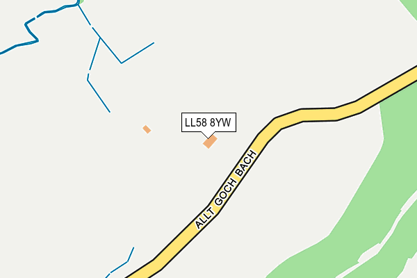
LL58 8YW is in Beaumaris. LL58 8YW is located in the Seiriol electoral ward, within the unitary authority of Isle of Anglesey and the Welsh Parliamentary constituency of Ynys M�n. The Local Health Board is Betsi Cadwaladr University and the police force is North Wales. This postcode has been in use since January 1980.


GetTheData
Source: OS OpenMap – Local (Ordnance Survey)
Source: OS VectorMap District (Ordnance Survey)
Licence: Open Government Licence (requires attribution)
| Easting | 259296 |
| Northing | 375420 |
| Latitude | 53.257074 |
| Longitude | -4.110687 |
GetTheData
Source: Open Postcode Geo
Licence: Open Government Licence
| Town/City | Beaumaris |
| Country | Wales |
| Postcode District | LL58 |
| ➜ LL58 open data dashboard ➜ See where LL58 is on a map | |
GetTheData
Source: Land Registry Price Paid Data
Licence: Open Government Licence
Elevation or altitude of LL58 8YW as distance above sea level:
| Metres | Feet | |
|---|---|---|
| Elevation | 90m | 295ft |
Elevation is measured from the approximate centre of the postcode, to the nearest point on an OS contour line from OS Terrain 50, which has contour spacing of ten vertical metres.
➜ How high above sea level am I? Find the elevation of your current position using your device's GPS.
GetTheData
Source: Open Postcode Elevation
Licence: Open Government Licence
| Ward | Seiriol |
| Constituency | Ynys M�n |
GetTheData
Source: ONS Postcode Database
Licence: Open Government Licence
| Cemetery (A545) | Beaumaris | 855m |
| Lidiart Parc (Main Road) | Hen Bentref Llandegfan | 870m |
| Lidiart Parc (Main Road) | Hen Bentref Llandegfan | 870m |
| Mile Lane (The Mile Road) | Beaumaris | 1,036m |
| Allt Goch Lodge (Unclassified Road) | Beaumaris | 1,051m |
| Bangor (Gwynedd) Station | 4.2km |
GetTheData
Source: NaPTAN
Licence: Open Government Licence
➜ Broadband speed and availability dashboard for LL58 8YW
| Percentage of properties with Next Generation Access | 85.7% |
| Percentage of properties with Superfast Broadband | 85.7% |
| Percentage of properties with Ultrafast Broadband | 42.9% |
| Percentage of properties with Full Fibre Broadband | 42.9% |
Superfast Broadband is between 30Mbps and 300Mbps
Ultrafast Broadband is > 300Mbps
| Median download speed | 10.7Mbps |
| Average download speed | 12.8Mbps |
| Maximum download speed | 21.67Mbps |
| Median upload speed | 1.2Mbps |
| Average upload speed | 1.0Mbps |
| Maximum upload speed | 1.28Mbps |
| Percentage of properties unable to receive 2Mbps | 0.0% |
| Percentage of properties unable to receive 5Mbps | 0.0% |
| Percentage of properties unable to receive 10Mbps | 0.0% |
| Percentage of properties unable to receive 30Mbps | 14.3% |
➜ Broadband speed and availability dashboard for LL58 8YW
GetTheData
Source: Ofcom
Licence: Ofcom Terms of Use (requires attribution)
GetTheData
Source: ONS Postcode Database
Licence: Open Government Licence


➜ Get more ratings from the Food Standards Agency
GetTheData
Source: Food Standards Agency
Licence: FSA terms & conditions
| Last Collection | |||
|---|---|---|---|
| Location | Mon-Fri | Sat | Distance |
| Beaumaris Post Office | 17:30 | 12:00 | 1,386m |
| County Hall | 09:30 | 09:30 | 1,547m |
| Beach Road | 17:30 | 11:07 | 2,840m |
GetTheData
Source: Dracos
Licence: Creative Commons Attribution-ShareAlike
| School | Phase of Education | Distance |
|---|---|---|
| Ysgol Gynradd Beaumaris Maeshyfryd, Beaumaris, LL58 8HL | Not applicable | 1km |
| Ysgol Gynradd Llandegfan Llandegfan, Porthaethwy, LL59 5UW | Not applicable | 2.8km |
| Ysgol Gynradd Hirael Orme Road, Bangor, Gwynedd, LL57 1BA | Not applicable | 3km |
GetTheData
Source: Edubase
Licence: Open Government Licence
The below table lists the International Territorial Level (ITL) codes (formerly Nomenclature of Territorial Units for Statistics (NUTS) codes) and Local Administrative Units (LAU) codes for LL58 8YW:
| ITL 1 Code | Name |
|---|---|
| TLL | Wales |
| ITL 2 Code | Name |
| TLL1 | West Wales and The Valleys |
| ITL 3 Code | Name |
| TLL11 | Isle of Anglesey |
| LAU 1 Code | Name |
| W06000001 | Isle of Anglesey |
GetTheData
Source: ONS Postcode Directory
Licence: Open Government Licence
The below table lists the Census Output Area (OA), Lower Layer Super Output Area (LSOA), and Middle Layer Super Output Area (MSOA) for LL58 8YW:
| Code | Name | |
|---|---|---|
| OA | W00000062 | |
| LSOA | W01000013 | Isle of Anglesey 005B |
| MSOA | W02000005 | Isle of Anglesey 005 |
GetTheData
Source: ONS Postcode Directory
Licence: Open Government Licence
| LL58 8YX | Cae Mair Uchaf | 525m |
| LL58 8YQ | Cae Mair | 635m |
| LL58 8YN | Cae Mair | 769m |
| LL58 8BL | Mill Lane | 924m |
| LL58 8HH | Iscoed | 946m |
| LL58 8HG | Thomas Close | 960m |
| LL58 8EE | Rosemary Lane | 1001m |
| LL58 8HD | Maeshyfryd | 1018m |
| LL58 8BH | Towns End | 1040m |
| LL58 8EG | New Street | 1069m |
GetTheData
Source: Open Postcode Geo; Land Registry Price Paid Data
Licence: Open Government Licence