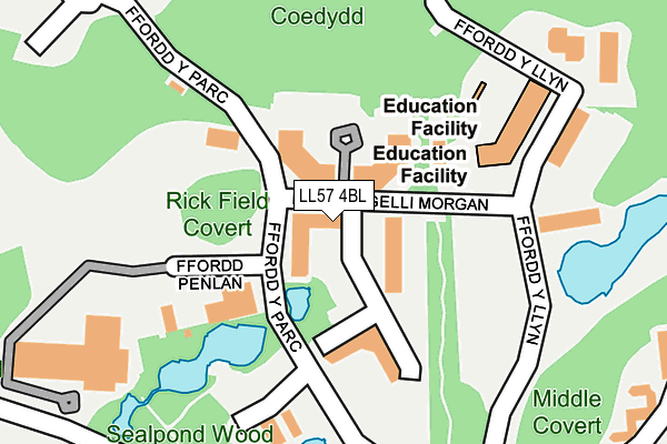
LL57 4BL is located in the Y Faenol electoral ward, within the unitary authority of Gwynedd and the Welsh Parliamentary constituency of Arfon. The Local Health Board is Betsi Cadwaladr University and the police force is North Wales. This postcode has been in use since January 1993.


GetTheData
Source: OS OpenMap – Local (Ordnance Survey)
Source: OS VectorMap District (Ordnance Survey)
Licence: Open Government Licence (requires attribution)
| Easting | 254318 |
| Northing | 369930 |
| Latitude | 53.206417 |
| Longitude | -4.182741 |
GetTheData
Source: Open Postcode Geo
Licence: Open Government Licence
| Country | Wales |
| Postcode District | LL57 |
| ➜ LL57 open data dashboard ➜ See where LL57 is on a map ➜ Where is Bangor? | |
GetTheData
Source: Land Registry Price Paid Data
Licence: Open Government Licence
Elevation or altitude of LL57 4BL as distance above sea level:
| Metres | Feet | |
|---|---|---|
| Elevation | 50m | 164ft |
Elevation is measured from the approximate centre of the postcode, to the nearest point on an OS contour line from OS Terrain 50, which has contour spacing of ten vertical metres.
➜ How high above sea level am I? Find the elevation of your current position using your device's GPS.
GetTheData
Source: Open Postcode Elevation
Licence: Open Government Licence
| Ward | Y Faenol |
| Constituency | Arfon |
GetTheData
Source: ONS Postcode Database
Licence: Open Government Licence
| April 2022 | Vehicle crime | On or near Ffordd Y Parc | 54m |
| April 2022 | Violence and sexual offences | On or near Ffordd Y Llyn | 169m |
| March 2022 | Drugs | On or near Ffordd Y Llyn | 169m |
| ➜ Get more crime data in our Crime section | |||
GetTheData
Source: data.police.uk
Licence: Open Government Licence
| Ffordd Gelli Morgan | Parc Menai | 37m |
| Ffordd Y Parc | Parc Menai | 58m |
| Ffordd-y-llyn (Ffordd Gelli Morgan) | Parc Menai | 155m |
| Llys Britannia (Ffordd Y Parc) | Capel-y-graig | 313m |
| Ffordd Y Parc | Parc Menai | 319m |
| Llanfairpwll Station | 2.4km |
| Bangor (Gwynedd) Station | 3.6km |
GetTheData
Source: NaPTAN
Licence: Open Government Licence
Estimated total energy consumption in LL57 4BL by fuel type, 2015.
| Consumption (kWh) | 130,848 |
|---|---|
| Meter count | 12 |
| Mean (kWh/meter) | 10,904 |
| Median (kWh/meter) | 9,225 |
GetTheData
Source: Postcode level gas estimates: 2015 (experimental)
Source: Postcode level electricity estimates: 2015 (experimental)
Licence: Open Government Licence
GetTheData
Source: ONS Postcode Database
Licence: Open Government Licence


➜ Get more ratings from the Food Standards Agency
GetTheData
Source: Food Standards Agency
Licence: FSA terms & conditions
| Last Collection | |||
|---|---|---|---|
| Location | Mon-Fri | Sat | Distance |
| Parc Menai | 18:30 | 11:30 | 220m |
| Capel Craig | 16:48 | 07:15 | 602m |
| Penrhosgarnedd | 16:50 | 11:00 | 1,115m |
GetTheData
Source: Dracos
Licence: Creative Commons Attribution-ShareAlike
| School | Phase of Education | Distance |
|---|---|---|
| Ysgol Y Faenol Penrhosgarnedd, Bangor, Gwynedd, LL57 2NN | Not applicable | 930m |
| Ysgol Gynradd Y Felinheli Felinheli, Gwynedd, LL56 4TZ | Not applicable | 2.1km |
| Ysgol Gynradd Llanfairpwll Llanfairpwll, Ynys Mon, LL61 5TX | Not applicable | 2.3km |
GetTheData
Source: Edubase
Licence: Open Government Licence
The below table lists the International Territorial Level (ITL) codes (formerly Nomenclature of Territorial Units for Statistics (NUTS) codes) and Local Administrative Units (LAU) codes for LL57 4BL:
| ITL 1 Code | Name |
|---|---|
| TLL | Wales |
| ITL 2 Code | Name |
| TLL1 | West Wales and The Valleys |
| ITL 3 Code | Name |
| TLL12 | Gwynedd |
| LAU 1 Code | Name |
| W06000002 | Gwynedd |
GetTheData
Source: ONS Postcode Directory
Licence: Open Government Licence
The below table lists the Census Output Area (OA), Lower Layer Super Output Area (LSOA), and Middle Layer Super Output Area (MSOA) for LL57 4BL:
| Code | Name | |
|---|---|---|
| OA | W00000522 | |
| LSOA | W01000103 | Gwynedd 005D |
| MSOA | W02000014 | Gwynedd 005 |
GetTheData
Source: ONS Postcode Directory
Licence: Open Government Licence
| LL57 4DF | Ffordd Y Llyn | 207m |
| LL57 4FH | Ffordd Y Parc | 303m |
| LL57 2NJ | Tyn Lon | 588m |
| LL57 2SJ | Ysgoldy Terrace | 621m |
| LL57 2SQ | Nant Y Mount | 624m |
| LL57 2NZ | 661m | |
| LL57 4BP | 723m | |
| LL57 2DL | Rhosfryn | 733m |
| LL57 2NX | 753m | |
| LL57 2NQ | Glan Menai | 760m |
GetTheData
Source: Open Postcode Geo; Land Registry Price Paid Data
Licence: Open Government Licence