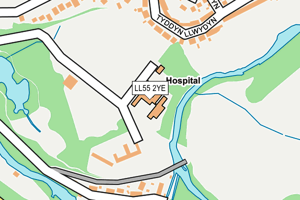
LL55 2YE is located in the Hendre electoral ward, within the unitary authority of Gwynedd and the Welsh Parliamentary constituency of Arfon. The Local Health Board is Betsi Cadwaladr University and the police force is North Wales. This postcode has been in use since January 1980.


GetTheData
Source: OS OpenMap – Local (Ordnance Survey)
Source: OS VectorMap District (Ordnance Survey)
Licence: Open Government Licence (requires attribution)
| Easting | 248704 |
| Northing | 361606 |
| Latitude | 53.130083 |
| Longitude | -4.262789 |
GetTheData
Source: Open Postcode Geo
Licence: Open Government Licence
| Country | Wales |
| Postcode District | LL55 |
| ➜ LL55 open data dashboard ➜ See where LL55 is on a map ➜ Where is Caernarfon? | |
GetTheData
Source: Land Registry Price Paid Data
Licence: Open Government Licence
Elevation or altitude of LL55 2YE as distance above sea level:
| Metres | Feet | |
|---|---|---|
| Elevation | 20m | 66ft |
Elevation is measured from the approximate centre of the postcode, to the nearest point on an OS contour line from OS Terrain 50, which has contour spacing of ten vertical metres.
➜ How high above sea level am I? Find the elevation of your current position using your device's GPS.
GetTheData
Source: Open Postcode Elevation
Licence: Open Government Licence
| Ward | Hendre |
| Constituency | Arfon |
GetTheData
Source: ONS Postcode Database
Licence: Open Government Licence
| January 2024 | Other crime | On or near Glan Seiont | 376m |
| November 2023 | Anti-social behaviour | On or near Glan Seiont | 376m |
| October 2023 | Violence and sexual offences | On or near Glan Seiont | 376m |
| ➜ Get more crime data in our Crime section | |||
GetTheData
Source: data.police.uk
Licence: Open Government Licence
| Tyddyn Llwydyn | Caernarfon | 250m |
| Lon Cilgwyn (Tyddyn Llwydyn) | Caernarfon | 263m |
| Lon Oleuwen (Ffordd Eryri) | Caernarfon | 284m |
| Moel Eilio (Caeau Bach) | Caernarfon | 340m |
| Parc Muriau (Pwllheli Road) | Caernarfon | 412m |
| Caernarfon (Welsh Highland Rly-caernarfon) | Caernarfon | 1,018m |
GetTheData
Source: NaPTAN
Licence: Open Government Licence
GetTheData
Source: ONS Postcode Database
Licence: Open Government Licence


➜ Get more ratings from the Food Standards Agency
GetTheData
Source: Food Standards Agency
Licence: FSA terms & conditions
| Last Collection | |||
|---|---|---|---|
| Location | Mon-Fri | Sat | Distance |
| Y Maes Box | 17:30 | 12:30 | 1,264m |
| Y Maes | 17:30 | 12:30 | 1,265m |
| Caernarfon Delivery Office | 17:30 | 13:00 | 1,677m |
GetTheData
Source: Dracos
Licence: Creative Commons Attribution-ShareAlike
| School | Phase of Education | Distance |
|---|---|---|
| Ysgol Yr Hendre Caernarfon, Gwynedd, LL55 2LY | Not applicable | 519m |
| Ysgol Pendalar Ffordd Bethel, Caernarfon, Gwynedd, LL55 2RN | Not applicable | 1km |
| Ysgol Gynradd Maesincla Maesincla Caernarfon, Gwynedd, LL55 1DF | Not applicable | 1.3km |
GetTheData
Source: Edubase
Licence: Open Government Licence
The below table lists the International Territorial Level (ITL) codes (formerly Nomenclature of Territorial Units for Statistics (NUTS) codes) and Local Administrative Units (LAU) codes for LL55 2YE:
| ITL 1 Code | Name |
|---|---|
| TLL | Wales |
| ITL 2 Code | Name |
| TLL1 | West Wales and The Valleys |
| ITL 3 Code | Name |
| TLL12 | Gwynedd |
| LAU 1 Code | Name |
| W06000002 | Gwynedd |
GetTheData
Source: ONS Postcode Directory
Licence: Open Government Licence
The below table lists the Census Output Area (OA), Lower Layer Super Output Area (LSOA), and Middle Layer Super Output Area (MSOA) for LL55 2YE:
| Code | Name | |
|---|---|---|
| OA | W00000571 | |
| LSOA | W01000110 | Gwynedd 006D |
| MSOA | W02000015 | Gwynedd 006 |
GetTheData
Source: ONS Postcode Directory
Licence: Open Government Licence
| LL55 2LX | Tyddyn Llwydyn | 175m |
| LL55 2YL | Seiont Mill Road | 191m |
| LL55 2DQ | Lon Cilgwyn | 226m |
| LL55 2DJ | Pen Morfa | 237m |
| LL55 2AG | Cwm Silyn | 259m |
| LL55 2UR | Ffordd Eryri | 298m |
| LL55 2BZ | Caeau Bach | 309m |
| LL55 2UY | Derwen Las | 340m |
| LL55 2UP | Lon Oleuwen | 363m |
| LL55 2DX | Glan Seiont | 368m |
GetTheData
Source: Open Postcode Geo; Land Registry Price Paid Data
Licence: Open Government Licence