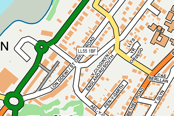
LL55 1BF lies on Maes Y Bwthyn in Caernarfon. LL55 1BF is located in the Menai electoral ward, within the unitary authority of Gwynedd and the Welsh Parliamentary constituency of Arfon. The Local Health Board is Betsi Cadwaladr University and the police force is North Wales. This postcode has been in use since December 2001.


GetTheData
Source: OS OpenMap – Local (Ordnance Survey)
Source: OS VectorMap District (Ordnance Survey)
Licence: Open Government Licence (requires attribution)
| Easting | 248406 |
| Northing | 363306 |
| Latitude | 53.145268 |
| Longitude | -4.268044 |
GetTheData
Source: Open Postcode Geo
Licence: Open Government Licence
| Street | Maes Y Bwthyn |
| Town/City | Caernarfon |
| Country | Wales |
| Postcode District | LL55 |
➜ See where LL55 is on a map ➜ Where is Caernarfon? | |
GetTheData
Source: Land Registry Price Paid Data
Licence: Open Government Licence
Elevation or altitude of LL55 1BF as distance above sea level:
| Metres | Feet | |
|---|---|---|
| Elevation | 30m | 98ft |
Elevation is measured from the approximate centre of the postcode, to the nearest point on an OS contour line from OS Terrain 50, which has contour spacing of ten vertical metres.
➜ How high above sea level am I? Find the elevation of your current position using your device's GPS.
GetTheData
Source: Open Postcode Elevation
Licence: Open Government Licence
| Ward | Menai |
| Constituency | Arfon |
GetTheData
Source: ONS Postcode Database
Licence: Open Government Licence
2016 20 DEC £350,000 |
1, MAES Y BWTHYN, CAERNARFON, LL55 1BF 2003 10 JAN £201,000 |
3, MAES Y BWTHYN, CAERNARFON, LL55 1BF 2002 31 JUL £172,500 |
2002 30 JUL £190,000 |
GetTheData
Source: HM Land Registry Price Paid Data
Licence: Contains HM Land Registry data © Crown copyright and database right 2025. This data is licensed under the Open Government Licence v3.0.
| Brynafon (Sydney Road) | Waterloo Port | 61m |
| Wilmar (England Road South) | Waterloo Port | 78m |
| Kiltynan (St David's Road) | Waterloo Port | 119m |
| Gwyddfor (St David`s Road) | Waterloo Port | 157m |
| L“n Campbell (North Road) | Waterloo Port | 203m |
| Caernarfon (Welsh Highland Rly-caernarfon) | Caernarfon | 906m |
GetTheData
Source: NaPTAN
Licence: Open Government Licence
| Percentage of properties with Next Generation Access | 100.0% |
| Percentage of properties with Superfast Broadband | 100.0% |
| Percentage of properties with Ultrafast Broadband | 0.0% |
| Percentage of properties with Full Fibre Broadband | 0.0% |
Superfast Broadband is between 30Mbps and 300Mbps
Ultrafast Broadband is > 300Mbps
| Percentage of properties unable to receive 2Mbps | 0.0% |
| Percentage of properties unable to receive 5Mbps | 0.0% |
| Percentage of properties unable to receive 10Mbps | 0.0% |
| Percentage of properties unable to receive 30Mbps | 0.0% |
GetTheData
Source: Ofcom
Licence: Ofcom Terms of Use (requires attribution)
GetTheData
Source: ONS Postcode Database
Licence: Open Government Licence


➜ Get more ratings from the Food Standards Agency
GetTheData
Source: Food Standards Agency
Licence: FSA terms & conditions
| Last Collection | |||
|---|---|---|---|
| Location | Mon-Fri | Sat | Distance |
| Y Maes Box | 17:30 | 12:30 | 789m |
| Y Maes | 17:30 | 12:30 | 790m |
| Caernarfon Delivery Office | 17:30 | 13:00 | 797m |
GetTheData
Source: Dracos
Licence: Creative Commons Attribution-ShareAlike
The below table lists the International Territorial Level (ITL) codes (formerly Nomenclature of Territorial Units for Statistics (NUTS) codes) and Local Administrative Units (LAU) codes for LL55 1BF:
| ITL 1 Code | Name |
|---|---|
| TLL | Wales |
| ITL 2 Code | Name |
| TLL1 | West Wales and The Valleys |
| ITL 3 Code | Name |
| TLL12 | Gwynedd |
| LAU 1 Code | Name |
| W06000002 | Gwynedd |
GetTheData
Source: ONS Postcode Directory
Licence: Open Government Licence
The below table lists the Census Output Area (OA), Lower Layer Super Output Area (LSOA), and Middle Layer Super Output Area (MSOA) for LL55 1BF:
| Code | Name | |
|---|---|---|
| OA | W00000475 | |
| LSOA | W01000093 | Gwynedd 006B |
| MSOA | W02000015 | Gwynedd 006 |
GetTheData
Source: ONS Postcode Directory
Licence: Open Government Licence
| LL55 1LA | Warfield Road | 41m |
| LL55 1HY | England Road South | 51m |
| LL55 1ET | Sydney Road | 114m |
| LL55 1BB | Bowling Green Cottages | 119m |
| LL55 1BD | North Road | 126m |
| LL55 1BH | St Davids Road | 129m |
| LL55 1EL | St Davids Road | 135m |
| LL55 1EY | Penygarth | 170m |
| LL55 1HJ | Llys Yr Orsedd | 181m |
| LL55 1HP | Priestley Road | 182m |
GetTheData
Source: Open Postcode Geo; Land Registry Price Paid Data
Licence: Open Government Licence