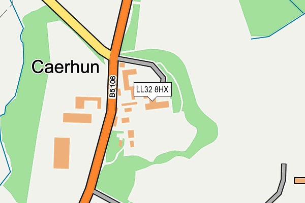
LL32 8HX is located in the Caerhun electoral ward, within the unitary authority of Conwy and the Welsh Parliamentary constituency of Aberconwy. The Local Health Board is Betsi Cadwaladr University and the police force is North Wales. This postcode has been in use since May 2016.


GetTheData
Source: OS OpenMap – Local (Ordnance Survey)
Source: OS VectorMap District (Ordnance Survey)
Licence: Open Government Licence (requires attribution)
| Easting | 277394 |
| Northing | 370549 |
| Latitude | 53.217806 |
| Longitude | -3.837677 |
GetTheData
Source: Open Postcode Geo
Licence: Open Government Licence
| Country | Wales |
| Postcode District | LL32 |
| ➜ LL32 open data dashboard ➜ See where LL32 is on a map ➜ Where is Caerhun? | |
GetTheData
Source: Land Registry Price Paid Data
Licence: Open Government Licence
Elevation or altitude of LL32 8HX as distance above sea level:
| Metres | Feet | |
|---|---|---|
| Elevation | 20m | 66ft |
Elevation is measured from the approximate centre of the postcode, to the nearest point on an OS contour line from OS Terrain 50, which has contour spacing of ten vertical metres.
➜ How high above sea level am I? Find the elevation of your current position using your device's GPS.
GetTheData
Source: Open Postcode Elevation
Licence: Open Government Licence
| Ward | Caerhun |
| Constituency | Aberconwy |
GetTheData
Source: ONS Postcode Database
Licence: Open Government Licence
| Caer Rhun Hall (Conway Road) | Caerhun | 96m |
| Caer Rhun Hall (Conway Road) | Caerhun | 108m |
| Church House (Conway Road) | Ty'n-y-groes | 641m |
| Pontwgan Bridge (Main Road) | Pontwgan | 808m |
| Red Lion Hotel (Conway Road) | Ty'n-y-groes | 1,077m |
| Tal-y-Cafn Station | 1.7km |
| Dolgarrog Station | 3.6km |
GetTheData
Source: NaPTAN
Licence: Open Government Licence
GetTheData
Source: ONS Postcode Database
Licence: Open Government Licence

➜ Get more ratings from the Food Standards Agency
GetTheData
Source: Food Standards Agency
Licence: FSA terms & conditions
| Last Collection | |||
|---|---|---|---|
| Location | Mon-Fri | Sat | Distance |
| Llanbedr | 16:45 | 10:00 | 1,629m |
| Talycafn Post Office | 16:45 | 09:45 | 1,735m |
| Top Llan Road | 15:30 | 07:00 | 5,839m |
GetTheData
Source: Dracos
Licence: Creative Commons Attribution-ShareAlike
| School | Phase of Education | Distance |
|---|---|---|
| Ysgol Dyffryn yr Enfys Ffordd Llanrwst, Dolgarrog, LL32 8QE | Not applicable | 2.6km |
| Ysgol Eglwysbach Eglwysbach, Bae Colwyn, Conwy, LL28 5UD | Not applicable | 3km |
| Ysgol Dolgarrog Ffordd Llanrwst, Dolgarrog, Conwy, LL32 8QE | Not applicable | 3km |
GetTheData
Source: Edubase
Licence: Open Government Licence
The below table lists the International Territorial Level (ITL) codes (formerly Nomenclature of Territorial Units for Statistics (NUTS) codes) and Local Administrative Units (LAU) codes for LL32 8HX:
| ITL 1 Code | Name |
|---|---|
| TLL | Wales |
| ITL 2 Code | Name |
| TLL1 | West Wales and The Valleys |
| ITL 3 Code | Name |
| TLL13 | Conwy and Denbighshire |
| LAU 1 Code | Name |
| W06000003 | Conwy |
GetTheData
Source: ONS Postcode Directory
Licence: Open Government Licence
The below table lists the Census Output Area (OA), Lower Layer Super Output Area (LSOA), and Middle Layer Super Output Area (MSOA) for LL32 8HX:
| Code | Name | |
|---|---|---|
| OA | W00000656 | |
| LSOA | W01000124 | Conwy 012A |
| MSOA | W02000038 | Conwy 012 |
GetTheData
Source: ONS Postcode Directory
Licence: Open Government Licence
| LL32 8UQ | 583m | |
| LL32 8TA | 642m | |
| LL32 8TB | 771m | |
| LL32 8UG | 812m | |
| LL32 8TD | 859m | |
| LL32 8TJ | 1003m | |
| LL32 8PA | Maes Rhun | 1013m |
| LL32 8TX | 1075m | |
| LL32 8TQ | 1104m | |
| LL32 8SZ | 1193m |
GetTheData
Source: Open Postcode Geo; Land Registry Price Paid Data
Licence: Open Government Licence