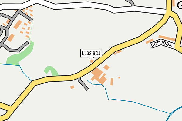
LL32 8DJ is located in the Caerhun electoral ward, within the unitary authority of Conwy and the Welsh Parliamentary constituency of Aberconwy. The Local Health Board is Betsi Cadwaladr University and the police force is North Wales. This postcode has been in use since January 1980.


GetTheData
Source: OS OpenMap – Local (Ordnance Survey)
Source: OS VectorMap District (Ordnance Survey)
Licence: Open Government Licence (requires attribution)
| Easting | 276637 |
| Northing | 375754 |
| Latitude | 53.264392 |
| Longitude | -3.851025 |
GetTheData
Source: Open Postcode Geo
Licence: Open Government Licence
| Country | Wales |
| Postcode District | LL32 |
| ➜ LL32 open data dashboard ➜ See where LL32 is on a map ➜ Where is Llechwedd? | |
GetTheData
Source: Land Registry Price Paid Data
Licence: Open Government Licence
Elevation or altitude of LL32 8DJ as distance above sea level:
| Metres | Feet | |
|---|---|---|
| Elevation | 50m | 164ft |
Elevation is measured from the approximate centre of the postcode, to the nearest point on an OS contour line from OS Terrain 50, which has contour spacing of ten vertical metres.
➜ How high above sea level am I? Find the elevation of your current position using your device's GPS.
GetTheData
Source: Open Postcode Elevation
Licence: Open Government Licence
| Ward | Caerhun |
| Constituency | Aberconwy |
GetTheData
Source: ONS Postcode Database
Licence: Open Government Licence
| Cyffredin Farm (Henryd Road) | Iolyn Park | 540m |
| Cottages (Hendre Road) | Hendre | 832m |
| Cottages (Hendre Road) | Hendre | 876m |
| Iolyn Park (Llanrwst Road) | Henryd | 877m |
| Iolyn Park (Llanrwst Road) | Henryd | 909m |
| Conwy Station | 2.2km |
| Llandudno Junction Station | 3.5km |
| Glan Conwy Station | 3.6km |
GetTheData
Source: NaPTAN
Licence: Open Government Licence
| Percentage of properties with Next Generation Access | 75.0% |
| Percentage of properties with Superfast Broadband | 75.0% |
| Percentage of properties with Ultrafast Broadband | 75.0% |
| Percentage of properties with Full Fibre Broadband | 75.0% |
Superfast Broadband is between 30Mbps and 300Mbps
Ultrafast Broadband is > 300Mbps
| Percentage of properties unable to receive 2Mbps | 0.0% |
| Percentage of properties unable to receive 5Mbps | 25.0% |
| Percentage of properties unable to receive 10Mbps | 25.0% |
| Percentage of properties unable to receive 30Mbps | 25.0% |
GetTheData
Source: Ofcom
Licence: Ofcom Terms of Use (requires attribution)
GetTheData
Source: ONS Postcode Database
Licence: Open Government Licence


➜ Get more ratings from the Food Standards Agency
GetTheData
Source: Food Standards Agency
Licence: FSA terms & conditions
| Last Collection | |||
|---|---|---|---|
| Location | Mon-Fri | Sat | Distance |
| Conwy Post Office | 17:05 | 11:45 | 2,280m |
| Capelulo Box | 16:45 | 11:15 | 2,390m |
| Castle Street | 17:15 | 12:15 | 2,417m |
GetTheData
Source: Dracos
Licence: Creative Commons Attribution-ShareAlike
| School | Phase of Education | Distance |
|---|---|---|
| Ysgol Llangelynnin Henryd, Conwy, LL32 8YB | Not applicable | 1.1km |
| Ysgol Porth y Felin Ffordd Llanrwst, Conwy, LL32 8FZ | Not applicable | 2km |
| Ysgol Aberconwy Morfa Drive, Conwy, LL32 8ED | Not applicable | 2.7km |
GetTheData
Source: Edubase
Licence: Open Government Licence
The below table lists the International Territorial Level (ITL) codes (formerly Nomenclature of Territorial Units for Statistics (NUTS) codes) and Local Administrative Units (LAU) codes for LL32 8DJ:
| ITL 1 Code | Name |
|---|---|
| TLL | Wales |
| ITL 2 Code | Name |
| TLL1 | West Wales and The Valleys |
| ITL 3 Code | Name |
| TLL13 | Conwy and Denbighshire |
| LAU 1 Code | Name |
| W06000003 | Conwy |
GetTheData
Source: ONS Postcode Directory
Licence: Open Government Licence
The below table lists the Census Output Area (OA), Lower Layer Super Output Area (LSOA), and Middle Layer Super Output Area (MSOA) for LL32 8DJ:
| Code | Name | |
|---|---|---|
| OA | W00000661 | |
| LSOA | W01000124 | Conwy 012A |
| MSOA | W02000038 | Conwy 012 |
GetTheData
Source: ONS Postcode Directory
Licence: Open Government Licence
| LL32 8HQ | Bron Idda | 249m |
| LL32 8SQ | 296m | |
| LL32 8RZ | Henryd Road | 479m |
| LL32 8DX | 498m | |
| LL32 8NX | 555m | |
| LL32 8YG | Henryd Road | 610m |
| LL32 8DQ | 619m | |
| LL32 8YF | Henryd Road | 688m |
| LL32 8RX | Hendre Road | 801m |
| LL32 8UX | Iolyn Park | 938m |
GetTheData
Source: Open Postcode Geo; Land Registry Price Paid Data
Licence: Open Government Licence