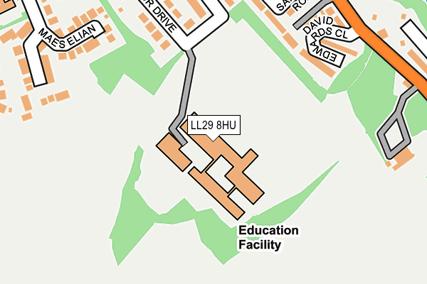
LL29 8HU is located in the Eirias electoral ward, within the unitary authority of Conwy and the Welsh Parliamentary constituency of Clwyd West. The Local Health Board is Betsi Cadwaladr University and the police force is North Wales. This postcode has been in use since January 1980.


GetTheData
Source: OS OpenMap – Local (Ordnance Survey)
Source: OS VectorMap District (Ordnance Survey)
Licence: Open Government Licence (requires attribution)
| Easting | 286421 |
| Northing | 377889 |
| Latitude | 53.285762 |
| Longitude | -3.705172 |
GetTheData
Source: Open Postcode Geo
Licence: Open Government Licence
| Country | Wales |
| Postcode District | LL29 |
| ➜ LL29 open data dashboard ➜ See where LL29 is on a map | |
GetTheData
Source: Land Registry Price Paid Data
Licence: Open Government Licence
Elevation or altitude of LL29 8HU as distance above sea level:
| Metres | Feet | |
|---|---|---|
| Elevation | 60m | 197ft |
Elevation is measured from the approximate centre of the postcode, to the nearest point on an OS contour line from OS Terrain 50, which has contour spacing of ten vertical metres.
➜ How high above sea level am I? Find the elevation of your current position using your device's GPS.
GetTheData
Source: Open Postcode Elevation
Licence: Open Government Licence
| Ward | Eirias |
| Constituency | Clwyd West |
GetTheData
Source: ONS Postcode Database
Licence: Open Government Licence
| June 2022 | Other crime | On or near Rayleigh Avenue | 157m |
| June 2022 | Other crime | On or near Rayleigh Avenue | 157m |
| June 2022 | Violence and sexual offences | On or near Rayleigh Avenue | 157m |
| ➜ Get more crime data in our Crime section | |||
GetTheData
Source: data.police.uk
Licence: Open Government Licence
| Ysgol Bryn Elian (Windsor Drive) | Old Colwyn | 156m |
| Pentre Newydd (Llanelian Road) | Old Colwyn | 310m |
| Kennedy Court (Llanelian Road) | Old Colwyn | 321m |
| Pentre Newydd (Llanellan Road) | Old Colwyn | 321m |
| Kennedy Court (Llanelian Road) | Old Colwyn | 328m |
| Colwyn Bay Station | 1.8km |
GetTheData
Source: NaPTAN
Licence: Open Government Licence
GetTheData
Source: ONS Postcode Database
Licence: Open Government Licence


➜ Get more ratings from the Food Standards Agency
GetTheData
Source: Food Standards Agency
Licence: FSA terms & conditions
| Last Collection | |||
|---|---|---|---|
| Location | Mon-Fri | Sat | Distance |
| Glyn Estate | 17:10 | 11:15 | 549m |
| Abergele Road Post Office | 17:15 | 12:00 | 1,296m |
| Greenfield Road | 17:15 | 11:30 | 1,452m |
GetTheData
Source: Dracos
Licence: Creative Commons Attribution-ShareAlike
| School | Phase of Education | Distance |
|---|---|---|
| Ysgol Bryn Elian Windsor Drive, Colwyn Bay, Conwy, LL29 8HU | Not applicable | 49m |
| Old Colwyn Junior C.P. School Church Walks, Old Colwyn, Conwy, LL29 9RU | Not applicable | 431m |
| Ysgol Bod Alaw Abergele Road, Colwyn Bay, LL29 7ST | Not applicable | 957m |
GetTheData
Source: Edubase
Licence: Open Government Licence
The below table lists the International Territorial Level (ITL) codes (formerly Nomenclature of Territorial Units for Statistics (NUTS) codes) and Local Administrative Units (LAU) codes for LL29 8HU:
| ITL 1 Code | Name |
|---|---|
| TLL | Wales |
| ITL 2 Code | Name |
| TLL1 | West Wales and The Valleys |
| ITL 3 Code | Name |
| TLL13 | Conwy and Denbighshire |
| LAU 1 Code | Name |
| W06000003 | Conwy |
GetTheData
Source: ONS Postcode Directory
Licence: Open Government Licence
The below table lists the Census Output Area (OA), Lower Layer Super Output Area (LSOA), and Middle Layer Super Output Area (MSOA) for LL29 8HU:
| Code | Name | |
|---|---|---|
| OA | W00000743 | |
| LSOA | W01000139 | Conwy 007A |
| MSOA | W02000033 | Conwy 007 |
GetTheData
Source: ONS Postcode Directory
Licence: Open Government Licence
| LL29 8BD | Rayleigh Avenue | 179m |
| LL29 9UE | David Edwards Close | 186m |
| LL29 8BB | Windsor Drive | 210m |
| LL29 8AU | Maes Elian | 222m |
| LL29 9UD | Sandhills Road | 228m |
| LL29 9UB | Hillside Avenue | 236m |
| LL29 8BE | Smith Avenue | 245m |
| LL29 9UA | Llanelian Road | 265m |
| LL29 9TY | Eaton Avenue | 282m |
| LL29 8AT | Hesketh Road | 305m |
GetTheData
Source: Open Postcode Geo; Land Registry Price Paid Data
Licence: Open Government Licence