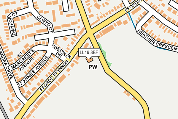
LL19 8BF is located in the Prestatyn Meliden electoral ward, within the unitary authority of Denbighshire and the Welsh Parliamentary constituency of Vale of Clwyd. The Local Health Board is Betsi Cadwaladr University and the police force is North Wales. This postcode has been in use since November 2016.


GetTheData
Source: OS OpenMap – Local (Ordnance Survey)
Source: OS VectorMap District (Ordnance Survey)
Licence: Open Government Licence (requires attribution)
| Easting | 305639 |
| Northing | 381671 |
| Latitude | 53.323537 |
| Longitude | -3.418132 |
GetTheData
Source: Open Postcode Geo
Licence: Open Government Licence
| Country | Wales |
| Postcode District | LL19 |
| ➜ LL19 open data dashboard ➜ See where LL19 is on a map ➜ Where is Prestatyn? | |
GetTheData
Source: Land Registry Price Paid Data
Licence: Open Government Licence
Elevation or altitude of LL19 8BF as distance above sea level:
| Metres | Feet | |
|---|---|---|
| Elevation | 10m | 33ft |
Elevation is measured from the approximate centre of the postcode, to the nearest point on an OS contour line from OS Terrain 50, which has contour spacing of ten vertical metres.
➜ How high above sea level am I? Find the elevation of your current position using your device's GPS.
GetTheData
Source: Open Postcode Elevation
Licence: Open Government Licence
| Ward | Prestatyn Meliden |
| Constituency | Vale Of Clwyd |
GetTheData
Source: ONS Postcode Database
Licence: Open Government Licence
| January 2024 | Criminal damage and arson | On or near Dwyfor Court | 284m |
| September 2023 | Violence and sexual offences | On or near Dwyfor Court | 284m |
| June 2023 | Violence and sexual offences | On or near Dwyfor Court | 284m |
| ➜ Get more crime data in our Crime section | |||
GetTheData
Source: data.police.uk
Licence: Open Government Licence
| Penrhwylfa Crossroads (Fforddisa) | Prestatyn | 123m |
| Penrhwylfa Crossroads (Fforddisa) | Prestatyn | 126m |
| Canterbury Drive | Prestatyn | 265m |
| Alexandra Drive | Prestatyn | 274m |
| Cardiff Way | Dawson Park | 282m |
| Prestatyn Station | 1.6km |
| Rhyl Station | 4.8km |
GetTheData
Source: NaPTAN
Licence: Open Government Licence
GetTheData
Source: ONS Postcode Database
Licence: Open Government Licence


➜ Get more ratings from the Food Standards Agency
GetTheData
Source: Food Standards Agency
Licence: FSA terms & conditions
| Last Collection | |||
|---|---|---|---|
| Location | Mon-Fri | Sat | Distance |
| Prestatyn Main Post Office | 17:25 | 12:00 | 1,570m |
| Trelawnyn Road | 16:45 | 09:30 | 2,461m |
| Dyserth Post Office | 17:20 | 11:00 | 2,591m |
GetTheData
Source: Dracos
Licence: Creative Commons Attribution-ShareAlike
| School | Phase of Education | Distance |
|---|---|---|
| Ysgol Y Llys Rhodfa'r Tywysog, Prestatyn, Denbighshire, LL19 8RW | Not applicable | 713m |
| Ysgol Melyd Ffordd Pennant, Meliden, Prestatyn, Denbighshire, LL19 8PE | Not applicable | 819m |
| Prestatyn High School 2 Princes Avenue, Prestatyn, Denbighshire, LL19 8RS | Not applicable | 823m |
GetTheData
Source: Edubase
Licence: Open Government Licence
The below table lists the International Territorial Level (ITL) codes (formerly Nomenclature of Territorial Units for Statistics (NUTS) codes) and Local Administrative Units (LAU) codes for LL19 8BF:
| ITL 1 Code | Name |
|---|---|
| TLL | Wales |
| ITL 2 Code | Name |
| TLL1 | West Wales and The Valleys |
| ITL 3 Code | Name |
| TLL13 | Conwy and Denbighshire |
| LAU 1 Code | Name |
| W06000004 | Denbighshire |
GetTheData
Source: ONS Postcode Directory
Licence: Open Government Licence
The below table lists the Census Output Area (OA), Lower Layer Super Output Area (LSOA), and Middle Layer Super Output Area (MSOA) for LL19 8BF:
| Code | Name | |
|---|---|---|
| OA | W00001155 | |
| LSOA | W01000217 | Denbighshire 008C |
| MSOA | W02000049 | Denbighshire 008 |
GetTheData
Source: ONS Postcode Directory
Licence: Open Government Licence
| LL19 8BA | Ffordd Ffynnon | 81m |
| LL19 8BH | Hardwyn Drive | 110m |
| LL19 8BT | Ffordd Penrhwylfa | 128m |
| LL19 8EA | Ffordd Isa | 144m |
| LL19 8EF | Ffordd Isa | 157m |
| LL19 8BL | St Annes Avenue | 177m |
| LL19 8DP | Clwyd Court | 178m |
| LL19 8BN | St Margarets Avenue | 191m |
| LL19 8BB | Ffordd Ffynnon | 192m |
| LL19 8BD | Ffordd Ffynnon | 202m |
GetTheData
Source: Open Postcode Geo; Land Registry Price Paid Data
Licence: Open Government Licence