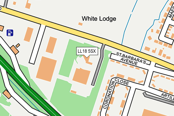
LL18 5SX is located in the Bodelwyddan electoral ward, within the unitary authority of Denbighshire and the Welsh Parliamentary constituency of Vale of Clwyd. The Local Health Board is Betsi Cadwaladr University and the police force is North Wales. This postcode has been in use since February 2009.


GetTheData
Source: OS OpenMap – Local (Ordnance Survey)
Source: OS VectorMap District (Ordnance Survey)
Licence: Open Government Licence (requires attribution)
| Easting | 299051 |
| Northing | 375798 |
| Latitude | 53.269531 |
| Longitude | -3.515132 |
GetTheData
Source: Open Postcode Geo
Licence: Open Government Licence
| Country | Wales |
| Postcode District | LL18 |
| ➜ LL18 open data dashboard ➜ See where LL18 is on a map | |
GetTheData
Source: Land Registry Price Paid Data
Licence: Open Government Licence
Elevation or altitude of LL18 5SX as distance above sea level:
| Metres | Feet | |
|---|---|---|
| Elevation | 20m | 66ft |
Elevation is measured from the approximate centre of the postcode, to the nearest point on an OS contour line from OS Terrain 50, which has contour spacing of ten vertical metres.
➜ How high above sea level am I? Find the elevation of your current position using your device's GPS.
GetTheData
Source: Open Postcode Elevation
Licence: Open Government Licence
| Ward | Bodelwyddan |
| Constituency | Vale Of Clwyd |
GetTheData
Source: ONS Postcode Database
Licence: Open Government Licence
| June 2022 | Criminal damage and arson | On or near Coronation Close | 214m |
| May 2022 | Criminal damage and arson | On or near Maes Owen | 385m |
| February 2022 | Public order | On or near Coronation Close | 214m |
| ➜ Get more crime data in our Crime section | |||
GetTheData
Source: data.police.uk
Licence: Open Government Licence
| Coronation Close | Bodelwyddan | 230m |
| Little Chef (A55) | Bodelwyddan | 274m |
| Little Chef (A55) | Bodelwyddan | 280m |
| St Barbara's Avenue (Abergele Road) | Bodelwyddan | 292m |
| Artillery Row (Abergele Road) | Bodelwyddan | 353m |
| Abergele & Pensarn Station | 5.3km |
GetTheData
Source: NaPTAN
Licence: Open Government Licence
GetTheData
Source: ONS Postcode Database
Licence: Open Government Licence


➜ Get more ratings from the Food Standards Agency
GetTheData
Source: Food Standards Agency
Licence: FSA terms & conditions
| Last Collection | |||
|---|---|---|---|
| Location | Mon-Fri | Sat | Distance |
| Glas Coed Gate | 11:00 | 11:00 | 1,910m |
| St Asaph Business Park | 18:30 | 3,108m | |
| St Asaph Business Park | 18:30 | 09:00 | 3,170m |
GetTheData
Source: Dracos
Licence: Creative Commons Attribution-ShareAlike
| School | Phase of Education | Distance |
|---|---|---|
| Ysgol Y Faenol John's Drive, Bodelwyddan, Nr. Rhyl, Denbighshire, LL18 5TG | Not applicable | 363m |
| St George Controlled Primary School Primrose Hill, St George, Abergele, Conwy, LL22 9BU | Not applicable | 1.6km |
| Pengwern College Sarn Lane, Rhuddlan, LL18 5UH | Not applicable | 2.3km |
GetTheData
Source: Edubase
Licence: Open Government Licence
The below table lists the International Territorial Level (ITL) codes (formerly Nomenclature of Territorial Units for Statistics (NUTS) codes) and Local Administrative Units (LAU) codes for LL18 5SX:
| ITL 1 Code | Name |
|---|---|
| TLL | Wales |
| ITL 2 Code | Name |
| TLL1 | West Wales and The Valleys |
| ITL 3 Code | Name |
| TLL13 | Conwy and Denbighshire |
| LAU 1 Code | Name |
| W06000004 | Denbighshire |
GetTheData
Source: ONS Postcode Directory
Licence: Open Government Licence
The below table lists the Census Output Area (OA), Lower Layer Super Output Area (LSOA), and Middle Layer Super Output Area (MSOA) for LL18 5SX:
| Code | Name | |
|---|---|---|
| OA | W00001020 | |
| LSOA | W01000191 | Denbighshire 009A |
| MSOA | W02000050 | Denbighshire 009 |
GetTheData
Source: ONS Postcode Directory
Licence: Open Government Licence
| LL18 5ST | St Barbaras Avenue | 135m |
| LL18 5SY | Coronation Close | 165m |
| LL18 5SR | Abergele Road | 205m |
| LL18 5SU | Artillery Row | 301m |
| LL18 5TN | Maes Owen | 343m |
| LL18 5TW | Canol Blas Avenue | 370m |
| LL18 5TB | Park Avenue | 412m |
| LL18 5TH | Henrys Avenue | 422m |
| LL18 5TA | Grenville Row | 449m |
| LL18 5TG | Johns Drive | 453m |
GetTheData
Source: Open Postcode Geo; Land Registry Price Paid Data
Licence: Open Government Licence