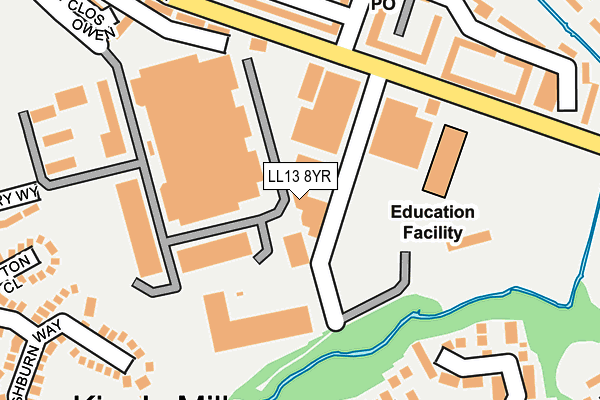
LL13 8YR is located in the Whitegate electoral ward, within the unitary authority of Wrexham and the Welsh Parliamentary constituency of Wrexham. The Local Health Board is Betsi Cadwaladr University and the police force is North Wales. This postcode has been in use since January 1991.


GetTheData
Source: OS OpenMap – Local (Ordnance Survey)
Source: OS VectorMap District (Ordnance Survey)
Licence: Open Government Licence (requires attribution)
| Easting | 334820 |
| Northing | 349560 |
| Latitude | 53.039340 |
| Longitude | -2.973554 |
GetTheData
Source: Open Postcode Geo
Licence: Open Government Licence
| Country | Wales |
| Postcode District | LL13 |
| ➜ LL13 open data dashboard ➜ See where LL13 is on a map ➜ Where is Wrexham? | |
GetTheData
Source: Land Registry Price Paid Data
Licence: Open Government Licence
Elevation or altitude of LL13 8YR as distance above sea level:
| Metres | Feet | |
|---|---|---|
| Elevation | 60m | 197ft |
Elevation is measured from the approximate centre of the postcode, to the nearest point on an OS contour line from OS Terrain 50, which has contour spacing of ten vertical metres.
➜ How high above sea level am I? Find the elevation of your current position using your device's GPS.
GetTheData
Source: Open Postcode Elevation
Licence: Open Government Licence
| Ward | Whitegate |
| Constituency | Wrexham |
GetTheData
Source: ONS Postcode Database
Licence: Open Government Licence
| January 2024 | Violence and sexual offences | On or near Queensway | 150m |
| January 2024 | Anti-social behaviour | On or near Parking Area | 278m |
| January 2024 | Anti-social behaviour | On or near Parking Area | 278m |
| ➜ Get more crime data in our Crime section | |||
GetTheData
Source: data.police.uk
Licence: Open Government Licence
| Bryn Hafod (Queensway) | The Dunks | 161m |
| Bryn Hafod (Queensway) | The Dunks | 176m |
| Queensway Industrial Est (Queensway) | The Dunks | 181m |
| Queensway Industrial Est (Queensway) | The Dunks | 213m |
| Y Wern | The Dunks | 343m |
| Wrexham Central Station | 1.9km |
| Wrexham General Station | 2.3km |
| Gwersyllt Station | 4.7km |
GetTheData
Source: NaPTAN
Licence: Open Government Licence
GetTheData
Source: ONS Postcode Database
Licence: Open Government Licence


➜ Get more ratings from the Food Standards Agency
GetTheData
Source: Food Standards Agency
Licence: FSA terms & conditions
| Last Collection | |||
|---|---|---|---|
| Location | Mon-Fri | Sat | Distance |
| Fenwick Drive | 16:00 | 12:00 | 1,364m |
| Queens Park Post Office | 16:30 | 11:30 | 1,395m |
| High Street | 18:30 | 12:30 | 1,412m |
GetTheData
Source: Dracos
Licence: Creative Commons Attribution-ShareAlike
| School | Phase of Education | Distance |
|---|---|---|
| Gwenfro Community Primary School Queensway, Wrexham, LL13 8UW | Not applicable | 174m |
| St Anne's R.C. Primary School Prince Charles Road, Wrexham, LL13 8TH | Not applicable | 550m |
| Ysgol Cae'r Gwenyn Prince Charles Road, Wrexham, LL13 8TH | Not applicable | 568m |
GetTheData
Source: Edubase
Licence: Open Government Licence
The below table lists the International Territorial Level (ITL) codes (formerly Nomenclature of Territorial Units for Statistics (NUTS) codes) and Local Administrative Units (LAU) codes for LL13 8YR:
| ITL 1 Code | Name |
|---|---|
| TLL | Wales |
| ITL 2 Code | Name |
| TLL2 | East Wales |
| ITL 3 Code | Name |
| TLL23 | Flintshire and Wrexham |
| LAU 1 Code | Name |
| W06000006 | Wrexham |
GetTheData
Source: ONS Postcode Directory
Licence: Open Government Licence
The below table lists the Census Output Area (OA), Lower Layer Super Output Area (LSOA), and Middle Layer Super Output Area (MSOA) for LL13 8YR:
| Code | Name | |
|---|---|---|
| OA | W00002256 | |
| LSOA | W01000423 | Wrexham 012D |
| MSOA | W02000089 | Wrexham 012 |
GetTheData
Source: ONS Postcode Directory
Licence: Open Government Licence
| LL13 8UU | Bryn Hafod | 179m |
| LL13 8TY | Y Wern | 188m |
| LL13 8UY | Bryn Hafod | 211m |
| LL13 0JL | Solva Close | 228m |
| LL13 8UN | Queensway | 250m |
| LL13 0JY | Goodwick Drive | 259m |
| LL13 0YY | Ashburn Way | 274m |
| LL13 8YA | Bryn Hafod | 275m |
| LL13 0JH | Fishguard Close | 292m |
| LL13 0YJ | Clifton Close | 293m |
GetTheData
Source: Open Postcode Geo; Land Registry Price Paid Data
Licence: Open Government Licence