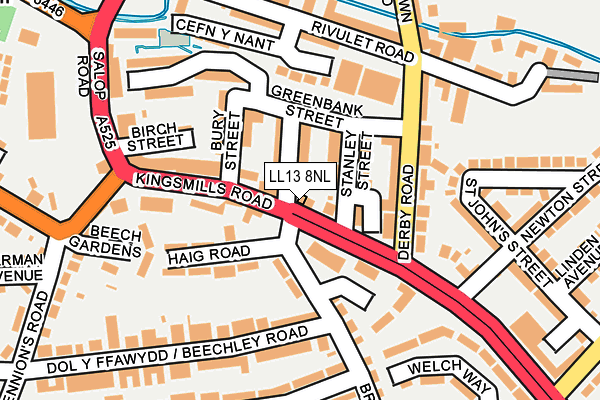
LL13 8NL is located in the Smithfield electoral ward, within the unitary authority of Wrexham and the Welsh Parliamentary constituency of Wrexham. The Local Health Board is Betsi Cadwaladr University and the police force is North Wales. This postcode has been in use since January 1980.


GetTheData
Source: OS OpenMap – Local (Ordnance Survey)
Source: OS VectorMap District (Ordnance Survey)
Licence: Open Government Licence (requires attribution)
| Easting | 333906 |
| Northing | 349728 |
| Latitude | 53.040737 |
| Longitude | -2.987218 |
GetTheData
Source: Open Postcode Geo
Licence: Open Government Licence
| Country | Wales |
| Postcode District | LL13 |
| ➜ LL13 open data dashboard ➜ See where LL13 is on a map ➜ Where is Wrexham? | |
GetTheData
Source: Land Registry Price Paid Data
Licence: Open Government Licence
Elevation or altitude of LL13 8NL as distance above sea level:
| Metres | Feet | |
|---|---|---|
| Elevation | 80m | 262ft |
Elevation is measured from the approximate centre of the postcode, to the nearest point on an OS contour line from OS Terrain 50, which has contour spacing of ten vertical metres.
➜ How high above sea level am I? Find the elevation of your current position using your device's GPS.
GetTheData
Source: Open Postcode Elevation
Licence: Open Government Licence
| Ward | Smithfield |
| Constituency | Wrexham |
GetTheData
Source: ONS Postcode Database
Licence: Open Government Licence
| January 2024 | Public order | On or near Parking Area | 480m |
| January 2024 | Shoplifting | On or near Parking Area | 480m |
| December 2023 | Violence and sexual offences | On or near Parking Area | 480m |
| ➜ Get more crime data in our Crime section | |||
GetTheData
Source: data.police.uk
Licence: Open Government Licence
| Post Office (Kingsmills Road) | Hightown | 21m |
| Post Office (Kingsmills Road) | Hightown | 39m |
| Beechley Road East (Brynycabanau Road) | Hightown | 112m |
| Beechley Road East (Brynycabanau Road) | Hightown | 114m |
| Green Dragon Hotel (Kingsmills Road) | Hightown | 123m |
| Wrexham Central Station | 1km |
| Wrexham General Station | 1.5km |
| Gwersyllt Station | 4.1km |
GetTheData
Source: NaPTAN
Licence: Open Government Licence
| Percentage of properties with Next Generation Access | 100.0% |
| Percentage of properties with Superfast Broadband | 100.0% |
| Percentage of properties with Ultrafast Broadband | 0.0% |
| Percentage of properties with Full Fibre Broadband | 0.0% |
Superfast Broadband is between 30Mbps and 300Mbps
Ultrafast Broadband is > 300Mbps
| Percentage of properties unable to receive 2Mbps | 0.0% |
| Percentage of properties unable to receive 5Mbps | 0.0% |
| Percentage of properties unable to receive 10Mbps | 0.0% |
| Percentage of properties unable to receive 30Mbps | 0.0% |
GetTheData
Source: Ofcom
Licence: Ofcom Terms of Use (requires attribution)
GetTheData
Source: ONS Postcode Database
Licence: Open Government Licence


➜ Get more ratings from the Food Standards Agency
GetTheData
Source: Food Standards Agency
Licence: FSA terms & conditions
| Last Collection | |||
|---|---|---|---|
| Location | Mon-Fri | Sat | Distance |
| High Street | 18:30 | 12:30 | 590m |
| High Street | 18:30 | 593m | |
| Town Hill Post Office | 16:45 | 11:30 | 645m |
GetTheData
Source: Dracos
Licence: Creative Commons Attribution-ShareAlike
| School | Phase of Education | Distance |
|---|---|---|
| St Giles VC Church in Wales Primary School Mederia Hill, Wrexham, LL13 7HD | Not applicable | 530m |
| Ysgol Bodhyfryd Range Road, Wrexham, LL13 7DA | Not applicable | 625m |
| St Mary's R.C. Primary School Lea Road, Wrexham, LL13 7NA | Not applicable | 703m |
GetTheData
Source: Edubase
Licence: Open Government Licence
The below table lists the International Territorial Level (ITL) codes (formerly Nomenclature of Territorial Units for Statistics (NUTS) codes) and Local Administrative Units (LAU) codes for LL13 8NL:
| ITL 1 Code | Name |
|---|---|
| TLL | Wales |
| ITL 2 Code | Name |
| TLL2 | East Wales |
| ITL 3 Code | Name |
| TLL23 | Flintshire and Wrexham |
| LAU 1 Code | Name |
| W06000006 | Wrexham |
GetTheData
Source: ONS Postcode Directory
Licence: Open Government Licence
The below table lists the Census Output Area (OA), Lower Layer Super Output Area (LSOA), and Middle Layer Super Output Area (MSOA) for LL13 8NL:
| Code | Name | |
|---|---|---|
| OA | W00002241 | |
| LSOA | W01001931 | Wrexham 012G |
| MSOA | W02000089 | Wrexham 012 |
GetTheData
Source: ONS Postcode Directory
Licence: Open Government Licence
| LL13 8NU | Stanley Street | 51m |
| LL13 8NT | Albert Street | 53m |
| LL13 8UQ | Stanley Street | 56m |
| LL13 7BT | Brynycabanau Road | 81m |
| LL13 8PA | Greenbank Street | 99m |
| LL13 8NY | Greenbank Street | 100m |
| LL13 8NH | Kingsmills Road | 107m |
| LL13 8NS | Bury Street | 118m |
| LL13 8EA | Derby Road | 122m |
| LL13 7BU | Haig Road | 128m |
GetTheData
Source: Open Postcode Geo; Land Registry Price Paid Data
Licence: Open Government Licence