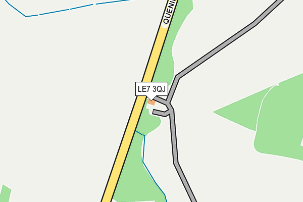
LE7 3QJ is located in the South Charnwood electoral ward, within the local authority district of Charnwood and the English Parliamentary constituency of Charnwood. The Sub Integrated Care Board (ICB) Location is NHS Leicester, Leicestershire and Rutland ICB - 03W and the police force is Leicestershire. This postcode has been in use since December 1996.


GetTheData
Source: OS OpenMap – Local (Ordnance Survey)
Source: OS VectorMap District (Ordnance Survey)
Licence: Open Government Licence (requires attribution)
| Easting | 463728 |
| Northing | 310224 |
| Latitude | 52.685987 |
| Longitude | -1.058672 |
GetTheData
Source: Open Postcode Geo
Licence: Open Government Licence
| Country | England |
| Postcode District | LE7 |
| ➜ LE7 open data dashboard ➜ See where LE7 is on a map ➜ Where is Barkby? | |
GetTheData
Source: Land Registry Price Paid Data
Licence: Open Government Licence
Elevation or altitude of LE7 3QJ as distance above sea level:
| Metres | Feet | |
|---|---|---|
| Elevation | 60m | 197ft |
Elevation is measured from the approximate centre of the postcode, to the nearest point on an OS contour line from OS Terrain 50, which has contour spacing of ten vertical metres.
➜ How high above sea level am I? Find the elevation of your current position using your device's GPS.
GetTheData
Source: Open Postcode Elevation
Licence: Open Government Licence
| Ward | South Charnwood |
| Constituency | Charnwood |
GetTheData
Source: ONS Postcode Database
Licence: Open Government Licence
| Malt Shovel (Queniborough Road) | Barkby | 368m |
| Malt Shovel (Queniborough Road) | Barkby | 373m |
| Barkby Hall (Beeby Road) | Barkby | 513m |
| Barkby Hall (Beeby Road) | Barkby | 525m |
| The Pochin School (Beeby Road) | Barkby | 696m |
| Syston Station | 1.8km |
GetTheData
Source: NaPTAN
Licence: Open Government Licence
| Percentage of properties with Next Generation Access | 100.0% |
| Percentage of properties with Superfast Broadband | 100.0% |
| Percentage of properties with Ultrafast Broadband | 0.0% |
| Percentage of properties with Full Fibre Broadband | 0.0% |
Superfast Broadband is between 30Mbps and 300Mbps
Ultrafast Broadband is > 300Mbps
| Percentage of properties unable to receive 2Mbps | 0.0% |
| Percentage of properties unable to receive 5Mbps | 0.0% |
| Percentage of properties unable to receive 10Mbps | 0.0% |
| Percentage of properties unable to receive 30Mbps | 0.0% |
GetTheData
Source: Ofcom
Licence: Ofcom Terms of Use (requires attribution)
GetTheData
Source: ONS Postcode Database
Licence: Open Government Licence


➜ Get more ratings from the Food Standards Agency
GetTheData
Source: Food Standards Agency
Licence: FSA terms & conditions
| Last Collection | |||
|---|---|---|---|
| Location | Mon-Fri | Sat | Distance |
| Barkby Turn | 16:40 | 09:15 | 443m |
| Ilston On The Hill | 15:40 | 08:45 | 489m |
| Tentercroft Avenue | 17:00 | 09:00 | 1,525m |
GetTheData
Source: Dracos
Licence: Creative Commons Attribution-ShareAlike
| Facility | Distance |
|---|---|
| Barkby United Cricket Club Beeby Road, Barkby Grass Pitches | 692m |
| The Merton Primary School Cherry Drive, Syston, Leicester Grass Pitches | 967m |
| Syston Rugby Football Club Barkby Road, Queniborough, Leicester Grass Pitches, Health and Fitness Gym, Studio, Outdoor Tennis Courts | 1.8km |
GetTheData
Source: Active Places
Licence: Open Government Licence
| School | Phase of Education | Distance |
|---|---|---|
| The Pochin School School Lane, Barkby, Leicester, LE7 3QL | Primary | 675m |
| The Merton Primary School Cherry Drive, Syston, Leicester, LE7 2PT | Primary | 964m |
| Eastfield Primary School Eastfield Road, Thurmaston, Leicester, LE4 8FP | Primary | 1.9km |
GetTheData
Source: Edubase
Licence: Open Government Licence
The below table lists the International Territorial Level (ITL) codes (formerly Nomenclature of Territorial Units for Statistics (NUTS) codes) and Local Administrative Units (LAU) codes for LE7 3QJ:
| ITL 1 Code | Name |
|---|---|
| TLF | East Midlands (England) |
| ITL 2 Code | Name |
| TLF2 | Leicestershire, Rutland and Northamptonshire |
| ITL 3 Code | Name |
| TLF22 | Leicestershire CC and Rutland |
| LAU 1 Code | Name |
| E07000130 | Charnwood |
GetTheData
Source: ONS Postcode Directory
Licence: Open Government Licence
The below table lists the Census Output Area (OA), Lower Layer Super Output Area (LSOA), and Middle Layer Super Output Area (MSOA) for LE7 3QJ:
| Code | Name | |
|---|---|---|
| OA | E00130543 | |
| LSOA | E01025730 | Charnwood 015C |
| MSOA | E02005359 | Charnwood 015 |
GetTheData
Source: ONS Postcode Directory
Licence: Open Government Licence
| LE7 3QG | Main Street | 432m |
| LE7 3QN | Vicarage Lane | 568m |
| LE7 3QA | Barkby Holt Lane | 579m |
| LE7 3QB | Beeby Road | 631m |
| LE7 3QL | School Lane | 645m |
| LE7 2DS | Blackfriars Road | 677m |
| LE7 3QD | Brookside | 708m |
| LE7 2DT | Exeter Close | 760m |
| LE7 2HL | Whissendine Way | 764m |
| LE7 2HJ | Manton Way | 782m |
GetTheData
Source: Open Postcode Geo; Land Registry Price Paid Data
Licence: Open Government Licence