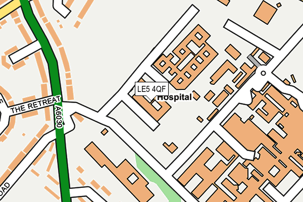
LE5 4QF is located in the Evington electoral ward, within the unitary authority of Leicester and the English Parliamentary constituency of Leicester East. The Sub Integrated Care Board (ICB) Location is NHS Leicester, Leicestershire and Rutland ICB - 04C and the police force is Leicestershire. This postcode has been in use since January 1993.


GetTheData
Source: OS OpenMap – Local (Ordnance Survey)
Source: OS VectorMap District (Ordnance Survey)
Licence: Open Government Licence (requires attribution)
| Easting | 461991 |
| Northing | 304043 |
| Latitude | 52.630611 |
| Longitude | -1.085532 |
GetTheData
Source: Open Postcode Geo
Licence: Open Government Licence
| Country | England |
| Postcode District | LE5 |
| ➜ LE5 open data dashboard ➜ See where LE5 is on a map ➜ Where is Leicester? | |
GetTheData
Source: Land Registry Price Paid Data
Licence: Open Government Licence
Elevation or altitude of LE5 4QF as distance above sea level:
| Metres | Feet | |
|---|---|---|
| Elevation | 100m | 328ft |
Elevation is measured from the approximate centre of the postcode, to the nearest point on an OS contour line from OS Terrain 50, which has contour spacing of ten vertical metres.
➜ How high above sea level am I? Find the elevation of your current position using your device's GPS.
GetTheData
Source: Open Postcode Elevation
Licence: Open Government Licence
| Ward | Evington |
| Constituency | Leicester East |
GetTheData
Source: ONS Postcode Database
Licence: Open Government Licence
| January 2024 | Violence and sexual offences | On or near Kegworth Avenue | 268m |
| January 2024 | Public order | On or near Avonside Drive | 366m |
| January 2024 | Anti-social behaviour | On or near Avonside Drive | 366m |
| ➜ Get more crime data in our Crime section | |||
GetTheData
Source: data.police.uk
Licence: Open Government Licence
| General Hospital | Crown Hills | 141m |
| General Hospital | Crown Hills | 149m |
| General Hospital Drive (Wakerley Road) | Crown Hills | 162m |
| General Hospital Drive (Wakerley Road) | Crown Hills | 165m |
| General Hospital Drive (Gwendolen Road) | Crown Hills | 166m |
| Leicester Station | 2.7km |
GetTheData
Source: NaPTAN
Licence: Open Government Licence
GetTheData
Source: ONS Postcode Database
Licence: Open Government Licence


➜ Get more ratings from the Food Standards Agency
GetTheData
Source: Food Standards Agency
Licence: FSA terms & conditions
| Last Collection | |||
|---|---|---|---|
| Location | Mon-Fri | Sat | Distance |
| Wakerley Road | 17:30 | 12:00 | 198m |
| Waterfield Close | 17:30 | 12:00 | 574m |
| Wicklow Drive Post Office | 17:30 | 12:00 | 837m |
GetTheData
Source: Dracos
Licence: Creative Commons Attribution-ShareAlike
| Facility | Distance |
|---|---|
| Goals (Leicester) Wakerley Road, Leicester Artificial Grass Pitch | 364m |
| Crown Hills Community College (Closed) Gwendolen Road, Leicester Sports Hall, Health and Fitness Gym, Grass Pitches, Studio | 384m |
| Crown Hills Community College Gwendolen Road, Leicester Health and Fitness Gym, Sports Hall, Studio, Grass Pitches | 540m |
GetTheData
Source: Active Places
Licence: Open Government Licence
| School | Phase of Education | Distance |
|---|---|---|
| Ash Field Academy Broad Avenue, Leicester, LE5 4PY | Not applicable | 159m |
| Crown Hills Community College Gwendolen Road, Leicester, LE5 5FT | Secondary | 384m |
| Coleman Primary School Gwendolen Road, Leicester, LE5 5FS | Primary | 589m |
GetTheData
Source: Edubase
Licence: Open Government Licence
The below table lists the International Territorial Level (ITL) codes (formerly Nomenclature of Territorial Units for Statistics (NUTS) codes) and Local Administrative Units (LAU) codes for LE5 4QF:
| ITL 1 Code | Name |
|---|---|
| TLF | East Midlands (England) |
| ITL 2 Code | Name |
| TLF2 | Leicestershire, Rutland and Northamptonshire |
| ITL 3 Code | Name |
| TLF21 | Leicester |
| LAU 1 Code | Name |
| E06000016 | Leicester |
GetTheData
Source: ONS Postcode Directory
Licence: Open Government Licence
The below table lists the Census Output Area (OA), Lower Layer Super Output Area (LSOA), and Middle Layer Super Output Area (MSOA) for LE5 4QF:
| Code | Name | |
|---|---|---|
| OA | E00068992 | |
| LSOA | E01013668 | Leicester 019F |
| MSOA | E02002845 | Leicester 019 |
GetTheData
Source: ONS Postcode Directory
Licence: Open Government Licence
| LE5 4PS | Broad Avenue | 217m |
| LE5 4WP | Hospital Close | 233m |
| LE5 4PU | Broad Avenue | 239m |
| LE5 5GA | The Retreat | 240m |
| LE5 4WJ | Wakerley Road | 250m |
| LE5 4PZ | Cropthorne Avenue | 262m |
| LE5 4LD | Blaken Hall Road | 291m |
| LE5 4QL | Cropthorne Avenue | 298m |
| LE5 4PG | Kegworth Avenue | 299m |
| LE5 5FJ | Gwendolen Road | 305m |
GetTheData
Source: Open Postcode Geo; Land Registry Price Paid Data
Licence: Open Government Licence