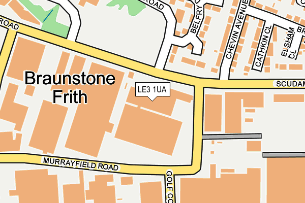
LE3 1UA is located in the Western electoral ward, within the unitary authority of Leicester and the English Parliamentary constituency of Leicester West. The Sub Integrated Care Board (ICB) Location is NHS Leicester, Leicestershire and Rutland ICB - 04C and the police force is Leicestershire. This postcode has been in use since April 2016.


GetTheData
Source: OS OpenMap – Local (Ordnance Survey)
Source: OS VectorMap District (Ordnance Survey)
Licence: Open Government Licence (requires attribution)
| Easting | 454409 |
| Northing | 304209 |
| Latitude | 52.632915 |
| Longitude | -1.197514 |
GetTheData
Source: Open Postcode Geo
Licence: Open Government Licence
| Country | England |
| Postcode District | LE3 |
| ➜ LE3 open data dashboard ➜ See where LE3 is on a map ➜ Where is Leicester? | |
GetTheData
Source: Land Registry Price Paid Data
Licence: Open Government Licence
Elevation or altitude of LE3 1UA as distance above sea level:
| Metres | Feet | |
|---|---|---|
| Elevation | 90m | 295ft |
Elevation is measured from the approximate centre of the postcode, to the nearest point on an OS contour line from OS Terrain 50, which has contour spacing of ten vertical metres.
➜ How high above sea level am I? Find the elevation of your current position using your device's GPS.
GetTheData
Source: Open Postcode Elevation
Licence: Open Government Licence
| Ward | Western |
| Constituency | Leicester West |
GetTheData
Source: ONS Postcode Database
Licence: Open Government Licence
| January 2024 | Shoplifting | On or near Ryder Road | 309m |
| January 2024 | Shoplifting | On or near Ryder Road | 309m |
| January 2024 | Shoplifting | On or near Ryder Road | 309m |
| ➜ Get more crime data in our Crime section | |||
GetTheData
Source: data.police.uk
Licence: Open Government Licence
| Fulford Road (Scudamore Road) | New Parks | 52m |
| Belfry Drive (Fulford Road) | New Parks | 108m |
| Chevin Avenue (Scudamore Road) | New Parks | 174m |
| Ryder Road (Scudamore Road) | New Parks | 176m |
| Glenrothes Close (Fulford Road) | New Parks | 200m |
| Leicester Station | 4.9km |
GetTheData
Source: NaPTAN
Licence: Open Government Licence
GetTheData
Source: ONS Postcode Database
Licence: Open Government Licence


➜ Get more ratings from the Food Standards Agency
GetTheData
Source: Food Standards Agency
Licence: FSA terms & conditions
| Last Collection | |||
|---|---|---|---|
| Location | Mon-Fri | Sat | Distance |
| Park Rise | 17:00 | 12:00 | 598m |
| Packer Avenue | 17:00 | 12:00 | 867m |
| L. F. E. Post Office | 17:30 | 12:00 | 870m |
GetTheData
Source: Dracos
Licence: Creative Commons Attribution-ShareAlike
| Facility | Distance |
|---|---|
| Hockley Farm Hockley Farm Road, Leicester Grass Pitches | 541m |
| Braunstone Frith School (Closed) Cuffling Drive, Leicester Sports Hall, Grass Pitches | 654m |
| Western Golf Course (Closed) Scudamore Road, Leicester Golf | 691m |
GetTheData
Source: Active Places
Licence: Open Government Licence
| School | Phase of Education | Distance |
|---|---|---|
| Braunstone Frith Primary Academy Cuffling Drive, Leicester, LE3 6NF | Primary | 656m |
| Braunstone Community Primary School Cort Crescent, Braunstone, Leicester, LE3 1QH | Primary | 1.1km |
| Fossebrook Primary School Holmfield Avenue West, Leicester Forest East, Leicester, LE3 3FF | Primary | 1.1km |
GetTheData
Source: Edubase
Licence: Open Government Licence
The below table lists the International Territorial Level (ITL) codes (formerly Nomenclature of Territorial Units for Statistics (NUTS) codes) and Local Administrative Units (LAU) codes for LE3 1UA:
| ITL 1 Code | Name |
|---|---|
| TLF | East Midlands (England) |
| ITL 2 Code | Name |
| TLF2 | Leicestershire, Rutland and Northamptonshire |
| ITL 3 Code | Name |
| TLF21 | Leicester |
| LAU 1 Code | Name |
| E06000016 | Leicester |
GetTheData
Source: ONS Postcode Directory
Licence: Open Government Licence
The below table lists the Census Output Area (OA), Lower Layer Super Output Area (LSOA), and Middle Layer Super Output Area (MSOA) for LE3 1UA:
| Code | Name | |
|---|---|---|
| OA | E00069264 | |
| LSOA | E01013729 | Leicester 020A |
| MSOA | E02002846 | Leicester 020 |
GetTheData
Source: ONS Postcode Directory
Licence: Open Government Licence
| LE3 6UU | Belfry Drive | 187m |
| LE3 6PW | Cathkin Close | 230m |
| LE3 6PX | Chevin Avenue | 234m |
| LE3 6UL | Fulford Road | 245m |
| LE3 6PY | Elsham Close | 307m |
| LE3 6PU | Brookdale Road | 319m |
| LE3 6TA | Ryder Road | 324m |
| LE3 6UN | Hollinwell Close | 342m |
| LE3 6PD | Cuffling Drive | 378m |
| LE3 6PZ | Woodhall Close | 380m |
GetTheData
Source: Open Postcode Geo; Land Registry Price Paid Data
Licence: Open Government Licence