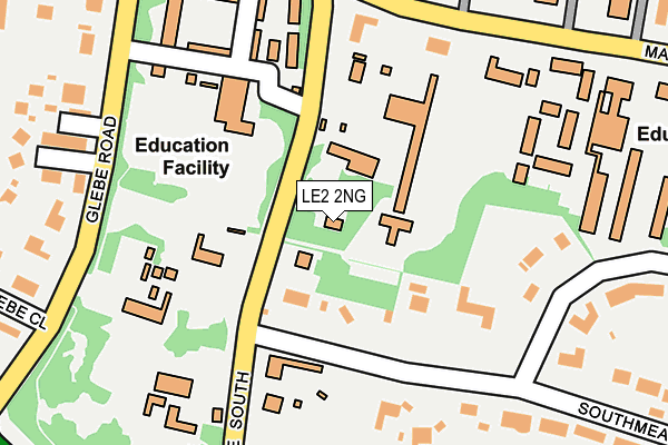
LE2 2NG is located in the Oadby Grange electoral ward, within the local authority district of Oadby and Wigston and the English Parliamentary constituency of Harborough. The Sub Integrated Care Board (ICB) Location is NHS Leicester, Leicestershire and Rutland ICB - 03W and the police force is Leicestershire. This postcode has been in use since January 1980.


GetTheData
Source: OS OpenMap – Local (Ordnance Survey)
Source: OS VectorMap District (Ordnance Survey)
Licence: Open Government Licence (requires attribution)
| Easting | 461763 |
| Northing | 301554 |
| Latitude | 52.608264 |
| Longitude | -1.089364 |
GetTheData
Source: Open Postcode Geo
Licence: Open Government Licence
| Country | England |
| Postcode District | LE2 |
| ➜ LE2 open data dashboard ➜ See where LE2 is on a map ➜ Where is Oadby? | |
GetTheData
Source: Land Registry Price Paid Data
Licence: Open Government Licence
Elevation or altitude of LE2 2NG as distance above sea level:
| Metres | Feet | |
|---|---|---|
| Elevation | 100m | 328ft |
Elevation is measured from the approximate centre of the postcode, to the nearest point on an OS contour line from OS Terrain 50, which has contour spacing of ten vertical metres.
➜ How high above sea level am I? Find the elevation of your current position using your device's GPS.
GetTheData
Source: Open Postcode Elevation
Licence: Open Government Licence
| Ward | Oadby Grange |
| Constituency | Harborough |
GetTheData
Source: ONS Postcode Database
Licence: Open Government Licence
| January 2024 | Vehicle crime | On or near Petrol Station | 440m |
| October 2023 | Violence and sexual offences | On or near Petrol Station | 440m |
| September 2023 | Violence and sexual offences | On or near Petrol Station | 440m |
| ➜ Get more crime data in our Crime section | |||
GetTheData
Source: data.police.uk
Licence: Open Government Licence
| Beaumont Hall (Stoughton Drive South) | Oadby | 65m |
| Beaumont Hall (Stoughton Drive South) | Oadby | 127m |
| Coppice Hall (Manor Road) | Oadby | 205m |
| Coppice Hall (Manor Road) | Oadby | 211m |
| Digby House (Stoughton Drive South) | Oadby | 265m |
| Leicester Station | 3.5km |
| South Wigston Station | 4.2km |
GetTheData
Source: NaPTAN
Licence: Open Government Licence
| Percentage of properties with Next Generation Access | 100.0% |
| Percentage of properties with Superfast Broadband | 100.0% |
| Percentage of properties with Ultrafast Broadband | 25.0% |
| Percentage of properties with Full Fibre Broadband | 0.0% |
Superfast Broadband is between 30Mbps and 300Mbps
Ultrafast Broadband is > 300Mbps
| Percentage of properties unable to receive 2Mbps | 0.0% |
| Percentage of properties unable to receive 5Mbps | 0.0% |
| Percentage of properties unable to receive 10Mbps | 0.0% |
| Percentage of properties unable to receive 30Mbps | 0.0% |
GetTheData
Source: Ofcom
Licence: Ofcom Terms of Use (requires attribution)
GetTheData
Source: ONS Postcode Database
Licence: Open Government Licence


➜ Get more ratings from the Food Standards Agency
GetTheData
Source: Food Standards Agency
Licence: FSA terms & conditions
| Last Collection | |||
|---|---|---|---|
| Location | Mon-Fri | Sat | Distance |
| Manor Road | 17:00 | 12:00 | 223m |
| Grenfell Road | 17:00 | 12:00 | 434m |
| Holbrook Road | 17:00 | 12:00 | 669m |
GetTheData
Source: Dracos
Licence: Creative Commons Attribution-ShareAlike
| Facility | Distance |
|---|---|
| Oadby Granville Tennis Club Leicester Road, Oadby, Leicester Outdoor Tennis Courts | 430m |
| Leicester High School For Girls London Road, Leicester Sports Hall, Outdoor Tennis Courts | 543m |
| The Roger Bettles Sports Centre Manor Road, Oadby, Leicester Sports Hall, Athletics, Health and Fitness Gym, Artificial Grass Pitch, Grass Pitches, Studio, Outdoor Tennis Courts, Swimming Pool | 561m |
GetTheData
Source: Active Places
Licence: Open Government Licence
| School | Phase of Education | Distance |
|---|---|---|
| Leicester High School for Girls 454 London Road, Leicester, LE2 2PP | Not applicable | 567m |
| Launde Primary School New Street, Oadby, Leicester, LE2 4LJ | Primary | 1.3km |
| Langmoor Primary School Oadby Kenilworth Drive, Oadby, Leicester, LE2 5HS | Primary | 1.4km |
GetTheData
Source: Edubase
Licence: Open Government Licence
The below table lists the International Territorial Level (ITL) codes (formerly Nomenclature of Territorial Units for Statistics (NUTS) codes) and Local Administrative Units (LAU) codes for LE2 2NG:
| ITL 1 Code | Name |
|---|---|
| TLF | East Midlands (England) |
| ITL 2 Code | Name |
| TLF2 | Leicestershire, Rutland and Northamptonshire |
| ITL 3 Code | Name |
| TLF22 | Leicestershire CC and Rutland |
| LAU 1 Code | Name |
| E07000135 | Oadby and Wigston |
GetTheData
Source: ONS Postcode Directory
Licence: Open Government Licence
The below table lists the Census Output Area (OA), Lower Layer Super Output Area (LSOA), and Middle Layer Super Output Area (MSOA) for LE2 2NG:
| Code | Name | |
|---|---|---|
| OA | E00174265 | |
| LSOA | E01025974 | Oadby and Wigston 009B |
| MSOA | E02006911 | Oadby and Wigston 009 |
GetTheData
Source: ONS Postcode Directory
Licence: Open Government Licence
| LE2 2LR | Southmeads Road | 187m |
| LE2 2LS | Southmeads Road | 240m |
| LE2 2LD | Glebe Road | 252m |
| LE2 2LN | Eynsford Close | 265m |
| LE2 2LA | Glebe Close | 333m |
| LE2 2LQ | Glebe Gardens | 338m |
| LE2 2PA | Grenfell Road | 357m |
| LE2 2HR | Oaks Way | 376m |
| LE2 2PD | Meadowcourt Road | 382m |
| LE2 2PG | Portland Towers | 407m |
GetTheData
Source: Open Postcode Geo; Land Registry Price Paid Data
Licence: Open Government Licence