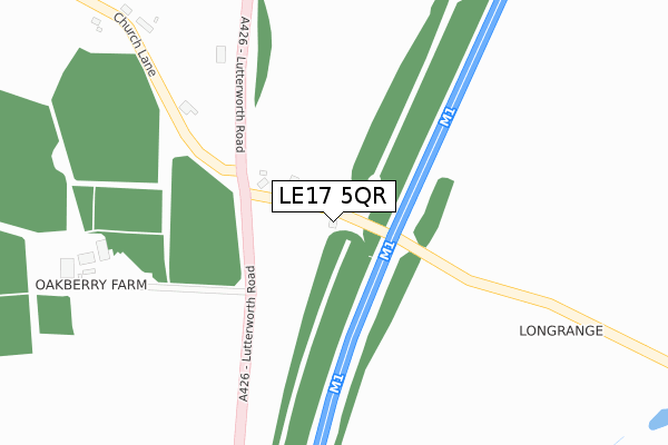
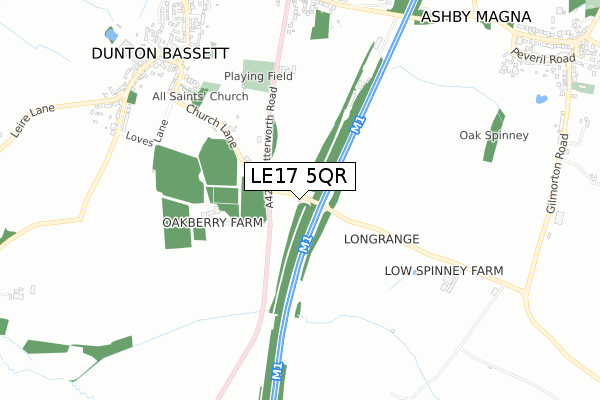
LE17 5QR is located in the Dunton electoral ward, within the local authority district of Harborough and the English Parliamentary constituency of South Leicestershire. The Sub Integrated Care Board (ICB) Location is NHS Leicester, Leicestershire and Rutland ICB - 03W and the police force is Leicestershire. This postcode has been in use since June 2012.


GetTheData
Source: OS Open Zoomstack (Ordnance Survey)
Licence: Open Government Licence (requires attribution)
Attribution: Contains OS data © Crown copyright and database right 2024
Source: Open Postcode Geo
Licence: Open Government Licence (requires attribution)
Attribution: Contains OS data © Crown copyright and database right 2024; Contains Royal Mail data © Royal Mail copyright and database right 2024; Source: Office for National Statistics licensed under the Open Government Licence v.3.0
| Easting | 455190 |
| Northing | 290007 |
| Latitude | 52.505175 |
| Longitude | -1.188335 |
GetTheData
Source: Open Postcode Geo
Licence: Open Government Licence
| Country | England |
| Postcode District | LE17 |
| ➜ LE17 open data dashboard ➜ See where LE17 is on a map | |
GetTheData
Source: Land Registry Price Paid Data
Licence: Open Government Licence
Elevation or altitude of LE17 5QR as distance above sea level:
| Metres | Feet | |
|---|---|---|
| Elevation | 130m | 427ft |
Elevation is measured from the approximate centre of the postcode, to the nearest point on an OS contour line from OS Terrain 50, which has contour spacing of ten vertical metres.
➜ How high above sea level am I? Find the elevation of your current position using your device's GPS.
GetTheData
Source: Open Postcode Elevation
Licence: Open Government Licence
| Ward | Dunton |
| Constituency | South Leicestershire |
GetTheData
Source: ONS Postcode Database
Licence: Open Government Licence
| Elwells Avenue (Main Street) | Dunton Bassett | 880m |
| Lutterworth Road (Coopers Lane) | Dunton Bassett | 890m |
| Lutterworth Road (Coopers Lane) | Dunton Bassett | 893m |
| Broughton Lane (Coopers Lane) | Dunton Bassett | 960m |
| Broughton Lane (Coopers Lane) | Dunton Bassett | 969m |
GetTheData
Source: NaPTAN
Licence: Open Government Licence
GetTheData
Source: ONS Postcode Database
Licence: Open Government Licence


➜ Get more ratings from the Food Standards Agency
GetTheData
Source: Food Standards Agency
Licence: FSA terms & conditions
| Last Collection | |||
|---|---|---|---|
| Location | Mon-Fri | Sat | Distance |
| Dunton Bassett Rso | 16:30 | 10:30 | 798m |
| Station Road | 16:45 | 10:00 | 2,656m |
| Leire Rso | 16:40 | 10:30 | 2,686m |
GetTheData
Source: Dracos
Licence: Creative Commons Attribution-ShareAlike
| Facility | Distance |
|---|---|
| Dunton And Broughton United Football Club Station Road, Dunton Bassett Grass Pitches, Artificial Grass Pitch | 908m |
| Lutterworth Tennis Club Hall Lane, Hall Lane, Bitteswell, Lutterworth Outdoor Tennis Courts | 2.9km |
| Lutterworth Football Academy Hall Lane, Bitteswell, Lutterworth Grass Pitches, Artificial Grass Pitch | 2.9km |
GetTheData
Source: Active Places
Licence: Open Government Licence
| School | Phase of Education | Distance |
|---|---|---|
| Dunton Bassett Primary School The Mount, Dunton Bassett, Lutterworth, LE17 5JL | Primary | 884m |
| Gilmorton Chandler Church of England Primary School Church Lane, Gilmorton, Lutterworth, LE17 5LU | Primary | 2.7km |
| Hallbrook Primary School Hallbrook Road, Broughton Astley, LE9 6WX | Primary | 3km |
GetTheData
Source: Edubase
Licence: Open Government Licence
The below table lists the International Territorial Level (ITL) codes (formerly Nomenclature of Territorial Units for Statistics (NUTS) codes) and Local Administrative Units (LAU) codes for LE17 5QR:
| ITL 1 Code | Name |
|---|---|
| TLF | East Midlands (England) |
| ITL 2 Code | Name |
| TLF2 | Leicestershire, Rutland and Northamptonshire |
| ITL 3 Code | Name |
| TLF22 | Leicestershire CC and Rutland |
| LAU 1 Code | Name |
| E07000131 | Harborough |
GetTheData
Source: ONS Postcode Directory
Licence: Open Government Licence
The below table lists the Census Output Area (OA), Lower Layer Super Output Area (LSOA), and Middle Layer Super Output Area (MSOA) for LE17 5QR:
| Code | Name | |
|---|---|---|
| OA | E00130788 | |
| LSOA | E01025777 | Harborough 006A |
| MSOA | E02005372 | Harborough 006 |
GetTheData
Source: ONS Postcode Directory
Licence: Open Government Licence
| LE17 5LE | Lutterworth Road | 123m |
| LE17 5JZ | Church Lane | 409m |
| LE17 5JY | Church Close | 670m |
| LE17 5JX | Church Lane | 722m |
| LE17 5LF | Lutterworth Road | 729m |
| LE17 5JH | Main Street | 780m |
| LE17 5LB | Elfin Grove | 783m |
| LE17 5JQ | Ralphs Close | 815m |
| LE17 5LQ | Station Road | 823m |
| LE17 5JJ | Bennetts Hill | 826m |
GetTheData
Source: Open Postcode Geo; Land Registry Price Paid Data
Licence: Open Government Licence