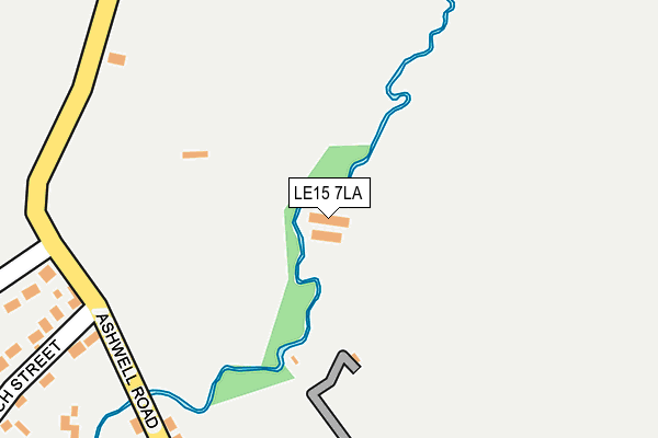
LE15 7LA is located in the Langham electoral ward, within the unitary authority of Rutland and the English Parliamentary constituency of Rutland and Melton. The Sub Integrated Care Board (ICB) Location is NHS Leicester, Leicestershire and Rutland ICB - 03W and the police force is Leicestershire. This postcode has been in use since March 2012.


GetTheData
Source: OS OpenMap – Local (Ordnance Survey)
Source: OS VectorMap District (Ordnance Survey)
Licence: Open Government Licence (requires attribution)
| Easting | 484808 |
| Northing | 311531 |
| Latitude | 52.694829 |
| Longitude | -0.746568 |
GetTheData
Source: Open Postcode Geo
Licence: Open Government Licence
| Country | England |
| Postcode District | LE15 |
➜ See where LE15 is on a map | |
GetTheData
Source: Land Registry Price Paid Data
Licence: Open Government Licence
Elevation or altitude of LE15 7LA as distance above sea level:
| Metres | Feet | |
|---|---|---|
| Elevation | 120m | 394ft |
Elevation is measured from the approximate centre of the postcode, to the nearest point on an OS contour line from OS Terrain 50, which has contour spacing of ten vertical metres.
➜ How high above sea level am I? Find the elevation of your current position using your device's GPS.
GetTheData
Source: Open Postcode Elevation
Licence: Open Government Licence
| Ward | Langham |
| Constituency | Rutland And Melton |
GetTheData
Source: ONS Postcode Database
Licence: Open Government Licence
| Jubilee Drive (Burley Road) | Langham | 693m |
| Jubilee Drive (Burley Road) | Langham | 698m |
| Melton Road | Langham | 812m |
| The Range (Melton Road) | Langham | 920m |
| Manor Lane (Melton Road) | Langham | 973m |
| Oakham Station | 2.7km |
GetTheData
Source: NaPTAN
Licence: Open Government Licence
GetTheData
Source: ONS Postcode Database
Licence: Open Government Licence


➜ Get more ratings from the Food Standards Agency
GetTheData
Source: Food Standards Agency
Licence: FSA terms & conditions
| Last Collection | |||
|---|---|---|---|
| Location | Mon-Fri | Sat | Distance |
| Melton Road/Well Street | 16:50 | 10:20 | 852m |
| Barleythorpe | 17:00 | 07:00 | 1,916m |
| Pillings Road | 17:30 | 08:00 | 1,975m |
GetTheData
Source: Dracos
Licence: Creative Commons Attribution-ShareAlike
| Risk of LE15 7LA flooding from rivers and sea | Medium |
| ➜ LE15 7LA flood map | |
GetTheData
Source: Open Flood Risk by Postcode
Licence: Open Government Licence
The below table lists the International Territorial Level (ITL) codes (formerly Nomenclature of Territorial Units for Statistics (NUTS) codes) and Local Administrative Units (LAU) codes for LE15 7LA:
| ITL 1 Code | Name |
|---|---|
| TLF | East Midlands (England) |
| ITL 2 Code | Name |
| TLF2 | Leicestershire, Rutland and Northamptonshire |
| ITL 3 Code | Name |
| TLF22 | Leicestershire CC and Rutland |
| LAU 1 Code | Name |
| E06000017 | Rutland |
GetTheData
Source: ONS Postcode Directory
Licence: Open Government Licence
The below table lists the Census Output Area (OA), Lower Layer Super Output Area (LSOA), and Middle Layer Super Output Area (MSOA) for LE15 7LA:
| Code | Name | |
|---|---|---|
| OA | E00069581 | |
| LSOA | E01013793 | Rutland 002A |
| MSOA | E02002864 | Rutland 002 |
GetTheData
Source: ONS Postcode Directory
Licence: Open Government Licence
| LE15 7HT | Ashwell Road | 246m |
| LE15 7JX | Grange Close | 383m |
| LE15 7JF | The Rookery | 390m |
| LE15 7JY | Sharrads Way | 395m |
| LE15 7JZ | Harewood Close | 445m |
| LE15 7JT | Westons Lane | 476m |
| LE15 7HY | Burley Road | 477m |
| LE15 7JE | Church Street | 500m |
| LE15 7JL | Manor Lane | 539m |
| LE15 7NZ | Ruddle Way | 602m |
GetTheData
Source: Open Postcode Geo; Land Registry Price Paid Data
Licence: Open Government Licence