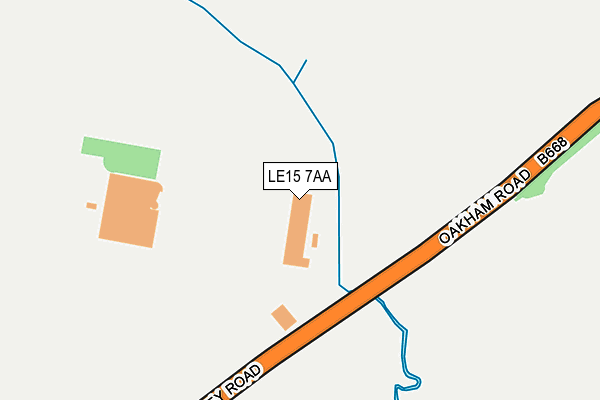
LE15 7AA is located in the Oakham North East electoral ward, within the unitary authority of Rutland and the English Parliamentary constituency of Rutland and Melton. The Sub Integrated Care Board (ICB) Location is NHS Leicester, Leicestershire and Rutland ICB - 03W and the police force is Leicestershire. This postcode has been in use since January 1980.


GetTheData
Source: OS OpenMap – Local (Ordnance Survey)
Source: OS VectorMap District (Ordnance Survey)
Licence: Open Government Licence (requires attribution)
| Easting | 487112 |
| Northing | 309858 |
| Latitude | 52.679428 |
| Longitude | -0.712928 |
GetTheData
Source: Open Postcode Geo
Licence: Open Government Licence
| Country | England |
| Postcode District | LE15 |
| ➜ LE15 open data dashboard ➜ See where LE15 is on a map | |
GetTheData
Source: Land Registry Price Paid Data
Licence: Open Government Licence
Elevation or altitude of LE15 7AA as distance above sea level:
| Metres | Feet | |
|---|---|---|
| Elevation | 100m | 328ft |
Elevation is measured from the approximate centre of the postcode, to the nearest point on an OS contour line from OS Terrain 50, which has contour spacing of ten vertical metres.
➜ How high above sea level am I? Find the elevation of your current position using your device's GPS.
GetTheData
Source: Open Postcode Elevation
Licence: Open Government Licence
| Ward | Oakham North East |
| Constituency | Rutland And Melton |
GetTheData
Source: ONS Postcode Database
Licence: Open Government Licence
| June 2022 | Shoplifting | On or near Burley Road | 117m |
| April 2022 | Other theft | On or near Burley Road | 117m |
| April 2022 | Shoplifting | On or near Burley Road | 117m |
| ➜ Get more crime data in our Crime section | |||
GetTheData
Source: data.police.uk
Licence: Open Government Licence
| Co-op Superstore (Burley Road) | Burley | 134m |
| Ladywell (Burley Road) | Oakham | 699m |
| Ladywell (Burley Road) | Oakham | 716m |
| Oakfield (Foxfield Way) | Oakham | 843m |
| Beech Road (Woodland View) | Oakham | 871m |
| Oakham Station | 1.6km |
GetTheData
Source: NaPTAN
Licence: Open Government Licence
GetTheData
Source: ONS Postcode Database
Licence: Open Government Licence


➜ Get more ratings from the Food Standards Agency
GetTheData
Source: Food Standards Agency
Licence: FSA terms & conditions
| Last Collection | |||
|---|---|---|---|
| Location | Mon-Fri | Sat | Distance |
| Bullfinch Close | 17:20 | 11:00 | 680m |
| Springfield Way | 17:20 | 11:00 | 790m |
| Schofield Road | 17:30 | 11:00 | 991m |
GetTheData
Source: Dracos
Licence: Creative Commons Attribution-ShareAlike
| Facility | Distance |
|---|---|
| Oakham School (Wilson Pavilion) Ashwell Road, Oakham Grass Pitches | 590m |
| Oakham School Sports Centre Kilburn Road, Oakham Sports Hall, Swimming Pool, Health and Fitness Gym, Artificial Grass Pitch, Grass Pitches, Squash Courts | 1.3km |
| Active Rutland Hub Oakham Enterprise Park, Ashwell Road, Oakham Sports Hall, Studio, Artificial Grass Pitch | 1.3km |
GetTheData
Source: Active Places
Licence: Open Government Licence
| School | Phase of Education | Distance |
|---|---|---|
| Oakham CofE Primary School Burley Road, Oakham, LE15 6GY | Primary | 905m |
| English Martyrs' Catholic Voluntary Academy Willow Crescent, Oakham, LE15 6EH | Primary | 984m |
| The Parks School Burley Road, Oakham, LE15 6GY | Not applicable | 985m |
GetTheData
Source: Edubase
Licence: Open Government Licence
The below table lists the International Territorial Level (ITL) codes (formerly Nomenclature of Territorial Units for Statistics (NUTS) codes) and Local Administrative Units (LAU) codes for LE15 7AA:
| ITL 1 Code | Name |
|---|---|
| TLF | East Midlands (England) |
| ITL 2 Code | Name |
| TLF2 | Leicestershire, Rutland and Northamptonshire |
| ITL 3 Code | Name |
| TLF22 | Leicestershire CC and Rutland |
| LAU 1 Code | Name |
| E06000017 | Rutland |
GetTheData
Source: ONS Postcode Directory
Licence: Open Government Licence
The below table lists the Census Output Area (OA), Lower Layer Super Output Area (LSOA), and Middle Layer Super Output Area (MSOA) for LE15 7AA:
| Code | Name | |
|---|---|---|
| OA | E00069603 | |
| LSOA | E01013798 | Rutland 003A |
| MSOA | E02002865 | Rutland 003 |
GetTheData
Source: ONS Postcode Directory
Licence: Open Government Licence
| LE15 6BY | Chaffinch Close | 509m |
| LE15 6HB | Martin Close | 514m |
| LE15 6BT | Robin Close | 528m |
| LE15 6BX | Partridge Way | 563m |
| LE15 6FE | Horn Close | 587m |
| LE15 6DD | Ladywell | 608m |
| LE15 6BN | Heron Road | 612m |
| LE15 6BJ | Jay Close | 617m |
| LE15 6BE | Plover Close | 632m |
| LE15 6BU | Kestrel Road | 633m |
GetTheData
Source: Open Postcode Geo; Land Registry Price Paid Data
Licence: Open Government Licence