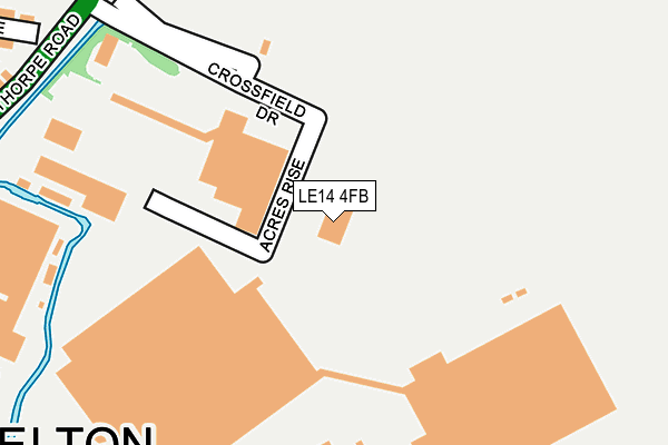
LE14 4FB is located in the Long Clawson and Stathern electoral ward, within the local authority district of Melton and the English Parliamentary constituency of Rutland and Melton. The Sub Integrated Care Board (ICB) Location is NHS Leicester, Leicestershire and Rutland ICB - 03W and the police force is Leicestershire. This postcode has been in use since May 2016.


GetTheData
Source: OS OpenMap – Local (Ordnance Survey)
Source: OS VectorMap District (Ordnance Survey)
Licence: Open Government Licence (requires attribution)
| Easting | 475276 |
| Northing | 331158 |
| Latitude | 52.872660 |
| Longitude | -0.883066 |
GetTheData
Source: Open Postcode Geo
Licence: Open Government Licence
| Country | England |
| Postcode District | LE14 |
➜ See where LE14 is on a map ➜ Where is Harby? | |
GetTheData
Source: Land Registry Price Paid Data
Licence: Open Government Licence
Elevation or altitude of LE14 4FB as distance above sea level:
| Metres | Feet | |
|---|---|---|
| Elevation | 80m | 262ft |
Elevation is measured from the approximate centre of the postcode, to the nearest point on an OS contour line from OS Terrain 50, which has contour spacing of ten vertical metres.
➜ How high above sea level am I? Find the elevation of your current position using your device's GPS.
GetTheData
Source: Open Postcode Elevation
Licence: Open Government Licence
| Ward | Long Clawson And Stathern |
| Constituency | Rutland And Melton |
GetTheData
Source: ONS Postcode Database
Licence: Open Government Licence
2021 28 MAY £277,500 |
2019 25 NOV £365,000 |
2, WHITAKERS FARM, HARBY, MELTON MOWBRAY, LE14 4FB 2019 21 MAR £270,000 |
3, WHITAKERS FARM, HARBY, MELTON MOWBRAY, LE14 4FB 2018 11 DEC £279,000 |
2017 20 OCT £391,330 |
GetTheData
Source: HM Land Registry Price Paid Data
Licence: Contains HM Land Registry data © Crown copyright and database right 2025. This data is licensed under the Open Government Licence v3.0.
| Pinfold Lane (Stathern Lane) | Harby | 253m |
| Pinfold Lane (Stathern Lane) | Harby | 256m |
| Boyers Orchard | Harby | 419m |
| Boyers Orchard | Harby | 440m |
| Walnut Paddock (Burden Lane) | Harby | 509m |
GetTheData
Source: NaPTAN
Licence: Open Government Licence
| Percentage of properties with Next Generation Access | 100.0% |
| Percentage of properties with Superfast Broadband | 100.0% |
| Percentage of properties with Ultrafast Broadband | 0.0% |
| Percentage of properties with Full Fibre Broadband | 0.0% |
Superfast Broadband is between 30Mbps and 300Mbps
Ultrafast Broadband is > 300Mbps
| Percentage of properties unable to receive 2Mbps | 0.0% |
| Percentage of properties unable to receive 5Mbps | 0.0% |
| Percentage of properties unable to receive 10Mbps | 0.0% |
| Percentage of properties unable to receive 30Mbps | 0.0% |
GetTheData
Source: Ofcom
Licence: Ofcom Terms of Use (requires attribution)
GetTheData
Source: ONS Postcode Database
Licence: Open Government Licence


➜ Get more ratings from the Food Standards Agency
GetTheData
Source: Food Standards Agency
Licence: FSA terms & conditions
| Last Collection | |||
|---|---|---|---|
| Location | Mon-Fri | Sat | Distance |
| Chapel End | 16:30 | 11:00 | 863m |
| East End | 16:15 | 09:00 | 4,276m |
| Langar Post Office | 16:30 | 09:00 | 4,450m |
GetTheData
Source: Dracos
Licence: Creative Commons Attribution-ShareAlike
The below table lists the International Territorial Level (ITL) codes (formerly Nomenclature of Territorial Units for Statistics (NUTS) codes) and Local Administrative Units (LAU) codes for LE14 4FB:
| ITL 1 Code | Name |
|---|---|
| TLF | East Midlands (England) |
| ITL 2 Code | Name |
| TLF2 | Leicestershire, Rutland and Northamptonshire |
| ITL 3 Code | Name |
| TLF22 | Leicestershire CC and Rutland |
| LAU 1 Code | Name |
| E07000133 | Melton |
GetTheData
Source: ONS Postcode Directory
Licence: Open Government Licence
The below table lists the Census Output Area (OA), Lower Layer Super Output Area (LSOA), and Middle Layer Super Output Area (MSOA) for LE14 4FB:
| Code | Name | |
|---|---|---|
| OA | E00131380 | |
| LSOA | E01025890 | Melton 001D |
| MSOA | E02005391 | Melton 001 |
GetTheData
Source: ONS Postcode Directory
Licence: Open Government Licence
| LE14 4BX | Pinfold Place | 186m |
| LE14 4BU | Pinfold Lane | 219m |
| LE14 4BQ | Green Lane | 328m |
| LE14 4DA | Stathern Lane | 365m |
| LE14 4GW | Gas Walk | 380m |
| LE14 4BA | Boyers Orchard | 381m |
| LE14 4BG | Dickmans Lane | 487m |
| LE14 4BB | Burden Lane | 583m |
| LE14 4BD | Walnut Paddock | 583m |
| LE14 4BY | Red Causeway | 623m |
GetTheData
Source: Open Postcode Geo; Land Registry Price Paid Data
Licence: Open Government Licence