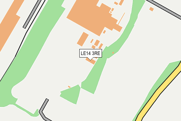
LE14 3RE is located in the Asfordby electoral ward, within the local authority district of Melton and the English Parliamentary constituency of Rutland and Melton. The Sub Integrated Care Board (ICB) Location is NHS Leicester, Leicestershire and Rutland ICB - 03W and the police force is Leicestershire. This postcode has been in use since January 1980.


GetTheData
Source: OS OpenMap – Local (Ordnance Survey)
Source: OS VectorMap District (Ordnance Survey)
Licence: Open Government Licence (requires attribution)
| Easting | 472776 |
| Northing | 320137 |
| Latitude | 52.773928 |
| Longitude | -0.922659 |
GetTheData
Source: Open Postcode Geo
Licence: Open Government Licence
| Country | England |
| Postcode District | LE14 |
| ➜ LE14 open data dashboard ➜ See where LE14 is on a map | |
GetTheData
Source: Land Registry Price Paid Data
Licence: Open Government Licence
Elevation or altitude of LE14 3RE as distance above sea level:
| Metres | Feet | |
|---|---|---|
| Elevation | 90m | 295ft |
Elevation is measured from the approximate centre of the postcode, to the nearest point on an OS contour line from OS Terrain 50, which has contour spacing of ten vertical metres.
➜ How high above sea level am I? Find the elevation of your current position using your device's GPS.
GetTheData
Source: Open Postcode Elevation
Licence: Open Government Licence
| Ward | Asfordby |
| Constituency | Rutland And Melton |
GetTheData
Source: ONS Postcode Database
Licence: Open Government Licence
| Primary School (Melton Road) | Asfordby Hill | 954m |
| Primary School (Melton Road) | Asfordby Hill | 970m |
| Roseberry Avenue (Valley Road) | Asfordby Hill | 1,353m |
| Roseberry Avenue (Valley Road) | Asfordby Hill | 1,378m |
| Collingwood Crescent (Asfordby Road) | Melton Mowbray | 1,461m |
| Melton Mowbray Station | 2.9km |
GetTheData
Source: NaPTAN
Licence: Open Government Licence
GetTheData
Source: ONS Postcode Database
Licence: Open Government Licence


➜ Get more ratings from the Food Standards Agency
GetTheData
Source: Food Standards Agency
Licence: FSA terms & conditions
| Last Collection | |||
|---|---|---|---|
| Location | Mon-Fri | Sat | Distance |
| Welby Lane Post Office | 17:30 | 12:00 | 1,662m |
| Asfordby Valley | 17:15 | 09:30 | 1,883m |
| Potters Hill | 17:15 | 09:30 | 1,890m |
GetTheData
Source: Dracos
Licence: Creative Commons Attribution-ShareAlike
| Facility | Distance |
|---|---|
| Holwell Sports Club Welby Road, Asfordby Hill, Melton Mowbray Grass Pitches, Outdoor Tennis Courts | 735m |
| Mowbray Rangers Fc Melton Road, Asfordby Hill, Melton Mowbray Grass Pitches | 1.1km |
| Sysonby Acres Ashfordby Road, Melton Mowbray Golf, Grass Pitches | 1.4km |
GetTheData
Source: Active Places
Licence: Open Government Licence
| School | Phase of Education | Distance |
|---|---|---|
| Asfordby Hill Primary School Melton Road, Asfordby Hill, Melton Mowbray, LE14 3QX | Primary | 938m |
| St Mary's Church of England Primary School Brampton Road, Melton Mowbray, LE13 0NA | Primary | 1.6km |
| The Grove Primary School Asfordby Road, Melton Mowbray, LE13 0HN | Primary | 2km |
GetTheData
Source: Edubase
Licence: Open Government Licence
The below table lists the International Territorial Level (ITL) codes (formerly Nomenclature of Territorial Units for Statistics (NUTS) codes) and Local Administrative Units (LAU) codes for LE14 3RE:
| ITL 1 Code | Name |
|---|---|
| TLF | East Midlands (England) |
| ITL 2 Code | Name |
| TLF2 | Leicestershire, Rutland and Northamptonshire |
| ITL 3 Code | Name |
| TLF22 | Leicestershire CC and Rutland |
| LAU 1 Code | Name |
| E07000133 | Melton |
GetTheData
Source: ONS Postcode Directory
Licence: Open Government Licence
The below table lists the Census Output Area (OA), Lower Layer Super Output Area (LSOA), and Middle Layer Super Output Area (MSOA) for LE14 3RE:
| Code | Name | |
|---|---|---|
| OA | E00131344 | |
| LSOA | E01025884 | Melton 003B |
| MSOA | E02005393 | Melton 003 |
GetTheData
Source: ONS Postcode Directory
Licence: Open Government Licence
| LE14 3RD | Welby Road | 573m |
| LE14 3QY | St Johns Road | 763m |
| LE14 3RF | West Side | 802m |
| LE14 3RB | Welby Road | 825m |
| LE14 3QZ | South Street | 847m |
| LE14 3QX | Melton Road | 996m |
| LE14 3QS | Crompton Road | 1104m |
| LE14 3QL | Houghton Close | 1125m |
| LE14 3QT | Glebe Road | 1125m |
| LE14 3RA | Stanton Road | 1133m |
GetTheData
Source: Open Postcode Geo; Land Registry Price Paid Data
Licence: Open Government Licence