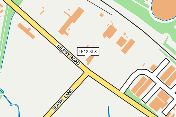
LE12 8LX is located in the Barrow upon Soar electoral ward, within the local authority district of Charnwood and the English Parliamentary constituency of Loughborough. The Sub Integrated Care Board (ICB) Location is NHS Leicester, Leicestershire and Rutland ICB - 04V and the police force is Leicestershire. This postcode has been in use since January 1980.


GetTheData
Source: OS OpenMap – Local (Ordnance Survey)
Source: OS VectorMap District (Ordnance Survey)
Licence: Open Government Licence (requires attribution)
| Easting | 458937 |
| Northing | 316468 |
| Latitude | 52.742634 |
| Longitude | -1.128428 |
GetTheData
Source: Open Postcode Geo
Licence: Open Government Licence
| Country | England |
| Postcode District | LE12 |
| ➜ LE12 open data dashboard ➜ See where LE12 is on a map ➜ Where is Barrow upon Soar? | |
GetTheData
Source: Land Registry Price Paid Data
Licence: Open Government Licence
Elevation or altitude of LE12 8LX as distance above sea level:
| Metres | Feet | |
|---|---|---|
| Elevation | 50m | 164ft |
Elevation is measured from the approximate centre of the postcode, to the nearest point on an OS contour line from OS Terrain 50, which has contour spacing of ten vertical metres.
➜ How high above sea level am I? Find the elevation of your current position using your device's GPS.
GetTheData
Source: Open Postcode Elevation
Licence: Open Government Licence
| Ward | Barrow Upon Soar |
| Constituency | Loughborough |
GetTheData
Source: ONS Postcode Database
Licence: Open Government Licence
| June 2022 | Criminal damage and arson | On or near River View | 488m |
| June 2022 | Violence and sexual offences | On or near River View | 488m |
| May 2022 | Violence and sexual offences | On or near Hayhill | 428m |
| ➜ Get more crime data in our Crime section | |||
GetTheData
Source: data.police.uk
Licence: Open Government Licence
| Hayhill (Sileby Road) | Barrow-upon-soar | 167m |
| Hayhill (Sileby Road) | Barrow-upon-soar | 206m |
| Huston Close (Sileby Road) | Barrow-upon-soar | 470m |
| Huston Close (Sileby Road) | Barrow-upon-soar | 524m |
| Barrow Road | Sileby | 689m |
| Barrow upon Soar Station | 1.3km |
| Sileby Station | 1.7km |
| Loughborough (Leics) Station | 6.1km |
GetTheData
Source: NaPTAN
Licence: Open Government Licence
GetTheData
Source: ONS Postcode Database
Licence: Open Government Licence


➜ Get more ratings from the Food Standards Agency
GetTheData
Source: Food Standards Agency
Licence: FSA terms & conditions
| Last Collection | |||
|---|---|---|---|
| Location | Mon-Fri | Sat | Distance |
| Babbington Road | 16:15 | 09:45 | 1,329m |
| Melton Road | 16:00 | 09:15 | 1,380m |
| Greedon Rise | 16:30 | 09:00 | 1,599m |
GetTheData
Source: Dracos
Licence: Creative Commons Attribution-ShareAlike
| Facility | Distance |
|---|---|
| Mountsorrel Memorial Playing Field Little Lane, Mountsorrel Grass Pitches | 1.6km |
| Redlands Community Primary School King Street, Sileby, Loughborough Grass Pitches | 1.7km |
| Soar Valley Leisure Centre Kingfisher Road, Mountsorrel, Loughborough Sports Hall, Swimming Pool, Health and Fitness Gym, Artificial Grass Pitch, Studio | 1.7km |
GetTheData
Source: Active Places
Licence: Open Government Licence
| School | Phase of Education | Distance |
|---|---|---|
| Quorn Hall School Quorn Hall, Meynell Road, Quorn, Leics, LE12 8QG | Not applicable | 1.3km |
| Homefield College 217 Loughborough Road, Mountsorrel, LE12 7AR | Not applicable | 1.6km |
| Barrow Hall Orchard Church of England Primary School Church Street, Barrow-upon-Soar, Loughborough, LE12 8HP | Primary | 1.6km |
GetTheData
Source: Edubase
Licence: Open Government Licence
The below table lists the International Territorial Level (ITL) codes (formerly Nomenclature of Territorial Units for Statistics (NUTS) codes) and Local Administrative Units (LAU) codes for LE12 8LX:
| ITL 1 Code | Name |
|---|---|
| TLF | East Midlands (England) |
| ITL 2 Code | Name |
| TLF2 | Leicestershire, Rutland and Northamptonshire |
| ITL 3 Code | Name |
| TLF22 | Leicestershire CC and Rutland |
| LAU 1 Code | Name |
| E07000130 | Charnwood |
GetTheData
Source: ONS Postcode Directory
Licence: Open Government Licence
The below table lists the Census Output Area (OA), Lower Layer Super Output Area (LSOA), and Middle Layer Super Output Area (MSOA) for LE12 8LX:
| Code | Name | |
|---|---|---|
| OA | E00130279 | |
| LSOA | E01025674 | Charnwood 011A |
| MSOA | E02005355 | Charnwood 011 |
GetTheData
Source: ONS Postcode Directory
Licence: Open Government Licence
| LE12 8LD | Hayhill | 340m |
| LE12 8NB | Huston Close | 382m |
| LE12 8LL | Riverview | 483m |
| LE12 8LT | Sileby Road | 514m |
| LE12 8LP | Sileby Road | 601m |
| LE12 8LS | Sileby Road | 752m |
| LE12 8LW | Sileby Road | 862m |
| LE12 8LA | The Pastures | 891m |
| LE12 8GY | The Moorings | 985m |
| LE12 8LR | Sileby Road | 1091m |
GetTheData
Source: Open Postcode Geo; Land Registry Price Paid Data
Licence: Open Government Licence