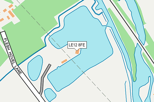
LE12 8FE is located in the Quorn & Mountsorrel Castle electoral ward, within the local authority district of Charnwood and the English Parliamentary constituency of Loughborough. The Sub Integrated Care Board (ICB) Location is NHS Leicester, Leicestershire and Rutland ICB - 04V and the police force is Leicestershire. This postcode has been in use since March 2008.


GetTheData
Source: OS OpenMap – Local (Ordnance Survey)
Source: OS VectorMap District (Ordnance Survey)
Licence: Open Government Licence (requires attribution)
| Easting | 456304 |
| Northing | 318308 |
| Latitude | 52.759473 |
| Longitude | -1.167103 |
GetTheData
Source: Open Postcode Geo
Licence: Open Government Licence
| Country | England |
| Postcode District | LE12 |
➜ See where LE12 is on a map | |
GetTheData
Source: Land Registry Price Paid Data
Licence: Open Government Licence
Elevation or altitude of LE12 8FE as distance above sea level:
| Metres | Feet | |
|---|---|---|
| Elevation | 40m | 131ft |
Elevation is measured from the approximate centre of the postcode, to the nearest point on an OS contour line from OS Terrain 50, which has contour spacing of ten vertical metres.
➜ How high above sea level am I? Find the elevation of your current position using your device's GPS.
GetTheData
Source: Open Postcode Elevation
Licence: Open Government Licence
| Ward | Quorn & Mountsorrel Castle |
| Constituency | Loughborough |
GetTheData
Source: ONS Postcode Database
Licence: Open Government Licence
| Strancliffe Lane (Cotes Road) | Barrow-upon-soar | 821m |
| Brooker Close (Willow Road) | Barrow-upon-soar | 828m |
| Strancliffe Lane (Cotes Road) | Barrow-upon-soar | 845m |
| Brooker Close (Willow Road) | Barrow-upon-soar | 859m |
| Alexander Road (Farley Way) | Quorn | 1,096m |
| Barrow upon Soar Station | 1.9km |
| Loughborough (Leics) Station | 2.9km |
| Sileby Station | 4.9km |
GetTheData
Source: NaPTAN
Licence: Open Government Licence
GetTheData
Source: ONS Postcode Database
Licence: Open Government Licence


➜ Get more ratings from the Food Standards Agency
GetTheData
Source: Food Standards Agency
Licence: FSA terms & conditions
| Last Collection | |||
|---|---|---|---|
| Location | Mon-Fri | Sat | Distance |
| Cotes Road | 16:00 | 08:30 | 1,172m |
| Barrow On Soar Post Office | 17:30 | 10:30 | 1,499m |
| Thirlmere Road | 16:00 | 08:30 | 1,510m |
GetTheData
Source: Dracos
Licence: Creative Commons Attribution-ShareAlike
| Risk of LE12 8FE flooding from rivers and sea | High |
| ➜ LE12 8FE flood map | |
GetTheData
Source: Open Flood Risk by Postcode
Licence: Open Government Licence
The below table lists the International Territorial Level (ITL) codes (formerly Nomenclature of Territorial Units for Statistics (NUTS) codes) and Local Administrative Units (LAU) codes for LE12 8FE:
| ITL 1 Code | Name |
|---|---|
| TLF | East Midlands (England) |
| ITL 2 Code | Name |
| TLF2 | Leicestershire, Rutland and Northamptonshire |
| ITL 3 Code | Name |
| TLF22 | Leicestershire CC and Rutland |
| LAU 1 Code | Name |
| E07000130 | Charnwood |
GetTheData
Source: ONS Postcode Directory
Licence: Open Government Licence
The below table lists the Census Output Area (OA), Lower Layer Super Output Area (LSOA), and Middle Layer Super Output Area (MSOA) for LE12 8FE:
| Code | Name | |
|---|---|---|
| OA | E00130559 | |
| LSOA | E01025732 | Charnwood 012A |
| MSOA | E02005356 | Charnwood 012 |
GetTheData
Source: ONS Postcode Directory
Licence: Open Government Licence
| LE12 8QW | Gardner Way | 549m |
| LE12 8JT | Cotes Road | 693m |
| LE12 8EN | Barrow Road | 772m |
| LE12 8GD | Brooker Close | 795m |
| LE12 8FS | Blake Close | 831m |
| LE12 8GG | Lockwood Road | 850m |
| LE12 8GL | Marianne Close | 917m |
| LE12 8UE | Loughborough Road | 927m |
| LE12 8UH | Alder Road | 948m |
| LE12 8GF | John Earl Road | 966m |
GetTheData
Source: Open Postcode Geo; Land Registry Price Paid Data
Licence: Open Government Licence