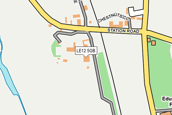
LE12 5GB is located in the Soar Valley electoral ward, within the local authority district of Rushcliffe and the English Parliamentary constituency of Rushcliffe. The Sub Integrated Care Board (ICB) Location is NHS Nottingham and Nottinghamshire ICB - 52R and the police force is Nottinghamshire. This postcode has been in use since January 1993.


GetTheData
Source: OS OpenMap – Local (Ordnance Survey)
Source: OS VectorMap District (Ordnance Survey)
Licence: Open Government Licence (requires attribution)
| Easting | 450065 |
| Northing | 326577 |
| Latitude | 52.834394 |
| Longitude | -1.258289 |
GetTheData
Source: Open Postcode Geo
Licence: Open Government Licence
| Country | England |
| Postcode District | LE12 |
| ➜ LE12 open data dashboard ➜ See where LE12 is on a map ➜ Where is Sutton Bonington? | |
GetTheData
Source: Land Registry Price Paid Data
Licence: Open Government Licence
Elevation or altitude of LE12 5GB as distance above sea level:
| Metres | Feet | |
|---|---|---|
| Elevation | 40m | 131ft |
Elevation is measured from the approximate centre of the postcode, to the nearest point on an OS contour line from OS Terrain 50, which has contour spacing of ten vertical metres.
➜ How high above sea level am I? Find the elevation of your current position using your device's GPS.
GetTheData
Source: Open Postcode Elevation
Licence: Open Government Licence
| Ward | Soar Valley |
| Constituency | Rushcliffe |
GetTheData
Source: ONS Postcode Database
Licence: Open Government Licence
| May 2022 | Other theft | On or near College Road | 479m |
| April 2022 | Burglary | On or near College Road | 479m |
| April 2022 | Criminal damage and arson | On or near College Road | 479m |
| ➜ Get more crime data in our Crime section | |||
GetTheData
Source: data.police.uk
Licence: Open Government Licence
| Station Road | Sutton Bonington | 108m |
| Station Road | Sutton Bonington | 112m |
| College Road | Sutton Bonington | 209m |
| College Road | Sutton Bonington | 210m |
| University Of Nottingham Campus (Unnamed Road) | Sutton Bonington | 501m |
| East Midlands Parkway Station | 3.1km |
GetTheData
Source: NaPTAN
Licence: Open Government Licence
| Percentage of properties with Next Generation Access | 100.0% |
| Percentage of properties with Superfast Broadband | 100.0% |
| Percentage of properties with Ultrafast Broadband | 0.0% |
| Percentage of properties with Full Fibre Broadband | 0.0% |
Superfast Broadband is between 30Mbps and 300Mbps
Ultrafast Broadband is > 300Mbps
| Percentage of properties unable to receive 2Mbps | 0.0% |
| Percentage of properties unable to receive 5Mbps | 0.0% |
| Percentage of properties unable to receive 10Mbps | 0.0% |
| Percentage of properties unable to receive 30Mbps | 0.0% |
GetTheData
Source: Ofcom
Licence: Ofcom Terms of Use (requires attribution)
GetTheData
Source: ONS Postcode Database
Licence: Open Government Licence


➜ Get more ratings from the Food Standards Agency
GetTheData
Source: Food Standards Agency
Licence: FSA terms & conditions
| Last Collection | |||
|---|---|---|---|
| Location | Mon-Fri | Sat | Distance |
| Agricultural College | 16:00 | 10:45 | 528m |
| Kingston On Soar | 17:30 | 10:30 | 1,145m |
| Mill Lane | 17:00 | 10:30 | 1,286m |
GetTheData
Source: Dracos
Licence: Creative Commons Attribution-ShareAlike
| Facility | Distance |
|---|---|
| University Of Nottingham (Sutton Bonnington Sports Centre) (Closed) College Road, Sutton Bonington, Loughborough Sports Hall, Health and Fitness Gym, Grass Pitches | 421m |
| University Of Nottingham (Sutton Bonington Sports Centre) College Road, Sutton Bonnington, Loughborough Health and Fitness Gym, Sports Hall, Studio, Squash Courts, Artificial Grass Pitch, Grass Pitches, Outdoor Tennis Courts | 607m |
| Sutton Bonington Tennis Club Landcroft Lane, Sutton Bonington, Loughborough Outdoor Tennis Courts | 948m |
GetTheData
Source: Active Places
Licence: Open Government Licence
| School | Phase of Education | Distance |
|---|---|---|
| Kegworth Primary School High Street, Kegworth, Derby, DE74 2DA | Primary | 1.6km |
| Sutton Bonington Primary School Park Lane, Sutton Bonington, Loughborough, LE12 5NH | Primary | 2.1km |
| Normanton-on-Soar Primary School Main Street, Normanton-on-Soar, Loughborough, LE12 5HB | Primary | 3.7km |
GetTheData
Source: Edubase
Licence: Open Government Licence
The below table lists the International Territorial Level (ITL) codes (formerly Nomenclature of Territorial Units for Statistics (NUTS) codes) and Local Administrative Units (LAU) codes for LE12 5GB:
| ITL 1 Code | Name |
|---|---|
| TLF | East Midlands (England) |
| ITL 2 Code | Name |
| TLF1 | Derbyshire and Nottinghamshire |
| ITL 3 Code | Name |
| TLF16 | South Nottinghamshire |
| LAU 1 Code | Name |
| E07000176 | Rushcliffe |
GetTheData
Source: ONS Postcode Directory
Licence: Open Government Licence
The below table lists the Census Output Area (OA), Lower Layer Super Output Area (LSOA), and Middle Layer Super Output Area (MSOA) for LE12 5GB:
| Code | Name | |
|---|---|---|
| OA | E00144756 | |
| LSOA | E01028408 | Rushcliffe 014C |
| MSOA | E02005919 | Rushcliffe 014 |
GetTheData
Source: ONS Postcode Directory
Licence: Open Government Licence
| LE12 5NU | Station Road | 59m |
| LE12 5RJ | Chestnuts Close | 168m |
| LE12 5RY | Old Bull Farm Close | 211m |
| DE74 2GE | Station Road | 264m |
| LE12 5RA | College Road | 479m |
| LE12 5PH | Soar Lane | 891m |
| DE74 2FS | Kingston Lane | 977m |
| LE12 5PG | Marle Pit Hill | 1014m |
| DE74 2GD | Mill Lane | 1067m |
| DE74 2FW | Bridge Fields | 1094m |
GetTheData
Source: Open Postcode Geo; Land Registry Price Paid Data
Licence: Open Government Licence