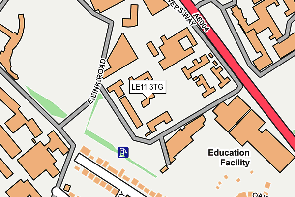
LE11 3TG is located in the Loughborough Ashby electoral ward, within the local authority district of Charnwood and the English Parliamentary constituency of Loughborough. The Sub Integrated Care Board (ICB) Location is NHS Leicester, Leicestershire and Rutland ICB - 04V and the police force is Leicestershire. This postcode has been in use since June 1981.


GetTheData
Source: OS OpenMap – Local (Ordnance Survey)
Source: OS VectorMap District (Ordnance Survey)
Licence: Open Government Licence (requires attribution)
| Easting | 452465 |
| Northing | 319007 |
| Latitude | 52.766122 |
| Longitude | -1.223880 |
GetTheData
Source: Open Postcode Geo
Licence: Open Government Licence
| Country | England |
| Postcode District | LE11 |
| ➜ LE11 open data dashboard ➜ See where LE11 is on a map ➜ Where is Loughborough? | |
GetTheData
Source: Land Registry Price Paid Data
Licence: Open Government Licence
Elevation or altitude of LE11 3TG as distance above sea level:
| Metres | Feet | |
|---|---|---|
| Elevation | 50m | 164ft |
Elevation is measured from the approximate centre of the postcode, to the nearest point on an OS contour line from OS Terrain 50, which has contour spacing of ten vertical metres.
➜ How high above sea level am I? Find the elevation of your current position using your device's GPS.
GetTheData
Source: Open Postcode Elevation
Licence: Open Government Licence
| Ward | Loughborough Ashby |
| Constituency | Loughborough |
GetTheData
Source: ONS Postcode Database
Licence: Open Government Licence
| June 2022 | Vehicle crime | On or near Mountfields Drive | 218m |
| June 2022 | Violence and sexual offences | On or near Sports/Recreation Area | 256m |
| June 2022 | Shoplifting | On or near Sports/Recreation Area | 256m |
| ➜ Get more crime data in our Crime section | |||
GetTheData
Source: data.police.uk
Licence: Open Government Licence
| East Link Road | Loughborough | 116m |
| Radmoor Centre (Radmoor Road) | Loughborough | 301m |
| Radmoor Centre (Radmoor Road) | Loughborough | 305m |
| Ball Court (Towers Way) | Loughborough | 307m |
| Student's Union (University Road) | Loughborough | 347m |
| Loughborough (Leics) Station | 2.4km |
GetTheData
Source: NaPTAN
Licence: Open Government Licence
| Percentage of properties with Next Generation Access | 100.0% |
| Percentage of properties with Superfast Broadband | 100.0% |
| Percentage of properties with Ultrafast Broadband | 0.0% |
| Percentage of properties with Full Fibre Broadband | 0.0% |
Superfast Broadband is between 30Mbps and 300Mbps
Ultrafast Broadband is > 300Mbps
| Percentage of properties unable to receive 2Mbps | 0.0% |
| Percentage of properties unable to receive 5Mbps | 0.0% |
| Percentage of properties unable to receive 10Mbps | 0.0% |
| Percentage of properties unable to receive 30Mbps | 0.0% |
GetTheData
Source: Ofcom
Licence: Ofcom Terms of Use (requires attribution)
GetTheData
Source: ONS Postcode Database
Licence: Open Government Licence


➜ Get more ratings from the Food Standards Agency
GetTheData
Source: Food Standards Agency
Licence: FSA terms & conditions
| Last Collection | |||
|---|---|---|---|
| Location | Mon-Fri | Sat | Distance |
| New Ashby Road | 17:30 | 12:00 | 413m |
| Outwoods Drive | 17:30 | 11:45 | 484m |
| Ashby Road/The Grove | 17:30 | 12:00 | 549m |
GetTheData
Source: Dracos
Licence: Creative Commons Attribution-ShareAlike
| Facility | Distance |
|---|---|
| Loughborough University (Holywell Fitness Centre) Towers Way, University Campus, Loughborough Health and Fitness Gym, Studio, Sports Hall, Grass Pitches, Artificial Grass Pitch | 227m |
| Loughborough College Radmoor Road, Loughborough Health and Fitness Gym, Grass Pitches, Sports Hall, Artificial Grass Pitch, Studio | 325m |
| Loughborough C Of E Primary School William Street, Loughborough Grass Pitches | 554m |
GetTheData
Source: Active Places
Licence: Open Government Licence
| School | Phase of Education | Distance |
|---|---|---|
| Loughborough College Radmoor Road, Loughborough, LE11 3BT | 16 plus | 275m |
| Loughborough University Ashby Road, Loughborough, LE11 3TU | Not applicable | 402m |
| Mountfields Lodge School Epinal Way, Loughborough, LE11 3GE | Primary | 506m |
GetTheData
Source: Edubase
Licence: Open Government Licence
The below table lists the International Territorial Level (ITL) codes (formerly Nomenclature of Territorial Units for Statistics (NUTS) codes) and Local Administrative Units (LAU) codes for LE11 3TG:
| ITL 1 Code | Name |
|---|---|
| TLF | East Midlands (England) |
| ITL 2 Code | Name |
| TLF2 | Leicestershire, Rutland and Northamptonshire |
| ITL 3 Code | Name |
| TLF22 | Leicestershire CC and Rutland |
| LAU 1 Code | Name |
| E07000130 | Charnwood |
GetTheData
Source: ONS Postcode Directory
Licence: Open Government Licence
The below table lists the Census Output Area (OA), Lower Layer Super Output Area (LSOA), and Middle Layer Super Output Area (MSOA) for LE11 3TG:
| Code | Name | |
|---|---|---|
| OA | E00173320 | |
| LSOA | E01025709 | Charnwood 007D |
| MSOA | E02005351 | Charnwood 007 |
GetTheData
Source: ONS Postcode Directory
Licence: Open Government Licence
| LE11 3JD | Mountfields Drive | 179m |
| LE11 3JE | Mountfields Drive | 212m |
| LE11 3HR | Charley Drive | 253m |
| LE11 3HN | Ashleigh Drive | 275m |
| LE11 3HW | Ashleigh Drive | 304m |
| LE11 3JF | Oaklands Avenue | 304m |
| LE11 3HS | Forest Road | 346m |
| LE11 3HU | Forest Road | 400m |
| LE11 3HG | Goldfinch Close | 424m |
| LE11 3NF | Kingfisher Way | 435m |
GetTheData
Source: Open Postcode Geo; Land Registry Price Paid Data
Licence: Open Government Licence