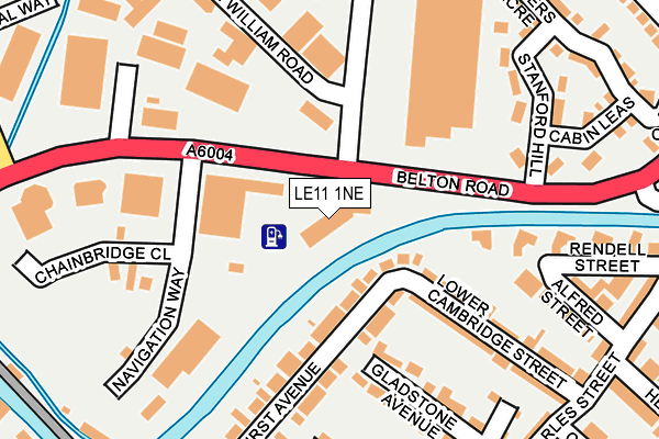
LE11 1NE is located in the Loughborough East electoral ward, within the local authority district of Charnwood and the English Parliamentary constituency of Loughborough. The Sub Integrated Care Board (ICB) Location is NHS Leicester, Leicestershire and Rutland ICB - 04V and the police force is Leicestershire. This postcode has been in use since August 1992.


GetTheData
Source: OS OpenMap – Local (Ordnance Survey)
Source: OS VectorMap District (Ordnance Survey)
Licence: Open Government Licence (requires attribution)
| Easting | 453414 |
| Northing | 320411 |
| Latitude | 52.778649 |
| Longitude | -1.209588 |
GetTheData
Source: Open Postcode Geo
Licence: Open Government Licence
| Country | England |
| Postcode District | LE11 |
➜ See where LE11 is on a map ➜ Where is Loughborough? | |
GetTheData
Source: Land Registry Price Paid Data
Licence: Open Government Licence
Elevation or altitude of LE11 1NE as distance above sea level:
| Metres | Feet | |
|---|---|---|
| Elevation | 40m | 131ft |
Elevation is measured from the approximate centre of the postcode, to the nearest point on an OS contour line from OS Terrain 50, which has contour spacing of ten vertical metres.
➜ How high above sea level am I? Find the elevation of your current position using your device's GPS.
GetTheData
Source: Open Postcode Elevation
Licence: Open Government Licence
| Ward | Loughborough East |
| Constituency | Loughborough |
GetTheData
Source: ONS Postcode Database
Licence: Open Government Licence
| Leopold Street (Derby Road) | Loughborough | 433m |
| Leopold Street (Derby Road) | Loughborough | 435m |
| Derby Road | Loughborough | 465m |
| Fennel Street | Loughborough | 475m |
| Derby Road | Loughborough | 476m |
| Loughborough Central (Great Central Railway) | Loughborough | 1,456m |
| Loughborough (Leics) Station | 0.9km |
| Barrow upon Soar Station | 5.5km |
GetTheData
Source: NaPTAN
Licence: Open Government Licence
GetTheData
Source: ONS Postcode Database
Licence: Open Government Licence


➜ Get more ratings from the Food Standards Agency
GetTheData
Source: Food Standards Agency
Licence: FSA terms & conditions
| Last Collection | |||
|---|---|---|---|
| Location | Mon-Fri | Sat | Distance |
| Toothill Road | 17:30 | 11:30 | 466m |
| Ratcliffe Road Post Office | 17:15 | 11:30 | 546m |
| Nottingham Road | 19:00 | 12:45 | 696m |
GetTheData
Source: Dracos
Licence: Creative Commons Attribution-ShareAlike
| Risk of LE11 1NE flooding from rivers and sea | Low |
| ➜ LE11 1NE flood map | |
GetTheData
Source: Open Flood Risk by Postcode
Licence: Open Government Licence
The below table lists the International Territorial Level (ITL) codes (formerly Nomenclature of Territorial Units for Statistics (NUTS) codes) and Local Administrative Units (LAU) codes for LE11 1NE:
| ITL 1 Code | Name |
|---|---|
| TLF | East Midlands (England) |
| ITL 2 Code | Name |
| TLF2 | Leicestershire, Rutland and Northamptonshire |
| ITL 3 Code | Name |
| TLF22 | Leicestershire CC and Rutland |
| LAU 1 Code | Name |
| E07000130 | Charnwood |
GetTheData
Source: ONS Postcode Directory
Licence: Open Government Licence
The below table lists the Census Output Area (OA), Lower Layer Super Output Area (LSOA), and Middle Layer Super Output Area (MSOA) for LE11 1NE:
| Code | Name | |
|---|---|---|
| OA | E00130429 | |
| LSOA | E01025704 | Charnwood 002E |
| MSOA | E02005346 | Charnwood 002 |
GetTheData
Source: ONS Postcode Directory
Licence: Open Government Licence
| LE11 1PH | Lower Cambridge Street | 189m |
| LE11 1PQ | Lower Cambridge Street | 194m |
| LE11 1NP | Gladstone Avenue | 195m |
| LE11 1LX | Stanford Hill | 206m |
| LE11 1PF | Limehurst Avenue | 211m |
| LE11 1PE | Limehurst Avenue | 219m |
| LE11 1NG | Alfred Street | 233m |
| LE11 1LN | Rendell Street | 242m |
| LE11 1LY | Cabin Leas | 247m |
| LE11 1PG | Linden Road | 248m |
GetTheData
Source: Open Postcode Geo; Land Registry Price Paid Data
Licence: Open Government Licence