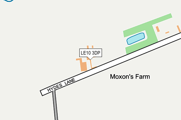
LE10 3DP lies on Hydes Lane in Hinckley. LE10 3DP is located in the Wolvey and Shilton electoral ward, within the local authority district of Rugby and the English Parliamentary constituency of Rugby. The Sub Integrated Care Board (ICB) Location is NHS Coventry and Warwickshire ICB - B2M3M and the police force is Warwickshire. This postcode has been in use since January 1980.


GetTheData
Source: OS OpenMap – Local (Ordnance Survey)
Source: OS VectorMap District (Ordnance Survey)
Licence: Open Government Licence (requires attribution)
| Easting | 440432 |
| Northing | 292037 |
| Latitude | 52.524715 |
| Longitude | -1.405498 |
GetTheData
Source: Open Postcode Geo
Licence: Open Government Licence
| Street | Hydes Lane |
| Town/City | Hinckley |
| Country | England |
| Postcode District | LE10 |
| ➜ LE10 open data dashboard ➜ See where LE10 is on a map | |
GetTheData
Source: Land Registry Price Paid Data
Licence: Open Government Licence
Elevation or altitude of LE10 3DP as distance above sea level:
| Metres | Feet | |
|---|---|---|
| Elevation | 90m | 295ft |
Elevation is measured from the approximate centre of the postcode, to the nearest point on an OS contour line from OS Terrain 50, which has contour spacing of ten vertical metres.
➜ How high above sea level am I? Find the elevation of your current position using your device's GPS.
GetTheData
Source: Open Postcode Elevation
Licence: Open Government Licence
| Ward | Wolvey And Shilton |
| Constituency | Rugby |
GetTheData
Source: ONS Postcode Database
Licence: Open Government Licence
| Paddock Way Cycleway (Paddock Way) | Hinckley | 960m |
| Harrowbrook Road (Coventry Road) | Hinckley | 1,098m |
| Harrowbrook Road (Coventry Road) | Hinckley | 1,114m |
| Logix Park (Logix Road) | Hinckley | 1,152m |
| Maple Drive (Coventry Road) | Hinckley | 1,158m |
| Hinckley Station | 2.5km |
| Nuneaton Station | 4km |
| Bermuda Park Station | 5.2km |
GetTheData
Source: NaPTAN
Licence: Open Government Licence
| Percentage of properties with Next Generation Access | 33.3% |
| Percentage of properties with Superfast Broadband | 0.0% |
| Percentage of properties with Ultrafast Broadband | 0.0% |
| Percentage of properties with Full Fibre Broadband | 0.0% |
Superfast Broadband is between 30Mbps and 300Mbps
Ultrafast Broadband is > 300Mbps
| Percentage of properties unable to receive 2Mbps | 0.0% |
| Percentage of properties unable to receive 5Mbps | 66.7% |
| Percentage of properties unable to receive 10Mbps | 100.0% |
| Percentage of properties unable to receive 30Mbps | 100.0% |
GetTheData
Source: Ofcom
Licence: Ofcom Terms of Use (requires attribution)
GetTheData
Source: ONS Postcode Database
Licence: Open Government Licence

➜ Get more ratings from the Food Standards Agency
GetTheData
Source: Food Standards Agency
Licence: FSA terms & conditions
| Last Collection | |||
|---|---|---|---|
| Location | Mon-Fri | Sat | Distance |
| Coventry Road Post Office | 17:30 | 12:00 | 1,439m |
| Langdale Road | 17:30 | 11:30 | 1,639m |
| Sketchley Meadows | 1,666m | ||
GetTheData
Source: Dracos
Licence: Creative Commons Attribution-ShareAlike
| Facility | Distance |
|---|---|
| Hammond Park Nutts Lane, Hinckley Grass Pitches | 887m |
| Hinckley Squash And Racketball Club Maple Drive, Hinckley Squash Courts, Health and Fitness Gym | 1.3km |
| Langdale Park Brodick Road, Hinckley Grass Pitches | 1.7km |
GetTheData
Source: Active Places
Licence: Open Government Licence
| School | Phase of Education | Distance |
|---|---|---|
| Westfield Infant School Ashford Road, Hinckley, LE10 0JL | Primary | 1.8km |
| Westfield Junior School Westfield Road, Hinckley, LE10 0LT | Primary | 2km |
| Sketchley School Manor Way, Sketchley, Burbage, LE10 3HT | Not applicable | 2.1km |
GetTheData
Source: Edubase
Licence: Open Government Licence
The below table lists the International Territorial Level (ITL) codes (formerly Nomenclature of Territorial Units for Statistics (NUTS) codes) and Local Administrative Units (LAU) codes for LE10 3DP:
| ITL 1 Code | Name |
|---|---|
| TLG | West Midlands (England) |
| ITL 2 Code | Name |
| TLG1 | Herefordshire, Worcestershire and Warwickshire |
| ITL 3 Code | Name |
| TLG13 | Warwickshire CC |
| LAU 1 Code | Name |
| E07000220 | Rugby |
GetTheData
Source: ONS Postcode Directory
Licence: Open Government Licence
The below table lists the Census Output Area (OA), Lower Layer Super Output Area (LSOA), and Middle Layer Super Output Area (MSOA) for LE10 3DP:
| Code | Name | |
|---|---|---|
| OA | E00158943 | |
| LSOA | E01031182 | Rugby 001E |
| MSOA | E02006492 | Rugby 001 |
GetTheData
Source: ONS Postcode Directory
Licence: Open Government Licence
| LE10 3EG | Nutts Lane | 812m |
| LE10 0FY | Beams Meadow | 830m |
| LE10 0FL | Applebees Meadow | 832m |
| LE10 0QS | Greyhound Croft | 855m |
| LE10 0RP | Stadium Lane | 883m |
| LE10 0FW | Applebees Walk | 889m |
| LE10 0FX | Greyhound Croft | 891m |
| LE10 0FQ | Bunneys Meadow | 899m |
| LE10 0BZ | Paddock Way | 950m |
| LE10 0FJ | Paddock Way | 961m |
GetTheData
Source: Open Postcode Geo; Land Registry Price Paid Data
Licence: Open Government Licence