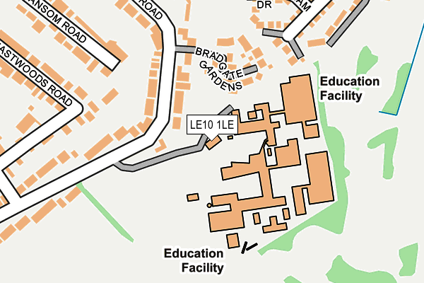
LE10 1LE is located in the Hinckley De Montfort electoral ward, within the local authority district of Hinckley and Bosworth and the English Parliamentary constituency of Bosworth. The Sub Integrated Care Board (ICB) Location is NHS Leicester, Leicestershire and Rutland ICB - 04V and the police force is Leicestershire. This postcode has been in use since January 1980.


GetTheData
Source: OS OpenMap – Local (Ordnance Survey)
Source: OS VectorMap District (Ordnance Survey)
Licence: Open Government Licence (requires attribution)
| Easting | 443956 |
| Northing | 294567 |
| Latitude | 52.547186 |
| Longitude | -1.353227 |
GetTheData
Source: Open Postcode Geo
Licence: Open Government Licence
| Country | England |
| Postcode District | LE10 |
| ➜ LE10 open data dashboard ➜ See where LE10 is on a map ➜ Where is Hinckley? | |
GetTheData
Source: Land Registry Price Paid Data
Licence: Open Government Licence
Elevation or altitude of LE10 1LE as distance above sea level:
| Metres | Feet | |
|---|---|---|
| Elevation | 130m | 427ft |
Elevation is measured from the approximate centre of the postcode, to the nearest point on an OS contour line from OS Terrain 50, which has contour spacing of ten vertical metres.
➜ How high above sea level am I? Find the elevation of your current position using your device's GPS.
GetTheData
Source: Open Postcode Elevation
Licence: Open Government Licence
| Ward | Hinckley De Montfort |
| Constituency | Bosworth |
GetTheData
Source: ONS Postcode Database
Licence: Open Government Licence
| June 2022 | Public order | On or near Bradgate Gardens | 120m |
| June 2022 | Violence and sexual offences | On or near Bradgate Gardens | 120m |
| June 2022 | Vehicle crime | On or near Sandford Close | 472m |
| ➜ Get more crime data in our Crime section | |||
GetTheData
Source: data.police.uk
Licence: Open Government Licence
| John Cleveland College (Butts Lane) | Hinckley | 46m |
| Hansom Road (Leicester Road) | Hinckley | 396m |
| Hansom Road (Leicester Road) | Hinckley | 408m |
| Laneside Drive (Stoneygate Drive) | Hinckley | 471m |
| Island Close (Leicester Road) | Hinckley | 475m |
| Hinckley Station | 1.9km |
GetTheData
Source: NaPTAN
Licence: Open Government Licence
GetTheData
Source: ONS Postcode Database
Licence: Open Government Licence


➜ Get more ratings from the Food Standards Agency
GetTheData
Source: Food Standards Agency
Licence: FSA terms & conditions
| Last Collection | |||
|---|---|---|---|
| Location | Mon-Fri | Sat | Distance |
| Hansom Road | 17:45 | 11:00 | 435m |
| Woodland Road | 17:45 | 11:30 | 472m |
| Leicester Road | 17:45 | 11:00 | 716m |
GetTheData
Source: Dracos
Licence: Creative Commons Attribution-ShareAlike
| Facility | Distance |
|---|---|
| Hinckley Academy And John Cleveland Sixth Form Centre Butt Lane, Hinckley Sports Hall, Swimming Pool, Grass Pitches, Artificial Grass Pitch, Outdoor Tennis Courts | 0m |
| Hinckley Golf Club Ltd Leicester Road, Hinckley Golf | 551m |
| Hinckley Parks Primary School Leicester Road, Hinckley Grass Pitches, Sports Hall | 633m |
GetTheData
Source: Active Places
Licence: Open Government Licence
| School | Phase of Education | Distance |
|---|---|---|
| The Hinckley School Butt Lane, Hinckley, LE10 1LE | Secondary | 72m |
| Hinckley Parks Primary School Leicester Road, Hinckley, LE10 1LP | Primary | 632m |
| Saint Peter's Catholic Primary School, A Voluntary Academy London Road, Hinckley, LE10 1HJ | Primary | 1km |
GetTheData
Source: Edubase
Licence: Open Government Licence
The below table lists the International Territorial Level (ITL) codes (formerly Nomenclature of Territorial Units for Statistics (NUTS) codes) and Local Administrative Units (LAU) codes for LE10 1LE:
| ITL 1 Code | Name |
|---|---|
| TLF | East Midlands (England) |
| ITL 2 Code | Name |
| TLF2 | Leicestershire, Rutland and Northamptonshire |
| ITL 3 Code | Name |
| TLF22 | Leicestershire CC and Rutland |
| LAU 1 Code | Name |
| E07000132 | Hinckley and Bosworth |
GetTheData
Source: ONS Postcode Directory
Licence: Open Government Licence
The below table lists the Census Output Area (OA), Lower Layer Super Output Area (LSOA), and Middle Layer Super Output Area (MSOA) for LE10 1LE:
| Code | Name | |
|---|---|---|
| OA | E00131219 | |
| LSOA | E01025862 | Hinckley and Bosworth 009D |
| MSOA | E02005385 | Hinckley and Bosworth 009 |
GetTheData
Source: ONS Postcode Directory
Licence: Open Government Licence
| LE10 1ND | Bradgate Gardens | 118m |
| LE10 1LA | Bradgate Road | 192m |
| LE10 1LB | Butt Lane | 238m |
| LE10 1FG | Amsterdam Drive | 239m |
| LE10 1LL | Hansom Road | 257m |
| LE10 1LH | Eastwoods Road | 273m |
| LE10 1FN | Helsinki Drive | 288m |
| LE10 1FZ | Stockholm Close | 308m |
| LE10 1ET | Olympic Way | 317m |
| LE10 1ES | Olympic Way | 341m |
GetTheData
Source: Open Postcode Geo; Land Registry Price Paid Data
Licence: Open Government Licence