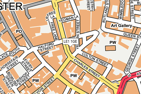
LE1 1GE is located in the Castle electoral ward, within the unitary authority of Leicester and the English Parliamentary constituency of Leicester South. The Sub Integrated Care Board (ICB) Location is NHS Leicester, Leicestershire and Rutland ICB - 04C and the police force is Leicestershire. This postcode has been in use since January 1980.


GetTheData
Source: OS OpenMap – Local (Ordnance Survey)
Source: OS VectorMap District (Ordnance Survey)
Licence: Open Government Licence (requires attribution)
| Easting | 459030 |
| Northing | 304440 |
| Latitude | 52.634509 |
| Longitude | -1.129204 |
GetTheData
Source: Open Postcode Geo
Licence: Open Government Licence
| Country | England |
| Postcode District | LE1 |
| ➜ LE1 open data dashboard ➜ See where LE1 is on a map ➜ Where is Leicester? | |
GetTheData
Source: Land Registry Price Paid Data
Licence: Open Government Licence
Elevation or altitude of LE1 1GE as distance above sea level:
| Metres | Feet | |
|---|---|---|
| Elevation | 60m | 197ft |
Elevation is measured from the approximate centre of the postcode, to the nearest point on an OS contour line from OS Terrain 50, which has contour spacing of ten vertical metres.
➜ How high above sea level am I? Find the elevation of your current position using your device's GPS.
GetTheData
Source: Open Postcode Elevation
Licence: Open Government Licence
| Ward | Castle |
| Constituency | Leicester South |
GetTheData
Source: ONS Postcode Database
Licence: Open Government Licence
| January 2024 | Drugs | On or near Horsefair Street | 254m |
| January 2024 | Possession of weapons | On or near Horsefair Street | 254m |
| January 2024 | Public order | On or near Horsefair Street | 254m |
| ➜ Get more crime data in our Crime section | |||
GetTheData
Source: data.police.uk
Licence: Open Government Licence
| Charles Street | Leicester | 60m |
| Charles Street | Leicester | 64m |
| Charles Street | Leicester | 76m |
| Charles Street | Leicester | 81m |
| Charles Street | Leicester | 81m |
| Leicester Station | 0.4km |
GetTheData
Source: NaPTAN
Licence: Open Government Licence
GetTheData
Source: ONS Postcode Database
Licence: Open Government Licence


➜ Get more ratings from the Food Standards Agency
GetTheData
Source: Food Standards Agency
Licence: FSA terms & conditions
| Last Collection | |||
|---|---|---|---|
| Location | Mon-Fri | Sat | Distance |
| Halford Street | 18:30 | 12:00 | 31m |
| Vestry Street | 18:30 | 12:00 | 250m |
| Sainsbury | 18:00 | 12:00 | 296m |
GetTheData
Source: Dracos
Licence: Creative Commons Attribution-ShareAlike
| Facility | Distance |
|---|---|
| Everlast Gyms (Leicester) Halford Street, Leicester Health and Fitness Gym, Studio | 132m |
| Dw Fitness First (Leicester) (Closed) Humberstone Gate, Leicester Health and Fitness Gym, Studio | 219m |
| Fitness First For Women (Leicester) (Closed) Humberstone Gate, Leicester Health and Fitness Gym, Studio | 279m |
GetTheData
Source: Active Places
Licence: Open Government Licence
| School | Phase of Education | Distance |
|---|---|---|
| Beauchamp City Sixth Form 1 South Albion Street, Leicester, LE1 6JL | 16 plus | 432m |
| Moat Community College Maidstone Road, Leicester, LE2 0TU | Secondary | 650m |
| De Montfort University The Gateway, Leicester, LE1 9BH | Not applicable | 750m |
GetTheData
Source: Edubase
Licence: Open Government Licence
The below table lists the International Territorial Level (ITL) codes (formerly Nomenclature of Territorial Units for Statistics (NUTS) codes) and Local Administrative Units (LAU) codes for LE1 1GE:
| ITL 1 Code | Name |
|---|---|
| TLF | East Midlands (England) |
| ITL 2 Code | Name |
| TLF2 | Leicestershire, Rutland and Northamptonshire |
| ITL 3 Code | Name |
| TLF21 | Leicester |
| LAU 1 Code | Name |
| E06000016 | Leicester |
GetTheData
Source: ONS Postcode Directory
Licence: Open Government Licence
The below table lists the Census Output Area (OA), Lower Layer Super Output Area (LSOA), and Middle Layer Super Output Area (MSOA) for LE1 1GE:
| Code | Name | |
|---|---|---|
| OA | E00169530 | |
| LSOA | E01032867 | Leicester 041A |
| MSOA | E02006851 | Leicester 041 |
GetTheData
Source: ONS Postcode Directory
Licence: Open Government Licence
| LE1 1RD | Rutland Street | 40m |
| LE1 1TR | Halford Street | 53m |
| LE1 1FB | Charles Street | 77m |
| LE1 1RF | Rutland Street | 79m |
| LE1 1JX | Free Lane | 83m |
| LE1 1RE | Rutland Street | 83m |
| LE1 1LB | Charles Street | 92m |
| LE1 1JA | Halford Street | 93m |
| LE1 1RB | Rutland Street | 97m |
| LE1 1UT | Yeoman Street | 97m |
GetTheData
Source: Open Postcode Geo; Land Registry Price Paid Data
Licence: Open Government Licence