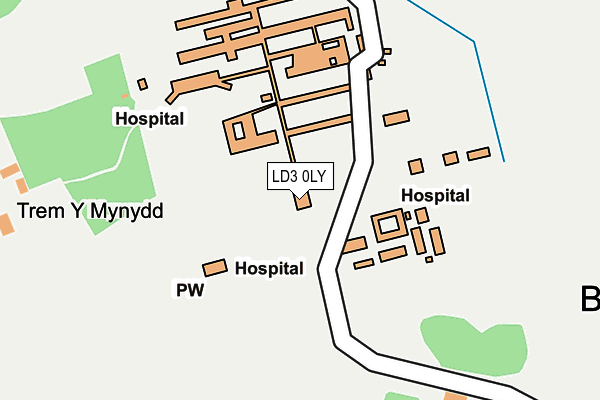
LD3 0LY is located in the Bronllys and Felin-fach electoral ward, within the unitary authority of Powys and the Welsh Parliamentary constituency of Brecon and Radnorshire. The Local Health Board is Powys Teaching and the police force is Dyfed-Powys. This postcode has been in use since January 1980.


GetTheData
Source: OS OpenMap – Local (Ordnance Survey)
Source: OS VectorMap District (Ordnance Survey)
Licence: Open Government Licence (requires attribution)
| Easting | 313674 |
| Northing | 235054 |
| Latitude | 52.007182 |
| Longitude | -3.259069 |
GetTheData
Source: Open Postcode Geo
Licence: Open Government Licence
| Country | Wales |
| Postcode District | LD3 |
| ➜ LD3 open data dashboard ➜ See where LD3 is on a map ➜ Where is Bronllys? | |
GetTheData
Source: Land Registry Price Paid Data
Licence: Open Government Licence
Elevation or altitude of LD3 0LY as distance above sea level:
| Metres | Feet | |
|---|---|---|
| Elevation | 160m | 525ft |
Elevation is measured from the approximate centre of the postcode, to the nearest point on an OS contour line from OS Terrain 50, which has contour spacing of ten vertical metres.
➜ How high above sea level am I? Find the elevation of your current position using your device's GPS.
GetTheData
Source: Open Postcode Elevation
Licence: Open Government Licence
| Ward | Bronllys And Felin-fach |
| Constituency | Brecon And Radnorshire |
GetTheData
Source: ONS Postcode Database
Licence: Open Government Licence
| June 2022 | Anti-social behaviour | On or near Hospital | 141m |
| May 2022 | Criminal damage and arson | On or near Hospital | 141m |
| May 2022 | Violence and sexual offences | On or near Hospital | 141m |
| ➜ Get more crime data in our Crime section | |||
GetTheData
Source: data.police.uk
Licence: Open Government Licence
| Hospital (A438) | Bronllys | 375m |
| Hospital (A438) | Bronllys | 388m |
| St Mary`s Church (A438) | Bronllys | 660m |
| St Mary`s Church (A438) | Bronllys | 664m |
| Cock Inn (A479) | Bronllys | 724m |
GetTheData
Source: NaPTAN
Licence: Open Government Licence
GetTheData
Source: ONS Postcode Database
Licence: Open Government Licence


➜ Get more ratings from the Food Standards Agency
GetTheData
Source: Food Standards Agency
Licence: FSA terms & conditions
| Last Collection | |||
|---|---|---|---|
| Location | Mon-Fri | Sat | Distance |
| Bronllys | 16:30 | 11:30 | 788m |
| Talgarth Post Office | 16:30 | 11:30 | 2,243m |
| Llanfillo | 16:00 | 07:30 | 2,446m |
GetTheData
Source: Dracos
Licence: Creative Commons Attribution-ShareAlike
| School | Phase of Education | Distance |
|---|---|---|
| Ty Bronllys Trem-Y-Mynydd, Bronllys, Brecon, LD3 0LU | Not applicable | 255m |
| Ysgol y Mynydd Du School Road, Talgarth, LD3 0DQ | Not applicable | 2.3km |
| Archdeacon Griffiths C.I.W. Primary School Llyswen, Brecon, Powys, LD3 0YB | Not applicable | 3.5km |
GetTheData
Source: Edubase
Licence: Open Government Licence
The below table lists the International Territorial Level (ITL) codes (formerly Nomenclature of Territorial Units for Statistics (NUTS) codes) and Local Administrative Units (LAU) codes for LD3 0LY:
| ITL 1 Code | Name |
|---|---|
| TLL | Wales |
| ITL 2 Code | Name |
| TLL2 | East Wales |
| ITL 3 Code | Name |
| TLL24 | Powys |
| LAU 1 Code | Name |
| W06000023 | Powys |
GetTheData
Source: ONS Postcode Directory
Licence: Open Government Licence
The below table lists the Census Output Area (OA), Lower Layer Super Output Area (LSOA), and Middle Layer Super Output Area (MSOA) for LD3 0LY:
| Code | Name | |
|---|---|---|
| OA | W00002291 | |
| LSOA | W01000430 | Powys 015A |
| MSOA | W02000111 | Powys 015 |
GetTheData
Source: ONS Postcode Directory
Licence: Open Government Licence
| LD3 0LU | 254m | |
| LD3 0LT | Watson Cottage | 420m |
| LD3 0HY | Esgair Y Gog | 458m |
| LD3 0LB | Beacon View | 535m |
| LD3 0LA | Neuadd Terrace | 543m |
| LD3 0HU | Pontywal Lane | 560m |
| LD3 0LP | Parc Y Berllan | 562m |
| LD3 0HT | 625m | |
| LD3 0HX | Fosse Way | 631m |
| LD3 0HS | 681m |
GetTheData
Source: Open Postcode Geo; Land Registry Price Paid Data
Licence: Open Government Licence