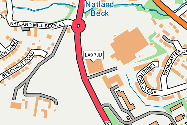
LA9 7JU is located in the Kendal South electoral ward, within the unitary authority of Westmorland and Furness and the English Parliamentary constituency of Westmorland and Lonsdale. The Sub Integrated Care Board (ICB) Location is NHS Lancashire and South Cumbria ICB - 01K and the police force is Cumbria. This postcode has been in use since January 1991.


GetTheData
Source: OS OpenMap – Local (Ordnance Survey)
Source: OS VectorMap District (Ordnance Survey)
Licence: Open Government Licence (requires attribution)
| Easting | 352222 |
| Northing | 490639 |
| Latitude | 54.309101 |
| Longitude | -2.735822 |
GetTheData
Source: Open Postcode Geo
Licence: Open Government Licence
| Country | England |
| Postcode District | LA9 |
| ➜ LA9 open data dashboard ➜ See where LA9 is on a map ➜ Where is Kendal? | |
GetTheData
Source: Land Registry Price Paid Data
Licence: Open Government Licence
Elevation or altitude of LA9 7JU as distance above sea level:
| Metres | Feet | |
|---|---|---|
| Elevation | 50m | 164ft |
Elevation is measured from the approximate centre of the postcode, to the nearest point on an OS contour line from OS Terrain 50, which has contour spacing of ten vertical metres.
➜ How high above sea level am I? Find the elevation of your current position using your device's GPS.
GetTheData
Source: Open Postcode Elevation
Licence: Open Government Licence
| Ward | Kendal South |
| Constituency | Westmorland And Lonsdale |
GetTheData
Source: ONS Postcode Database
Licence: Open Government Licence
| April 2023 | Criminal damage and arson | On or near Ruskin Close | 440m |
| June 2022 | Violence and sexual offences | On or near Kirkstone Close | 173m |
| June 2022 | Burglary | On or near Natland Mill Beck Lane | 209m |
| ➜ Get more crime data in our Crime section | |||
GetTheData
Source: data.police.uk
Licence: Open Government Licence
| Asda (Burton Road) | Kendal | 163m |
| Asda (Burton Road) | Kendal | 173m |
| Oxenholme Road (Kendal Parks Road) | Kendal Parks | 327m |
| Helme Chase (Burton Road) | Kendal | 436m |
| Westmorland General Hospital (Burton Road) | Kendal | 436m |
| Oxenholme Lake District Station | 1km |
| Kendal Station | 2.6km |
GetTheData
Source: NaPTAN
Licence: Open Government Licence
GetTheData
Source: ONS Postcode Database
Licence: Open Government Licence


➜ Get more ratings from the Food Standards Agency
GetTheData
Source: Food Standards Agency
Licence: FSA terms & conditions
| Last Collection | |||
|---|---|---|---|
| Location | Mon-Fri | Sat | Distance |
| Oxenholme Road | 17:00 | 12:15 | 345m |
| Gallowbarrow | 17:00 | 11:45 | 466m |
| Kendal Parks | 16:45 | 12:15 | 517m |
GetTheData
Source: Dracos
Licence: Creative Commons Attribution-ShareAlike
| Facility | Distance |
|---|---|
| Kendal Leisure Centre Burton Road, Kendal Sports Hall, Swimming Pool, Health and Fitness Gym, Studio, Squash Courts | 739m |
| Kendal Golf Driving Range Oxenholme Road, Kendal Golf | 919m |
| Heron Hill School Hayfell Avenue, Kendal Grass Pitches | 944m |
GetTheData
Source: Active Places
Licence: Open Government Licence
| School | Phase of Education | Distance |
|---|---|---|
| Heron Hill Primary School Hayfell Avenue, Kendal, LA9 7JH | Primary | 944m |
| Kirkbie Kendal School Lound Road, Kendal, LA9 7EQ | Secondary | 991m |
| Kendal College Milnthorpe Road, Kendal, LA9 5AY | 16 plus | 1.2km |
GetTheData
Source: Edubase
Licence: Open Government Licence
The below table lists the International Territorial Level (ITL) codes (formerly Nomenclature of Territorial Units for Statistics (NUTS) codes) and Local Administrative Units (LAU) codes for LA9 7JU:
| ITL 1 Code | Name |
|---|---|
| TLD | North West (England) |
| ITL 2 Code | Name |
| TLD1 | Cumbria |
| ITL 3 Code | Name |
| TLD12 | East Cumbria |
| LAU 1 Code | Name |
| E07000031 | South Lakeland |
GetTheData
Source: ONS Postcode Directory
Licence: Open Government Licence
The below table lists the Census Output Area (OA), Lower Layer Super Output Area (LSOA), and Middle Layer Super Output Area (MSOA) for LA9 7JU:
| Code | Name | |
|---|---|---|
| OA | E00168539 | |
| LSOA | E01019367 | South Lakeland 006B |
| MSOA | E02004020 | South Lakeland 006 |
GetTheData
Source: ONS Postcode Directory
Licence: Open Government Licence
| LA9 7JX | Kirkstone Mews | 139m |
| LA9 7HU | Kirkstone Close | 182m |
| LA9 7RL | Murley Moss Business Park | 224m |
| LA9 7QA | 234m | |
| LA9 7FF | Beechnut Road | 254m |
| LA9 7HW | Carrock Close | 266m |
| LA9 7JA | Burton Road | 271m |
| LA9 7FP | Wintergreen Lane | 282m |
| LA9 7JB | Helme Drive | 286m |
| LA9 7HE | Whinlatter Drive | 295m |
GetTheData
Source: Open Postcode Geo; Land Registry Price Paid Data
Licence: Open Government Licence