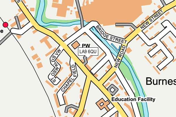
LA9 6QU lies on Ketel Houses in Burneside, Kendal. LA9 6QU is located in the Upper Kent electoral ward, within the unitary authority of Westmorland and Furness and the English Parliamentary constituency of Westmorland and Lonsdale. The Sub Integrated Care Board (ICB) Location is NHS Lancashire and South Cumbria ICB - 01K and the police force is Cumbria. This postcode has been in use since January 1980.


GetTheData
Source: OS OpenMap – Local (Ordnance Survey)
Source: OS VectorMap District (Ordnance Survey)
Licence: Open Government Licence (requires attribution)
| Easting | 350527 |
| Northing | 495694 |
| Latitude | 54.354374 |
| Longitude | -2.762713 |
GetTheData
Source: Open Postcode Geo
Licence: Open Government Licence
| Street | Ketel Houses |
| Locality | Burneside |
| Town/City | Kendal |
| Country | England |
| Postcode District | LA9 |
| ➜ LA9 open data dashboard ➜ See where LA9 is on a map ➜ Where is Burneside? | |
GetTheData
Source: Land Registry Price Paid Data
Licence: Open Government Licence
Elevation or altitude of LA9 6QU as distance above sea level:
| Metres | Feet | |
|---|---|---|
| Elevation | 60m | 197ft |
Elevation is measured from the approximate centre of the postcode, to the nearest point on an OS contour line from OS Terrain 50, which has contour spacing of ten vertical metres.
➜ How high above sea level am I? Find the elevation of your current position using your device's GPS.
GetTheData
Source: Open Postcode Elevation
Licence: Open Government Licence
| Ward | Upper Kent |
| Constituency | Westmorland And Lonsdale |
GetTheData
Source: ONS Postcode Database
Licence: Open Government Licence
| January 2024 | Violence and sexual offences | On or near St Oswald'S View | 117m |
| October 2023 | Violence and sexual offences | On or near St Oswald'S View | 117m |
| February 2023 | Criminal damage and arson | On or near St Oswald'S View | 117m |
| ➜ Get more crime data in our Crime section | |||
GetTheData
Source: data.police.uk
Licence: Open Government Licence
| St Oswald's Church (Unnamed Road) | Burneside | 64m |
| St Oswalds Church (Unnamed Road) | Burneside | 70m |
| Ford Bridge (Unnamed Road) | Burneside | 70m |
| St Oswald's School (Unnamed Road) | Burneside | 85m |
| Vicarage (Bridge Street) | Burneside | 93m |
| Burneside (Cumbria) Station | 0.3km |
| Kendal Station | 2.9km |
| Staveley Station | 4.3km |
GetTheData
Source: NaPTAN
Licence: Open Government Licence
| Percentage of properties with Next Generation Access | 100.0% |
| Percentage of properties with Superfast Broadband | 100.0% |
| Percentage of properties with Ultrafast Broadband | 0.0% |
| Percentage of properties with Full Fibre Broadband | 0.0% |
Superfast Broadband is between 30Mbps and 300Mbps
Ultrafast Broadband is > 300Mbps
| Percentage of properties unable to receive 2Mbps | 0.0% |
| Percentage of properties unable to receive 5Mbps | 0.0% |
| Percentage of properties unable to receive 10Mbps | 0.0% |
| Percentage of properties unable to receive 30Mbps | 0.0% |
GetTheData
Source: Ofcom
Licence: Ofcom Terms of Use (requires attribution)
GetTheData
Source: ONS Postcode Database
Licence: Open Government Licence


➜ Get more ratings from the Food Standards Agency
GetTheData
Source: Food Standards Agency
Licence: FSA terms & conditions
| Last Collection | |||
|---|---|---|---|
| Location | Mon-Fri | Sat | Distance |
| Kentrigg | 17:30 | 12:00 | 1,652m |
| Briarigg | 17:15 | 11:45 | 1,682m |
| Hallgarth Post Office | 16:45 | 12:00 | 1,692m |
GetTheData
Source: Dracos
Licence: Creative Commons Attribution-ShareAlike
| Facility | Distance |
|---|---|
| St Oswalds Ce Primary School Burneside, Kendal Grass Pitches | 153m |
| Hollins Lane Playing Fields Hollins Lane, Burneside, Kendal Grass Pitches | 279m |
| Burneside Cricket Club Hollins Lane, Burneside Grass Pitches | 300m |
GetTheData
Source: Active Places
Licence: Open Government Licence
| School | Phase of Education | Distance |
|---|---|---|
| St Oswald's CofE Primary School Howgill Close, Burneside, Kendal, LA9 6QR | Primary | 153m |
| St Thomas's CofE Primary School Kendal Green, Kendal, LA9 5PP | Primary | 2km |
| Cambian Whinfell School 110 Windermere Road, Kendal, LA9 5EZ | Not applicable | 2.2km |
GetTheData
Source: Edubase
Licence: Open Government Licence
The below table lists the International Territorial Level (ITL) codes (formerly Nomenclature of Territorial Units for Statistics (NUTS) codes) and Local Administrative Units (LAU) codes for LA9 6QU:
| ITL 1 Code | Name |
|---|---|
| TLD | North West (England) |
| ITL 2 Code | Name |
| TLD1 | Cumbria |
| ITL 3 Code | Name |
| TLD12 | East Cumbria |
| LAU 1 Code | Name |
| E07000031 | South Lakeland |
GetTheData
Source: ONS Postcode Directory
Licence: Open Government Licence
The below table lists the Census Output Area (OA), Lower Layer Super Output Area (LSOA), and Middle Layer Super Output Area (MSOA) for LA9 6QU:
| Code | Name | |
|---|---|---|
| OA | E00097771 | |
| LSOA | E01019346 | South Lakeland 003A |
| MSOA | E02004017 | South Lakeland 003 |
GetTheData
Source: ONS Postcode Directory
Licence: Open Government Licence
| LA9 6PY | Steeles Row | 29m |
| LA9 6QT | Church View Cottage | 33m |
| LA9 6RH | St Oswalds View | 127m |
| LA9 6QP | Chapel Field | 140m |
| LA9 6QN | Hollins Row | 200m |
| LA9 6QX | 207m | |
| LA9 6QL | Hollins Lane | 225m |
| LA9 6QQ | Ivy Crescent | 229m |
| LA9 6QF | Hall Park | 241m |
| LA9 6QE | Hall Road | 242m |
GetTheData
Source: Open Postcode Geo; Land Registry Price Paid Data
Licence: Open Government Licence