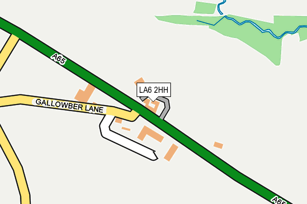
LA6 2HH is located in the Sedbergh and Kirkby Lonsdale electoral ward, within the unitary authority of Westmorland and Furness and the English Parliamentary constituency of Westmorland and Lonsdale. The Sub Integrated Care Board (ICB) Location is NHS Lancashire and South Cumbria ICB - 01K and the police force is Cumbria. This postcode has been in use since January 1980.


GetTheData
Source: OS OpenMap – Local (Ordnance Survey)
Source: OS VectorMap District (Ordnance Survey)
Licence: Open Government Licence (requires attribution)
| Easting | 359910 |
| Northing | 478872 |
| Latitude | 54.204028 |
| Longitude | -2.616092 |
GetTheData
Source: Open Postcode Geo
Licence: Open Government Licence
| Country | England |
| Postcode District | LA6 |
| ➜ LA6 open data dashboard ➜ See where LA6 is on a map | |
GetTheData
Source: Land Registry Price Paid Data
Licence: Open Government Licence
Elevation or altitude of LA6 2HH as distance above sea level:
| Metres | Feet | |
|---|---|---|
| Elevation | 90m | 295ft |
Elevation is measured from the approximate centre of the postcode, to the nearest point on an OS contour line from OS Terrain 50, which has contour spacing of ten vertical metres.
➜ How high above sea level am I? Find the elevation of your current position using your device's GPS.
GetTheData
Source: Open Postcode Elevation
Licence: Open Government Licence
| Ward | Sedbergh And Kirkby Lonsdale |
| Constituency | Westmorland And Lonsdale |
GetTheData
Source: ONS Postcode Database
Licence: Open Government Licence
| August 2021 | Public order | On or near Petrol Station | 143m |
| August 2021 | Shoplifting | On or near Petrol Station | 143m |
| May 2021 | Other theft | On or near Petrol Station | 143m |
| ➜ Get more crime data in our Crime section | |||
GetTheData
Source: data.police.uk
Licence: Open Government Licence
| Queen Elizabeth School (Kendal Road) | Kirkby Lonsdale | 676m |
| Queen Elizabeth School (Kendal Road) | Kirkby Lonsdale | 710m |
| Abbotsgate (Mitchelgate) | Kirkby Lonsdale | 977m |
| Booth's Supermarket (Dodgson Croft) | Kirkby Lonsdale | 1,087m |
| Booths (Bentinck Drive) | Kirkby Lonsdale | 1,222m |
GetTheData
Source: NaPTAN
Licence: Open Government Licence
GetTheData
Source: ONS Postcode Database
Licence: Open Government Licence


➜ Get more ratings from the Food Standards Agency
GetTheData
Source: Food Standards Agency
Licence: FSA terms & conditions
| Last Collection | |||
|---|---|---|---|
| Location | Mon-Fri | Sat | Distance |
| Low Biggins | 17:00 | 07:30 | 843m |
| Fairbank | 16:00 | 11:30 | 962m |
| Beckhead | 17:00 | 11:15 | 1,172m |
GetTheData
Source: Dracos
Licence: Creative Commons Attribution-ShareAlike
| Facility | Distance |
|---|---|
| St Marys Ce Primary School Kendal Road, Kirkby Lonsdale, Carnforth Grass Pitches | 725m |
| Queen Elizabeth School Kirkby Lonsdale, Carnforth Artificial Grass Pitch, Grass Pitches, Sports Hall | 839m |
| Underley Park Raygarth, Kirkby Lonsdale, Carnforth Health and Fitness Gym, Grass Pitches | 1.2km |
GetTheData
Source: Active Places
Licence: Open Government Licence
| School | Phase of Education | Distance |
|---|---|---|
| St Mary's CofE Primary School Kendal Road, Kirkby Lonsdale, Carnforth, LA6 2DN | Primary | 725m |
| Queen Elizabeth Studio School Kirkby Lonsdale, LA6 2HJ | Secondary | 839m |
| Queen Elizabeth School Kirkby Lonsdale, LA6 2HJ | Secondary | 839m |
GetTheData
Source: Edubase
Licence: Open Government Licence
The below table lists the International Territorial Level (ITL) codes (formerly Nomenclature of Territorial Units for Statistics (NUTS) codes) and Local Administrative Units (LAU) codes for LA6 2HH:
| ITL 1 Code | Name |
|---|---|
| TLD | North West (England) |
| ITL 2 Code | Name |
| TLD1 | Cumbria |
| ITL 3 Code | Name |
| TLD12 | East Cumbria |
| LAU 1 Code | Name |
| E07000031 | South Lakeland |
GetTheData
Source: ONS Postcode Directory
Licence: Open Government Licence
The below table lists the Census Output Area (OA), Lower Layer Super Output Area (LSOA), and Middle Layer Super Output Area (MSOA) for LA6 2HH:
| Code | Name | |
|---|---|---|
| OA | E00097944 | |
| LSOA | E01019373 | South Lakeland 009B |
| MSOA | E02004023 | South Lakeland 009 |
GetTheData
Source: ONS Postcode Directory
Licence: Open Government Licence
| LA6 2NP | 644m | |
| LA6 2DJ | Harling Bank | 787m |
| LA6 2EH | 811m | |
| LA6 2FB | Fairgarth Drive | 840m |
| LA6 2HN | 867m | |
| LA6 2HL | 880m | |
| LA6 2FL | Springfield | 881m |
| LA6 2HF | Fairview | 882m |
| LA6 2DH | 892m | |
| LA6 2DX | 894m |
GetTheData
Source: Open Postcode Geo; Land Registry Price Paid Data
Licence: Open Government Licence