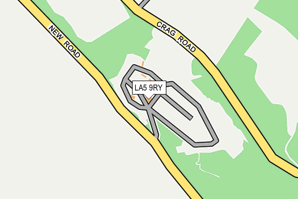
LA5 9RY is located in the Warton electoral ward, within the local authority district of Lancaster and the English Parliamentary constituency of Morecambe and Lunesdale. The Sub Integrated Care Board (ICB) Location is NHS Lancashire and South Cumbria ICB - 01K and the police force is Lancashire. This postcode has been in use since January 1980.


GetTheData
Source: OS OpenMap – Local (Ordnance Survey)
Source: OS VectorMap District (Ordnance Survey)
Licence: Open Government Licence (requires attribution)
| Easting | 348479 |
| Northing | 472517 |
| Latitude | 54.145894 |
| Longitude | -2.790225 |
GetTheData
Source: Open Postcode Geo
Licence: Open Government Licence
| Country | England |
| Postcode District | LA5 |
| ➜ LA5 open data dashboard ➜ See where LA5 is on a map | |
GetTheData
Source: Land Registry Price Paid Data
Licence: Open Government Licence
Elevation or altitude of LA5 9RY as distance above sea level:
| Metres | Feet | |
|---|---|---|
| Elevation | 20m | 66ft |
Elevation is measured from the approximate centre of the postcode, to the nearest point on an OS contour line from OS Terrain 50, which has contour spacing of ten vertical metres.
➜ How high above sea level am I? Find the elevation of your current position using your device's GPS.
GetTheData
Source: Open Postcode Elevation
Licence: Open Government Licence
| Ward | Warton |
| Constituency | Morecambe And Lunesdale |
GetTheData
Source: ONS Postcode Database
Licence: Open Government Licence
| Town End (Mill Lane) | Warton | 1,041m |
| Town End (Mill Lane) | Warton | 1,055m |
| Mill Lane (Main Street) | Warton | 1,164m |
| Mill Lane (Main Street) | Warton | 1,166m |
| Cottages (New Road) | Crag Foot | 1,247m |
| Carnforth Station | 2.2km |
| Silverdale Station | 2.8km |
GetTheData
Source: NaPTAN
Licence: Open Government Licence
GetTheData
Source: ONS Postcode Database
Licence: Open Government Licence


➜ Get more ratings from the Food Standards Agency
GetTheData
Source: Food Standards Agency
Licence: FSA terms & conditions
| Last Collection | |||
|---|---|---|---|
| Location | Mon-Fri | Sat | Distance |
| Millhead | 17:00 | 11:30 | 1,638m |
| Carnforth Post Office | 17:30 | 12:00 | 2,356m |
| New Street | 17:00 | 11:30 | 2,447m |
GetTheData
Source: Dracos
Licence: Creative Commons Attribution-ShareAlike
| Facility | Distance |
|---|---|
| Archbishop Hutton's Primary School Back Lane, Warton, Carnforth Grass Pitches | 1.5km |
| Iodine Park Carlisle Terrace, Millhead, Carnforth Grass Pitches | 1.7km |
| Christ Church C.e. Primary School North Road, Carnforth Grass Pitches | 2.5km |
GetTheData
Source: Active Places
Licence: Open Government Licence
| School | Phase of Education | Distance |
|---|---|---|
| Warton Archbishop Hutton's VC Primary School Warton, Back Lane, Warton, Back Lane, Nr Carnforth, LA5 9QU | Primary | 1.5km |
| Carnforth Community Primary School North Road, Carnforth, LA5 9LQ | Primary | 2.5km |
| Carnforth Christ Church, Church of England, Voluntary Aided Primary School North Road, Carnforth, LA5 9LJ | Primary | 2.5km |
GetTheData
Source: Edubase
Licence: Open Government Licence
The below table lists the International Territorial Level (ITL) codes (formerly Nomenclature of Territorial Units for Statistics (NUTS) codes) and Local Administrative Units (LAU) codes for LA5 9RY:
| ITL 1 Code | Name |
|---|---|
| TLD | North West (England) |
| ITL 2 Code | Name |
| TLD4 | Lancashire |
| ITL 3 Code | Name |
| TLD44 | Lancaster and Wyre |
| LAU 1 Code | Name |
| E07000121 | Lancaster |
GetTheData
Source: ONS Postcode Directory
Licence: Open Government Licence
The below table lists the Census Output Area (OA), Lower Layer Super Output Area (LSOA), and Middle Layer Super Output Area (MSOA) for LA5 9RY:
| Code | Name | |
|---|---|---|
| OA | E00127739 | |
| LSOA | E01025169 | Lancaster 001G |
| MSOA | E02005221 | Lancaster 001 |
GetTheData
Source: ONS Postcode Directory
Licence: Open Government Licence
| LA5 9SB | Crag Road | 479m |
| LA5 9NE | Townend Fold | 970m |
| LA5 9NJ | Sand Lane | 980m |
| LA5 9NN | Sand Lane | 1004m |
| LA5 9TL | Hutton Gardens | 1024m |
| LA5 9PE | Farleton Close | 1039m |
| LA5 9NW | Mill Lane | 1053m |
| LA5 9NR | Main Street | 1053m |
| LA5 9NP | Westbourne Road | 1068m |
| LA5 9NS | Main Street | 1210m |
GetTheData
Source: Open Postcode Geo; Land Registry Price Paid Data
Licence: Open Government Licence