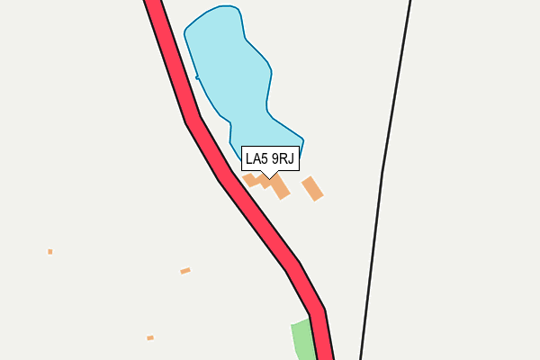
LA5 9RJ is located in the Warton electoral ward, within the local authority district of Lancaster and the English Parliamentary constituency of Morecambe and Lunesdale. The Sub Integrated Care Board (ICB) Location is NHS Lancashire and South Cumbria ICB - 01K and the police force is Lancashire. This postcode has been in use since January 1980.


GetTheData
Source: OS OpenMap – Local (Ordnance Survey)
Source: OS VectorMap District (Ordnance Survey)
Licence: Open Government Licence (requires attribution)
| Easting | 351199 |
| Northing | 474347 |
| Latitude | 54.162606 |
| Longitude | -2.748886 |
GetTheData
Source: Open Postcode Geo
Licence: Open Government Licence
| Country | England |
| Postcode District | LA5 |
| ➜ LA5 open data dashboard ➜ See where LA5 is on a map | |
GetTheData
Source: Land Registry Price Paid Data
Licence: Open Government Licence
Elevation or altitude of LA5 9RJ as distance above sea level:
| Metres | Feet | |
|---|---|---|
| Elevation | 20m | 66ft |
Elevation is measured from the approximate centre of the postcode, to the nearest point on an OS contour line from OS Terrain 50, which has contour spacing of ten vertical metres.
➜ How high above sea level am I? Find the elevation of your current position using your device's GPS.
GetTheData
Source: Open Postcode Elevation
Licence: Open Government Licence
| Ward | Warton |
| Constituency | Morecambe And Lunesdale |
GetTheData
Source: ONS Postcode Database
Licence: Open Government Licence
| Quaker Old Sch (Yealand Road) | Yealand Conyers | 859m |
| Quakers Hall (Yealand Road) | Yealand Conyers | 871m |
| New Inn (Yealnad Road) | Yealand Conyers | 925m |
| New Inn (Yealand Road) | Yealand Conyers | 936m |
| Longlands Hotel (Burton Road) | Tewitfield | 1,026m |
| Silverdale Station | 3.7km |
| Carnforth Station | 3.9km |
GetTheData
Source: NaPTAN
Licence: Open Government Licence
GetTheData
Source: ONS Postcode Database
Licence: Open Government Licence


➜ Get more ratings from the Food Standards Agency
GetTheData
Source: Food Standards Agency
Licence: FSA terms & conditions
| Last Collection | |||
|---|---|---|---|
| Location | Mon-Fri | Sat | Distance |
| Borwick Green | 16:45 | 07:30 | 1,851m |
| Priest Hutton | 16:45 | 09:15 | 1,953m |
| Borwick Station | 16:45 | 07:30 | 2,799m |
GetTheData
Source: Dracos
Licence: Creative Commons Attribution-ShareAlike
| Facility | Distance |
|---|---|
| Yealand Church Of England Primary School Footeran Lane, Yealand Conyers, Carnforth Grass Pitches, Outdoor Tennis Courts | 1.2km |
| Warton Cricket Club Borwick Lane, Warton Grass Pitches | 1.4km |
| South Lakeland Leisure Village Borwick Lane, Dock Acres, Carnforth Health and Fitness Gym, Swimming Pool, Studio | 1.6km |
GetTheData
Source: Active Places
Licence: Open Government Licence
| School | Phase of Education | Distance |
|---|---|---|
| Yealand Church of England Primary School Footeran Lane, Yealand Redmayne, Carnforth, LA5 9SU | Primary | 1.2km |
| Prospect House Birch Cottage, Moss Lane Off Eight Acre Lane, Yealand Redmayne, Carnforth, LA5 9TG | Not applicable | 2.2km |
| Warton Archbishop Hutton's VC Primary School Warton, Back Lane, Warton, Back Lane, Nr Carnforth, LA5 9QU | Primary | 2.3km |
GetTheData
Source: Edubase
Licence: Open Government Licence
The below table lists the International Territorial Level (ITL) codes (formerly Nomenclature of Territorial Units for Statistics (NUTS) codes) and Local Administrative Units (LAU) codes for LA5 9RJ:
| ITL 1 Code | Name |
|---|---|
| TLD | North West (England) |
| ITL 2 Code | Name |
| TLD4 | Lancashire |
| ITL 3 Code | Name |
| TLD44 | Lancaster and Wyre |
| LAU 1 Code | Name |
| E07000121 | Lancaster |
GetTheData
Source: ONS Postcode Directory
Licence: Open Government Licence
The below table lists the Census Output Area (OA), Lower Layer Super Output Area (LSOA), and Middle Layer Super Output Area (MSOA) for LA5 9RJ:
| Code | Name | |
|---|---|---|
| OA | E00127640 | |
| LSOA | E01025148 | Lancaster 001E |
| MSOA | E02005221 | Lancaster 001 |
GetTheData
Source: ONS Postcode Directory
Licence: Open Government Licence
| LA5 9SW | A6 Road | 360m |
| LA5 9SN | Dykes Lane | 518m |
| LA5 9SL | 719m | |
| LA5 9SP | Dykes Lane | 774m |
| LA5 9SH | Yealand Road | 817m |
| LA5 9SG | Yealand Road | 858m |
| LA5 9SF | Yealand Road | 906m |
| LA5 9SJ | Yealand Road | 909m |
| LA5 9TY | Roseacre Lane | 917m |
| LA6 1JH | 1032m |
GetTheData
Source: Open Postcode Geo; Land Registry Price Paid Data
Licence: Open Government Licence