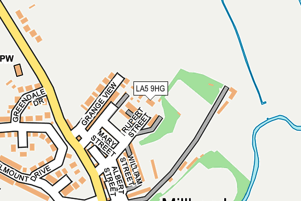
LA5 9HG lies on Archer Hill in Carnforth. LA5 9HG is located in the Carnforth & Millhead electoral ward, within the local authority district of Lancaster and the English Parliamentary constituency of Morecambe and Lunesdale. The Sub Integrated Care Board (ICB) Location is NHS Lancashire and South Cumbria ICB - 01K and the police force is Lancashire. This postcode has been in use since January 1980.


GetTheData
Source: OS OpenMap – Local (Ordnance Survey)
Source: OS VectorMap District (Ordnance Survey)
Licence: Open Government Licence (requires attribution)
| Easting | 349811 |
| Northing | 471492 |
| Latitude | 54.136805 |
| Longitude | -2.769666 |
GetTheData
Source: Open Postcode Geo
Licence: Open Government Licence
| Street | Archer Hill |
| Town/City | Carnforth |
| Country | England |
| Postcode District | LA5 |
| ➜ LA5 open data dashboard ➜ See where LA5 is on a map ➜ Where is Carnforth? | |
GetTheData
Source: Land Registry Price Paid Data
Licence: Open Government Licence
Elevation or altitude of LA5 9HG as distance above sea level:
| Metres | Feet | |
|---|---|---|
| Elevation | 20m | 66ft |
Elevation is measured from the approximate centre of the postcode, to the nearest point on an OS contour line from OS Terrain 50, which has contour spacing of ten vertical metres.
➜ How high above sea level am I? Find the elevation of your current position using your device's GPS.
GetTheData
Source: Open Postcode Elevation
Licence: Open Government Licence
| Ward | Carnforth & Millhead |
| Constituency | Morecambe And Lunesdale |
GetTheData
Source: ONS Postcode Database
Licence: Open Government Licence
| June 2022 | Violence and sexual offences | On or near Hazelmount Avenue | 266m |
| May 2022 | Other theft | On or near Mary Street | 131m |
| May 2022 | Criminal damage and arson | On or near William Street | 133m |
| ➜ Get more crime data in our Crime section | |||
GetTheData
Source: data.police.uk
Licence: Open Government Licence
| The Nib (Mill Lane) | Millhead | 178m |
| The Nib (Mill Lane) | Millhead | 185m |
| Carlisle Terrace (Warton Road) | Millhead | 205m |
| Carlisle Terrace (Warton Road) | Millhead | 209m |
| Midland Terrace (Warton Road) | Millhead | 308m |
| Carnforth Station | 0.8km |
| Silverdale Station | 4.3km |
GetTheData
Source: NaPTAN
Licence: Open Government Licence
| Percentage of properties with Next Generation Access | 100.0% |
| Percentage of properties with Superfast Broadband | 100.0% |
| Percentage of properties with Ultrafast Broadband | 0.0% |
| Percentage of properties with Full Fibre Broadband | 0.0% |
Superfast Broadband is between 30Mbps and 300Mbps
Ultrafast Broadband is > 300Mbps
| Percentage of properties unable to receive 2Mbps | 0.0% |
| Percentage of properties unable to receive 5Mbps | 0.0% |
| Percentage of properties unable to receive 10Mbps | 0.0% |
| Percentage of properties unable to receive 30Mbps | 0.0% |
GetTheData
Source: Ofcom
Licence: Ofcom Terms of Use (requires attribution)
GetTheData
Source: ONS Postcode Database
Licence: Open Government Licence


➜ Get more ratings from the Food Standards Agency
GetTheData
Source: Food Standards Agency
Licence: FSA terms & conditions
| Last Collection | |||
|---|---|---|---|
| Location | Mon-Fri | Sat | Distance |
| Millhead | 17:00 | 11:30 | 169m |
| Carnforth Post Office | 17:30 | 12:00 | 878m |
| North Road | 16:45 | 10:00 | 962m |
GetTheData
Source: Dracos
Licence: Creative Commons Attribution-ShareAlike
| Facility | Distance |
|---|---|
| Iodine Park Carlisle Terrace, Millhead, Carnforth Grass Pitches | 77m |
| Archbishop Hutton's Primary School Back Lane, Warton, Carnforth Grass Pitches | 907m |
| Carnforth Civic Hall North Road, Carnforth Sports Hall | 1km |
GetTheData
Source: Active Places
Licence: Open Government Licence
| School | Phase of Education | Distance |
|---|---|---|
| Warton Archbishop Hutton's VC Primary School Warton, Back Lane, Warton, Back Lane, Nr Carnforth, LA5 9QU | Primary | 899m |
| Carnforth Christ Church, Church of England, Voluntary Aided Primary School North Road, Carnforth, LA5 9LJ | Primary | 1km |
| Carnforth Community Primary School North Road, Carnforth, LA5 9LQ | Primary | 1.1km |
GetTheData
Source: Edubase
Licence: Open Government Licence
The below table lists the International Territorial Level (ITL) codes (formerly Nomenclature of Territorial Units for Statistics (NUTS) codes) and Local Administrative Units (LAU) codes for LA5 9HG:
| ITL 1 Code | Name |
|---|---|
| TLD | North West (England) |
| ITL 2 Code | Name |
| TLD4 | Lancashire |
| ITL 3 Code | Name |
| TLD44 | Lancaster and Wyre |
| LAU 1 Code | Name |
| E07000121 | Lancaster |
GetTheData
Source: ONS Postcode Directory
Licence: Open Government Licence
The below table lists the Census Output Area (OA), Lower Layer Super Output Area (LSOA), and Middle Layer Super Output Area (MSOA) for LA5 9HG:
| Code | Name | |
|---|---|---|
| OA | E00127738 | |
| LSOA | E01025168 | Lancaster 001F |
| MSOA | E02005221 | Lancaster 001 |
GetTheData
Source: ONS Postcode Directory
Licence: Open Government Licence
| LA5 9HF | Jackson Terrace | 40m |
| LA5 9HQ | Park View | 41m |
| LA5 9HL | Grange View | 90m |
| LA5 9HH | Stainton Street | 104m |
| LA5 9HJ | Mary Street | 126m |
| LA5 9HE | William Street | 128m |
| LA5 9UB | Foundry Gardens | 147m |
| LA5 9DR | Albert Street | 158m |
| LA5 9HW | Eldrams Meadow | 164m |
| LA5 9UU | Rupert Street | 164m |
GetTheData
Source: Open Postcode Geo; Land Registry Price Paid Data
Licence: Open Government Licence