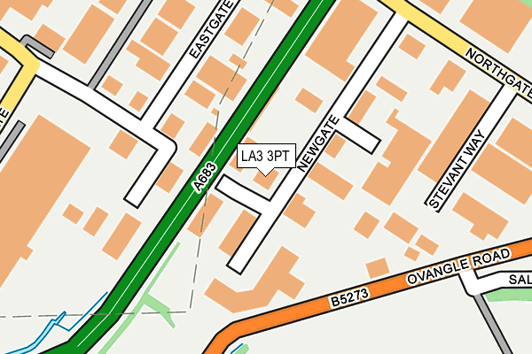
LA3 3PT is located in the Westgate electoral ward, within the local authority district of Lancaster and the English Parliamentary constituency of Morecambe and Lunesdale. The Sub Integrated Care Board (ICB) Location is NHS Lancashire and South Cumbria ICB - 01K and the police force is Lancashire. This postcode has been in use since January 1995.


GetTheData
Source: OS OpenMap – Local (Ordnance Survey)
Source: OS VectorMap District (Ordnance Survey)
Licence: Open Government Licence (requires attribution)
| Easting | 345461 |
| Northing | 462634 |
| Latitude | 54.056768 |
| Longitude | -2.834635 |
GetTheData
Source: Open Postcode Geo
Licence: Open Government Licence
| Country | England |
| Postcode District | LA3 |
| ➜ LA3 open data dashboard ➜ See where LA3 is on a map ➜ Where is Morecambe? | |
GetTheData
Source: Land Registry Price Paid Data
Licence: Open Government Licence
Elevation or altitude of LA3 3PT as distance above sea level:
| Metres | Feet | |
|---|---|---|
| Elevation | 10m | 33ft |
Elevation is measured from the approximate centre of the postcode, to the nearest point on an OS contour line from OS Terrain 50, which has contour spacing of ten vertical metres.
➜ How high above sea level am I? Find the elevation of your current position using your device's GPS.
GetTheData
Source: Open Postcode Elevation
Licence: Open Government Licence
| Ward | Westgate |
| Constituency | Morecambe And Lunesdale |
GetTheData
Source: ONS Postcode Database
Licence: Open Government Licence
| June 2022 | Other theft | On or near Woodgate | 62m |
| June 2022 | Vehicle crime | On or near Eastgate | 207m |
| June 2022 | Public order | On or near Parking Area | 285m |
| ➜ Get more crime data in our Crime section | |||
GetTheData
Source: data.police.uk
Licence: Open Government Licence
| Newgate (Northgate) | White Lund | 203m |
| Newgate (Northgate) | White Lund | 218m |
| Northgate (A683) | White Lund | 286m |
| Northgate (Lancaster Morecambe Bypass) | White Lund | 289m |
| Asda (Northgate) | White Lund | 294m |
| Bare Lane Station | 2km |
| Lancaster Station | 2km |
| Morecambe Station | 2.7km |
GetTheData
Source: NaPTAN
Licence: Open Government Licence
GetTheData
Source: ONS Postcode Database
Licence: Open Government Licence


➜ Get more ratings from the Food Standards Agency
GetTheData
Source: Food Standards Agency
Licence: FSA terms & conditions
| Last Collection | |||
|---|---|---|---|
| Location | Mon-Fri | Sat | Distance |
| Asda | 16:00 | 11:30 | 500m |
| Scale Farm Road | 16:00 | 11:30 | 697m |
| Scale Hall Post Office | 17:00 | 12:00 | 876m |
GetTheData
Source: Dracos
Licence: Creative Commons Attribution-ShareAlike
| Facility | Distance |
|---|---|
| Morecambe & Heysham Grosvenor Park Primary School Roeburn Drive, Morecambe Grass Pitches | 523m |
| Morecambe Road School Morecambe Road, Morecambe Grass Pitches | 605m |
| Salt Ayre Leisure Centre Salt Ayre Lane, Lancaster Sports Hall, Athletics, Swimming Pool, Health and Fitness Gym, Artificial Grass Pitch, Grass Pitches, Studio, Cycling | 768m |
GetTheData
Source: Active Places
Licence: Open Government Licence
| School | Phase of Education | Distance |
|---|---|---|
| Morecambe and Heysham Grosvenor Park Primary School Roeburn Drive, Grosvenor Park, Morecambe, LA3 3RY | Primary | 416m |
| Morecambe Road School Morecambe Road, Morecambe, LA3 3AB | Not applicable | 605m |
| Lancaster and Morecambe College Morecambe Road, Lancaster, LA1 2TY | 16 plus | 853m |
GetTheData
Source: Edubase
Licence: Open Government Licence
The below table lists the International Territorial Level (ITL) codes (formerly Nomenclature of Territorial Units for Statistics (NUTS) codes) and Local Administrative Units (LAU) codes for LA3 3PT:
| ITL 1 Code | Name |
|---|---|
| TLD | North West (England) |
| ITL 2 Code | Name |
| TLD4 | Lancashire |
| ITL 3 Code | Name |
| TLD44 | Lancaster and Wyre |
| LAU 1 Code | Name |
| E07000121 | Lancaster |
GetTheData
Source: ONS Postcode Directory
Licence: Open Government Licence
The below table lists the Census Output Area (OA), Lower Layer Super Output Area (LSOA), and Middle Layer Super Output Area (MSOA) for LA3 3PT:
| Code | Name | |
|---|---|---|
| OA | E00127767 | |
| LSOA | E01025172 | Lancaster 010C |
| MSOA | E02005230 | Lancaster 010 |
GetTheData
Source: ONS Postcode Directory
Licence: Open Government Licence
| LA3 3PA | Northgate | 179m |
| LA3 3BN | Middlegate | 307m |
| LA3 3SH | Wenning Court | 339m |
| LA3 3RJ | Washburn Court | 361m |
| LA3 3ST | Severn Court | 380m |
| LA3 3SN | Langden Brook Mews | 394m |
| LA3 3SW | Duddon Close | 402m |
| LA3 3RY | Roeburn Drive | 417m |
| LA3 3BB | Northgate | 445m |
| LA3 3SR | Trent Close | 454m |
GetTheData
Source: Open Postcode Geo; Land Registry Price Paid Data
Licence: Open Government Licence