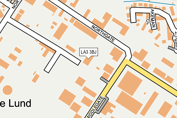
LA3 3BJ is located in the Westgate electoral ward, within the local authority district of Lancaster and the English Parliamentary constituency of Morecambe and Lunesdale. The Sub Integrated Care Board (ICB) Location is NHS Lancashire and South Cumbria ICB - 01K and the police force is Lancashire. This postcode has been in use since January 1980.


GetTheData
Source: OS OpenMap – Local (Ordnance Survey)
Source: OS VectorMap District (Ordnance Survey)
Licence: Open Government Licence (requires attribution)
| Easting | 345069 |
| Northing | 463062 |
| Latitude | 54.060562 |
| Longitude | -2.840703 |
GetTheData
Source: Open Postcode Geo
Licence: Open Government Licence
| Country | England |
| Postcode District | LA3 |
| ➜ LA3 open data dashboard ➜ See where LA3 is on a map ➜ Where is Morecambe? | |
GetTheData
Source: Land Registry Price Paid Data
Licence: Open Government Licence
Elevation or altitude of LA3 3BJ as distance above sea level:
| Metres | Feet | |
|---|---|---|
| Elevation | 10m | 33ft |
Elevation is measured from the approximate centre of the postcode, to the nearest point on an OS contour line from OS Terrain 50, which has contour spacing of ten vertical metres.
➜ How high above sea level am I? Find the elevation of your current position using your device's GPS.
GetTheData
Source: Open Postcode Elevation
Licence: Open Government Licence
| Ward | Westgate |
| Constituency | Morecambe And Lunesdale |
GetTheData
Source: ONS Postcode Database
Licence: Open Government Licence
| June 2022 | Other theft | On or near Middlegate | 121m |
| June 2022 | Vehicle crime | On or near Middlegate | 121m |
| June 2022 | Criminal damage and arson | On or near Bus/Coach Station | 135m |
| ➜ Get more crime data in our Crime section | |||
GetTheData
Source: data.police.uk
Licence: Open Government Licence
| Cannon Hygiene (Northgate) | White Lund | 94m |
| Cannon Hygiene (Northgate) | White Lund | 131m |
| Trading Estate (Northgate) | White Lund | 188m |
| Trading Estate (Northgate) | White Lund | 260m |
| White Lund Est (Northgate) | White Lund | 306m |
| Bare Lane Station | 1.6km |
| Morecambe Station | 2.2km |
| Lancaster Station | 2.5km |
GetTheData
Source: NaPTAN
Licence: Open Government Licence
GetTheData
Source: ONS Postcode Database
Licence: Open Government Licence


➜ Get more ratings from the Food Standards Agency
GetTheData
Source: Food Standards Agency
Licence: FSA terms & conditions
| Last Collection | |||
|---|---|---|---|
| Location | Mon-Fri | Sat | Distance |
| White Lund Industrial Estate | 17:30 | 11:45 | 348m |
| Branksome | 16:30 | 12:00 | 602m |
| Cross Roads | 17:00 | 12:00 | 629m |
GetTheData
Source: Dracos
Licence: Creative Commons Attribution-ShareAlike
| Facility | Distance |
|---|---|
| Morecambe Road School Morecambe Road, Morecambe Grass Pitches | 486m |
| Ironmasters Gym Whitefield Place, Morecambe Health and Fitness Gym | 753m |
| Morecambe & Heysham Grosvenor Park Primary School Roeburn Drive, Morecambe Grass Pitches | 914m |
GetTheData
Source: Active Places
Licence: Open Government Licence
| School | Phase of Education | Distance |
|---|---|---|
| Morecambe Road School Morecambe Road, Morecambe, LA3 3AB | Not applicable | 486m |
| Morecambe and Heysham Grosvenor Park Primary School Roeburn Drive, Grosvenor Park, Morecambe, LA3 3RY | Primary | 720m |
| Lancaster and Morecambe College Morecambe Road, Lancaster, LA1 2TY | 16 plus | 972m |
GetTheData
Source: Edubase
Licence: Open Government Licence
The below table lists the International Territorial Level (ITL) codes (formerly Nomenclature of Territorial Units for Statistics (NUTS) codes) and Local Administrative Units (LAU) codes for LA3 3BJ:
| ITL 1 Code | Name |
|---|---|
| TLD | North West (England) |
| ITL 2 Code | Name |
| TLD4 | Lancashire |
| ITL 3 Code | Name |
| TLD44 | Lancaster and Wyre |
| LAU 1 Code | Name |
| E07000121 | Lancaster |
GetTheData
Source: ONS Postcode Directory
Licence: Open Government Licence
The below table lists the Census Output Area (OA), Lower Layer Super Output Area (LSOA), and Middle Layer Super Output Area (MSOA) for LA3 3BJ:
| Code | Name | |
|---|---|---|
| OA | E00127745 | |
| LSOA | E01025173 | Lancaster 010D |
| MSOA | E02005230 | Lancaster 010 |
GetTheData
Source: ONS Postcode Directory
Licence: Open Government Licence
| LA3 3BL | Pilgrims Way | 191m |
| LA3 3BP | Akeman Close | 232m |
| LA3 3BB | Northgate | 256m |
| LA3 3BQ | Foss Court | 291m |
| LA3 3BN | Middlegate | 298m |
| LA3 3BX | Hadrian Road | 329m |
| LA3 3AJ | Stanhope Avenue | 334m |
| LA3 3BU | Ermine Place | 373m |
| LA3 3BG | Watling Close | 387m |
| LA3 3AW | Filton Grove | 392m |
GetTheData
Source: Open Postcode Geo; Land Registry Price Paid Data
Licence: Open Government Licence