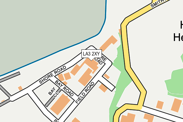
LA3 2XY is located in the Heysham South electoral ward, within the local authority district of Lancaster and the English Parliamentary constituency of Morecambe and Lunesdale. The Sub Integrated Care Board (ICB) Location is NHS Lancashire and South Cumbria ICB - 01K and the police force is Lancashire. This postcode has been in use since January 1991.


GetTheData
Source: OS OpenMap – Local (Ordnance Survey)
Source: OS VectorMap District (Ordnance Survey)
Licence: Open Government Licence (requires attribution)
| Easting | 340721 |
| Northing | 460667 |
| Latitude | 54.038557 |
| Longitude | -2.906652 |
GetTheData
Source: Open Postcode Geo
Licence: Open Government Licence
| Country | England |
| Postcode District | LA3 |
| ➜ LA3 open data dashboard ➜ See where LA3 is on a map ➜ Where is Heysham? | |
GetTheData
Source: Land Registry Price Paid Data
Licence: Open Government Licence
Elevation or altitude of LA3 2XY as distance above sea level:
| Metres | Feet | |
|---|---|---|
| Elevation | 10m | 33ft |
Elevation is measured from the approximate centre of the postcode, to the nearest point on an OS contour line from OS Terrain 50, which has contour spacing of ten vertical metres.
➜ How high above sea level am I? Find the elevation of your current position using your device's GPS.
GetTheData
Source: Open Postcode Elevation
Licence: Open Government Licence
| Ward | Heysham South |
| Constituency | Morecambe And Lunesdale |
GetTheData
Source: ONS Postcode Database
Licence: Open Government Licence
| April 2023 | Anti-social behaviour | On or near Moneyclose Grove | 278m |
| March 2023 | Violence and sexual offences | On or near Moneyclose Grove | 278m |
| June 2022 | Anti-social behaviour | On or near Moneyclose Grove | 278m |
| ➜ Get more crime data in our Crime section | |||
GetTheData
Source: data.police.uk
Licence: Open Government Licence
| Mcdonald Road (Rothesay Road) | Heysham | 384m |
| Londonderry Road (Rothesay Road) | Heysham | 455m |
| Kintyre Way (Barrows Lane) | Heysham | 484m |
| Peel Avenue (Delamere Avenue) | Heysham | 522m |
| Peel Avenue (Heathfoot Avenue) | Heysham | 534m |
| Heysham Port Station | 0.7km |
| Morecambe Station | 4.3km |
| Bare Lane Station | 6.2km |
GetTheData
Source: NaPTAN
Licence: Open Government Licence
GetTheData
Source: ONS Postcode Database
Licence: Open Government Licence


➜ Get more ratings from the Food Standards Agency
GetTheData
Source: Food Standards Agency
Licence: FSA terms & conditions
| Last Collection | |||
|---|---|---|---|
| Location | Mon-Fri | Sat | Distance |
| Heysham Village Post Office | 16:45 | 12:00 | 923m |
| Hale Carr Lane, Heysham | 16:30 | 11:00 | 1,299m |
| Oxcliffe Post Office | 16:45 | 12:00 | 2,091m |
GetTheData
Source: Dracos
Licence: Creative Commons Attribution-ShareAlike
| Facility | Distance |
|---|---|
| Peel Avenue Playing Fields Peel Avenue, Heysham, Morecambe Grass Pitches | 457m |
| Trumacar Nursery And Community Primary School Combermere Road, Heysham, Morecambe Grass Pitches | 705m |
| Barrows Lane Football Pitch Carr Lane, Heysham, Morecambe Grass Pitches | 764m |
GetTheData
Source: Active Places
Licence: Open Government Licence
| School | Phase of Education | Distance |
|---|---|---|
| Trumacar Nursery and Community Primary School Combermere Road, Higher Heysham, Morecambe, LA3 2ST | Primary | 716m |
| Heysham St Peter's Church of England Primary School School Road, Heysham, Morecambe, LA3 2RF | Primary | 912m |
| Mossgate Primary School Kingsway, Heysham, Morecambe, LA3 2EE | Primary | 1.8km |
GetTheData
Source: Edubase
Licence: Open Government Licence
The below table lists the International Territorial Level (ITL) codes (formerly Nomenclature of Territorial Units for Statistics (NUTS) codes) and Local Administrative Units (LAU) codes for LA3 2XY:
| ITL 1 Code | Name |
|---|---|
| TLD | North West (England) |
| ITL 2 Code | Name |
| TLD4 | Lancashire |
| ITL 3 Code | Name |
| TLD44 | Lancaster and Wyre |
| LAU 1 Code | Name |
| E07000121 | Lancaster |
GetTheData
Source: ONS Postcode Directory
Licence: Open Government Licence
The below table lists the Census Output Area (OA), Lower Layer Super Output Area (LSOA), and Middle Layer Super Output Area (MSOA) for LA3 2XY:
| Code | Name | |
|---|---|---|
| OA | E00127513 | |
| LSOA | E01025122 | Lancaster 016D |
| MSOA | E02005236 | Lancaster 016 |
GetTheData
Source: ONS Postcode Directory
Licence: Open Government Licence
| LA3 2UZ | Penrod Way | 311m |
| LA3 2XW | Moneyclose Grove | 320m |
| LA3 2UW | Moneyclose Lane | 326m |
| LA3 2XR | Rothesay Crescent | 345m |
| LA3 2LA | Moon Bay Wharf | 392m |
| LA3 2UP | Rothesay Road | 402m |
| LA3 2QR | Cyprus Road | 435m |
| LA3 2UX | Mcdonald Road | 444m |
| LA3 2QT | Sylvan Place | 448m |
| LA3 2TS | Delamere Avenue | 451m |
GetTheData
Source: Open Postcode Geo; Land Registry Price Paid Data
Licence: Open Government Licence