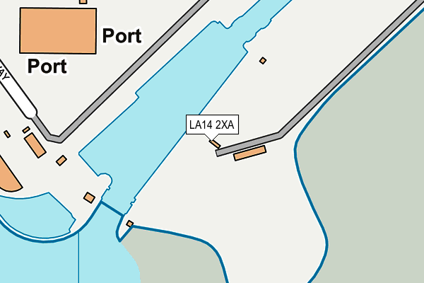
LA14 2XA is located in the Old Barrow and Hindpool electoral ward, within the unitary authority of Westmorland and Furness and the English Parliamentary constituency of Barrow and Furness. The Sub Integrated Care Board (ICB) Location is NHS Lancashire and South Cumbria ICB - 01K and the police force is Cumbria. This postcode has been in use since July 1983.


GetTheData
Source: OS OpenMap – Local (Ordnance Survey)
Source: OS VectorMap District (Ordnance Survey)
Licence: Open Government Licence (requires attribution)
| Easting | 320892 |
| Northing | 467780 |
| Latitude | 54.099815 |
| Longitude | -3.211221 |
GetTheData
Source: Open Postcode Geo
Licence: Open Government Licence
| Country | England |
| Postcode District | LA14 |
| ➜ LA14 open data dashboard ➜ See where LA14 is on a map | |
GetTheData
Source: Land Registry Price Paid Data
Licence: Open Government Licence
Elevation or altitude of LA14 2XA as distance above sea level:
| Metres | Feet | |
|---|---|---|
| Elevation | 10m | 33ft |
Elevation is measured from the approximate centre of the postcode, to the nearest point on an OS contour line from OS Terrain 50, which has contour spacing of ten vertical metres.
➜ How high above sea level am I? Find the elevation of your current position using your device's GPS.
GetTheData
Source: Open Postcode Elevation
Licence: Open Government Licence
| Ward | Old Barrow And Hindpool |
| Constituency | Barrow And Furness |
GetTheData
Source: ONS Postcode Database
Licence: Open Government Licence
| June 2022 | Public order | On or near Park/Open Space | 131m |
| December 2021 | Violence and sexual offences | On or near Park/Open Space | 131m |
| ➜ Get more crime data in our Crime section | |||
GetTheData
Source: data.police.uk
Licence: Open Government Licence
| Marsh Street (Salthouse Road) | Barrow-in-furness | 1,071m |
| Ruskin Terrace (Salthouse Road) | Barrow-in-furness | 1,086m |
| Rawlinson Street (Salthouse Road) | Barrow-in-furness | 1,089m |
| Bowling Club (Roose Road) | Salthouse | 1,092m |
| Salthouse Road (Marsh Street) | Barrow-in-furness | 1,096m |
| Roose Station | 2km |
| Barrow-in-Furness Station | 2.3km |
GetTheData
Source: NaPTAN
Licence: Open Government Licence
GetTheData
Source: ONS Postcode Database
Licence: Open Government Licence


➜ Get more ratings from the Food Standards Agency
GetTheData
Source: Food Standards Agency
Licence: FSA terms & conditions
| Last Collection | |||
|---|---|---|---|
| Location | Mon-Fri | Sat | Distance |
| Westway | 17:30 | 11:15 | 1,518m |
| Town Hall | 18:00 | 11:00 | 1,590m |
| Furness House Post Office | 18:00 | 12:30 | 1,604m |
GetTheData
Source: Dracos
Licence: Creative Commons Attribution-ShareAlike
| Facility | Distance |
|---|---|
| Cavendish Park Island Road, Barrow-in-furness Grass Pitches | 861m |
| St Georges C Of E School School Street, Barrow-in-furness Sports Hall | 1.2km |
| The Alfred Barrow School (Closed) Duke Street, Barrow-in-furness Sports Hall | 1.5km |
GetTheData
Source: Active Places
Licence: Open Government Licence
| School | Phase of Education | Distance |
|---|---|---|
| St George's CofE School School Street, Barrow-in-Furness, LA14 2JN | Primary | 1.1km |
| Sacred Heart Catholic Primary School, Barrow Sacred Heart Catholic Primary School, Lumley Street, Barrow-in-Furness, LA14 2BA | Primary | 1.2km |
| Barrow Island Community Primary School Trinity Street, Barrow-in-Furness, LA14 2SJ | Primary | 1.3km |
GetTheData
Source: Edubase
Licence: Open Government Licence
The below table lists the International Territorial Level (ITL) codes (formerly Nomenclature of Territorial Units for Statistics (NUTS) codes) and Local Administrative Units (LAU) codes for LA14 2XA:
| ITL 1 Code | Name |
|---|---|
| TLD | North West (England) |
| ITL 2 Code | Name |
| TLD1 | Cumbria |
| ITL 3 Code | Name |
| TLD11 | West Cumbria |
| LAU 1 Code | Name |
| E07000027 | Barrow-in-Furness |
GetTheData
Source: ONS Postcode Directory
Licence: Open Government Licence
The below table lists the Census Output Area (OA), Lower Layer Super Output Area (LSOA), and Middle Layer Super Output Area (MSOA) for LA14 2XA:
| Code | Name | |
|---|---|---|
| OA | E00096730 | |
| LSOA | E01019138 | Barrow-in-Furness 010A |
| MSOA | E02003986 | Barrow-in-Furness 010 |
GetTheData
Source: ONS Postcode Directory
Licence: Open Government Licence
| LA14 2SX | Ancaster Street | 918m |
| LA14 2TA | Aberdare Street | 953m |
| LA14 2SY | Ancaster Street | 956m |
| LA14 2SB | Island Road | 993m |
| LA14 2SZ | Andover Street | 995m |
| LA14 2BQ | Vulcan Road | 995m |
| LA14 2SA | Dunvegan Street | 999m |
| LA14 2BG | Brathay Crescent | 1007m |
| LA14 2BH | Vulcan Road | 1013m |
| LA14 2ST | St Andrews Street | 1032m |
GetTheData
Source: Open Postcode Geo; Land Registry Price Paid Data
Licence: Open Government Licence