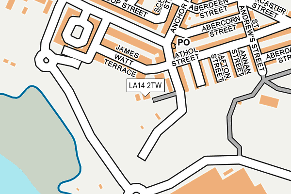
LA14 2TW is located in the Old Barrow and Hindpool electoral ward, within the unitary authority of Westmorland and Furness and the English Parliamentary constituency of Barrow and Furness. The Sub Integrated Care Board (ICB) Location is NHS Lancashire and South Cumbria ICB - 01K and the police force is Cumbria. This postcode has been in use since January 1980.


GetTheData
Source: OS OpenMap – Local (Ordnance Survey)
Source: OS VectorMap District (Ordnance Survey)
Licence: Open Government Licence (requires attribution)
| Easting | 319668 |
| Northing | 467916 |
| Latitude | 54.100839 |
| Longitude | -3.229974 |
GetTheData
Source: Open Postcode Geo
Licence: Open Government Licence
| Country | England |
| Postcode District | LA14 |
| ➜ LA14 open data dashboard ➜ See where LA14 is on a map ➜ Where is Barrow-in-Furness? | |
GetTheData
Source: Land Registry Price Paid Data
Licence: Open Government Licence
Elevation or altitude of LA14 2TW as distance above sea level:
| Metres | Feet | |
|---|---|---|
| Elevation | 10m | 33ft |
Elevation is measured from the approximate centre of the postcode, to the nearest point on an OS contour line from OS Terrain 50, which has contour spacing of ten vertical metres.
➜ How high above sea level am I? Find the elevation of your current position using your device's GPS.
GetTheData
Source: Open Postcode Elevation
Licence: Open Government Licence
| Ward | Old Barrow And Hindpool |
| Constituency | Barrow And Furness |
GetTheData
Source: ONS Postcode Database
Licence: Open Government Licence
| January 2024 | Drugs | On or near Rothesay Street | 385m |
| January 2024 | Other theft | On or near Rothesay Street | 385m |
| January 2024 | Drugs | On or near Rothesay Street | 385m |
| ➜ Get more crime data in our Crime section | |||
GetTheData
Source: data.police.uk
Licence: Open Government Licence
| Tea House (Anchor Road) | Barrow Island | 177m |
| The Devonshire (Ramsden Dock Square) | Barrow Island | 242m |
| St Johns Church (Island Road) | Barrow Island | 317m |
| Coffee House (Michaelson Road) | Barrow Island | 458m |
| Coffee House (Michaelson Road) | Barrow Island | 459m |
| Barrow-in-Furness Station | 2km |
| Roose Station | 2.8km |
GetTheData
Source: NaPTAN
Licence: Open Government Licence
GetTheData
Source: ONS Postcode Database
Licence: Open Government Licence


➜ Get more ratings from the Food Standards Agency
GetTheData
Source: Food Standards Agency
Licence: FSA terms & conditions
| Last Collection | |||
|---|---|---|---|
| Location | Mon-Fri | Sat | Distance |
| Furness House Post Office | 18:00 | 12:30 | 1,174m |
| Town Hall | 18:00 | 11:00 | 1,328m |
| Duke Street Post Office | 17:30 | 12:15 | 1,449m |
GetTheData
Source: Dracos
Licence: Creative Commons Attribution-ShareAlike
| Facility | Distance |
|---|---|
| Cavendish Park Island Road, Barrow-in-furness Grass Pitches | 513m |
| The Alfred Barrow School (Closed) Duke Street, Barrow-in-furness Sports Hall | 1.1km |
| St Georges C Of E School School Street, Barrow-in-furness Sports Hall | 1.1km |
GetTheData
Source: Active Places
Licence: Open Government Licence
| School | Phase of Education | Distance |
|---|---|---|
| Barrow Island Community Primary School Trinity Street, Barrow-in-Furness, LA14 2SJ | Primary | 389m |
| St George's CofE School School Street, Barrow-in-Furness, LA14 2JN | Primary | 1.1km |
| South Walney Junior School Amphitrite Street South, Walney, South Walney Junior School Amphitrite Street South, Barrow-in-Furness, LA14 3BG | Primary | 1.2km |
GetTheData
Source: Edubase
Licence: Open Government Licence
The below table lists the International Territorial Level (ITL) codes (formerly Nomenclature of Territorial Units for Statistics (NUTS) codes) and Local Administrative Units (LAU) codes for LA14 2TW:
| ITL 1 Code | Name |
|---|---|
| TLD | North West (England) |
| ITL 2 Code | Name |
| TLD1 | Cumbria |
| ITL 3 Code | Name |
| TLD11 | West Cumbria |
| LAU 1 Code | Name |
| E07000027 | Barrow-in-Furness |
GetTheData
Source: ONS Postcode Directory
Licence: Open Government Licence
The below table lists the Census Output Area (OA), Lower Layer Super Output Area (LSOA), and Middle Layer Super Output Area (MSOA) for LA14 2TW:
| Code | Name | |
|---|---|---|
| OA | E00096732 | |
| LSOA | E01019139 | Barrow-in-Furness 010B |
| MSOA | E02003986 | Barrow-in-Furness 010 |
GetTheData
Source: ONS Postcode Directory
Licence: Open Government Licence
| LA14 2TR | Ramsden Dock Road | 91m |
| LA14 2TS | James Watt Terrace | 100m |
| LA14 2TN | Ramsden Dock Road | 112m |
| LA14 2QY | Ayr Street | 128m |
| LA14 2TP | Ramsden Dock Road | 137m |
| LA14 2TX | Egerton Court | 159m |
| LA14 2QX | Afton Street | 170m |
| LA14 2QW | Anchor Road | 173m |
| LA14 2QT | Athol Street | 176m |
| LA14 2QU | Annan Street | 189m |
GetTheData
Source: Open Postcode Geo; Land Registry Price Paid Data
Licence: Open Government Licence