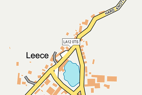
LA12 0TS lies on Park Terrace in Leece, Ulverston. LA12 0TS is located in the Low Furness electoral ward, within the unitary authority of Westmorland and Furness and the English Parliamentary constituency of Barrow and Furness. The Sub Integrated Care Board (ICB) Location is NHS Lancashire and South Cumbria ICB - 01K and the police force is Cumbria. This postcode has been in use since December 1996.


GetTheData
Source: OS OpenMap – Local (Ordnance Survey)
Source: OS VectorMap District (Ordnance Survey)
Licence: Open Government Licence (requires attribution)
| Easting | 324388 |
| Northing | 469488 |
| Latitude | 54.115681 |
| Longitude | -3.158203 |
GetTheData
Source: Open Postcode Geo
Licence: Open Government Licence
| Street | Park Terrace |
| Locality | Leece |
| Town/City | Ulverston |
| Country | England |
| Postcode District | LA12 |
| ➜ LA12 open data dashboard ➜ See where LA12 is on a map ➜ Where is Leece? | |
GetTheData
Source: Land Registry Price Paid Data
Licence: Open Government Licence
Elevation or altitude of LA12 0TS as distance above sea level:
| Metres | Feet | |
|---|---|---|
| Elevation | 30m | 98ft |
Elevation is measured from the approximate centre of the postcode, to the nearest point on an OS contour line from OS Terrain 50, which has contour spacing of ten vertical metres.
➜ How high above sea level am I? Find the elevation of your current position using your device's GPS.
GetTheData
Source: Open Postcode Elevation
Licence: Open Government Licence
| Ward | Low Furness |
| Constituency | Barrow And Furness |
GetTheData
Source: ONS Postcode Database
Licence: Open Government Licence
| May 2022 | Violence and sexual offences | On or near Flower Street | 39m |
| April 2022 | Vehicle crime | On or near Flower Street | 39m |
| February 2022 | Violence and sexual offences | On or near Flower Street | 39m |
| ➜ Get more crime data in our Crime section | |||
GetTheData
Source: data.police.uk
Licence: Open Government Licence
| Moorhead Cottages (Rampside Road) | Roosecote | 1,588m |
| Moorside Cottages (Rampside Road) | Roosecote | 1,604m |
| Roose Station | 2.4km |
| Barrow-in-Furness Station | 4.5km |
| Dalton Station | 4.5km |
GetTheData
Source: NaPTAN
Licence: Open Government Licence
| Percentage of properties with Next Generation Access | 100.0% |
| Percentage of properties with Superfast Broadband | 0.0% |
| Percentage of properties with Ultrafast Broadband | 0.0% |
| Percentage of properties with Full Fibre Broadband | 0.0% |
Superfast Broadband is between 30Mbps and 300Mbps
Ultrafast Broadband is > 300Mbps
| Percentage of properties unable to receive 2Mbps | 0.0% |
| Percentage of properties unable to receive 5Mbps | 0.0% |
| Percentage of properties unable to receive 10Mbps | 0.0% |
| Percentage of properties unable to receive 30Mbps | 100.0% |
GetTheData
Source: Ofcom
Licence: Ofcom Terms of Use (requires attribution)
GetTheData
Source: ONS Postcode Database
Licence: Open Government Licence


➜ Get more ratings from the Food Standards Agency
GetTheData
Source: Food Standards Agency
Licence: FSA terms & conditions
| Last Collection | |||
|---|---|---|---|
| Location | Mon-Fri | Sat | Distance |
| Tarn Cottage, Leece | 12:00 | 09:15 | 26m |
| Dendron Farm, Dendron | 12:00 | 09:00 | 1,237m |
| Orchard Cottage, Gleaston | 11:45 | 08:45 | 1,779m |
GetTheData
Source: Dracos
Licence: Creative Commons Attribution-ShareAlike
| Facility | Distance |
|---|---|
| Furness Cavaliers Association Football Club Rampside Road, Barrow-in-furness Grass Pitches | 2km |
| Roose Pioneers Arlfc Featherstone Crescent, Barrow-in-furness Grass Pitches | 2.5km |
| St Bernards Catholic High School Rating Lane, Barrow-in-furness Grass Pitches, Sports Hall, Outdoor Tennis Courts | 3.2km |
GetTheData
Source: Active Places
Licence: Open Government Licence
| School | Phase of Education | Distance |
|---|---|---|
| Roose School North Row, Barrow-in-Furness, LA13 0HF | Primary | 2km |
| Yarlside Academy Red Oak Avenue, Barrow-in-Furness, LA13 0LH | Primary | 2.1km |
| Newton Village Academy Newton Road, Newton-in-Furness, Barrow-in-Furness, LA13 0LT | Primary | 2.4km |
GetTheData
Source: Edubase
Licence: Open Government Licence
The below table lists the International Territorial Level (ITL) codes (formerly Nomenclature of Territorial Units for Statistics (NUTS) codes) and Local Administrative Units (LAU) codes for LA12 0TS:
| ITL 1 Code | Name |
|---|---|
| TLD | North West (England) |
| ITL 2 Code | Name |
| TLD1 | Cumbria |
| ITL 3 Code | Name |
| TLD12 | East Cumbria |
| LAU 1 Code | Name |
| E07000031 | South Lakeland |
GetTheData
Source: ONS Postcode Directory
Licence: Open Government Licence
The below table lists the Census Output Area (OA), Lower Layer Super Output Area (LSOA), and Middle Layer Super Output Area (MSOA) for LA12 0TS:
| Code | Name | |
|---|---|---|
| OA | E00097973 | |
| LSOA | E01019380 | South Lakeland 014C |
| MSOA | E02004028 | South Lakeland 014 |
GetTheData
Source: ONS Postcode Directory
Licence: Open Government Licence
| LA12 0TT | Flower Street | 38m |
| LA12 0QR | 50m | |
| LA12 0QP | 57m | |
| LA12 0QX | 112m | |
| LA12 0QS | 135m | |
| LA12 0QT | 201m | |
| LA12 0QU | Dale Garth | 203m |
| LA12 0QZ | Tarn Foot Cottages | 221m |
| LA12 0QW | 692m | |
| LA12 0RD | 777m |
GetTheData
Source: Open Postcode Geo; Land Registry Price Paid Data
Licence: Open Government Licence